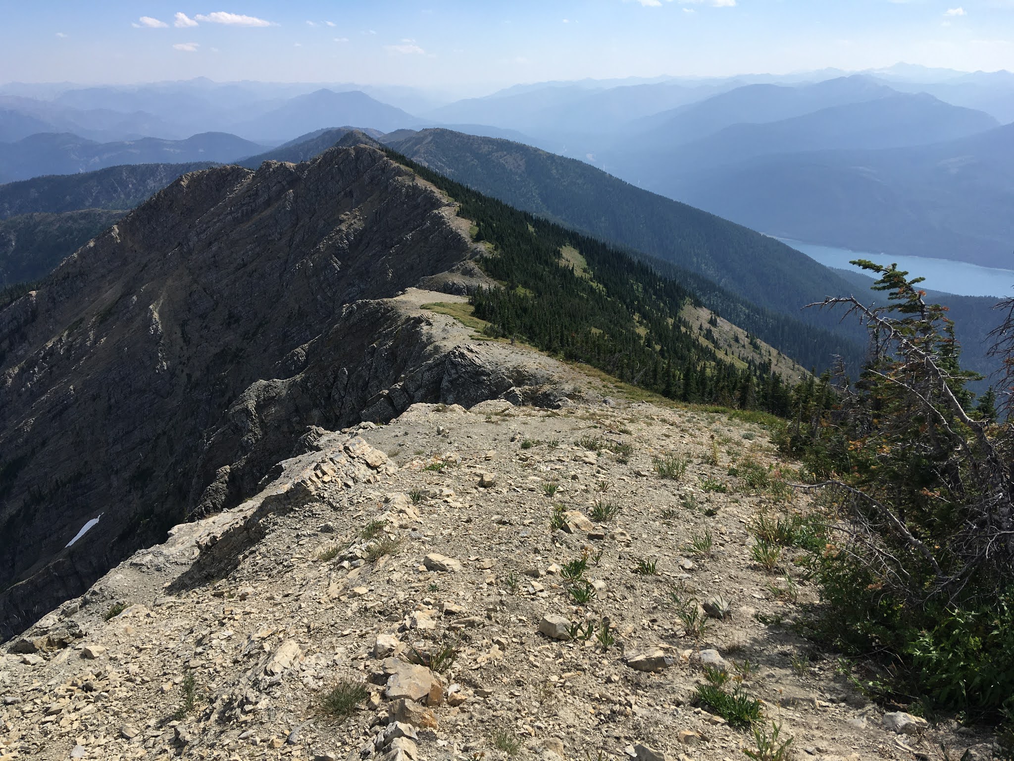
Thursday, May 6, 2021

Sheepshead and McDonald ski for time

Moments like this are why we backcountry ski.

2023 update:  I now kind of think that this route was not complete.  I think that the East ridge run should be extended down to the tarn at about 8,300 feet, providing a natural, complete end point to the run.  A complete descent is more aesthetic than cutting the run short, and I think that this is merited since the East ridge of Sheepshead is a quality objective in its own right.  I guess the only way to rectify this is to go back and try again!

One of the first post-foot recovery outings I undertook was to go for a fast time on the Sheepshead/McDonald peak loop in the Missions.  I hadn't been skiing a lot, but had enough of a fitness base from biking that I felt reasonably prepared.  I think that the link up is one of the finest in the Missions, with excellent skiing, iconic peaks, and enough bushwacking and tricky routefinding in the heart of the Grizzly conservation zone to count as a legitimate Mission adventure.  It was forecast to be a hot day, so I timed the outing to hit the skiing on the firm side of corn o'clock, and started walking casually from a parking spot just above the canal at 7 am.  

At the upper trailhead, I took a nice break, switched into ski boots, set the clock, and started off.  I made pretty decent time to the base of the peak, and climbed efficiently to about 8,500 feet where the upper Northwest ridge becomes cliffy.  Unfortunately, the light overnight refreeze wasn't enough to be supportable, and I spent more time crotch deep in snow than I was hoping for as I ground out the last thousand vertical feet to the summit.  It did not help that I slightly botched the route and had to climb a tricky little mixed step.  It was OK though, I pushed as hard as reasonable while still moving with careful intention.  The East ridge and Southeast face skied perfectly.  

Feeling less than fast on the summit of Sheepshead...

...but definitely excited to ski and climb McDonald.

After a quick transition, I set off for the summit of McDonald, psyched for a hard push.   As it turns out, I didn't have as much gas as I had hoped for, so I slammed a few more calories and gave it all I had.  The South face was also excellent skiing.  A little icy, but not bad, and fast.  Since it was obvious that my time was going to be pretty soft, I skied at a reasonable speed, taking enough time to enjoy the day.  The descent to the lake went quickly, and the lakes were well frozen, so I made good time skating across them.  The exit trail was a bit of a disaster.  For starters, I didn't really find it right away and lost a few minutes fighting through thick brush.  The majority of the trail also had deep, punchy snow and a lot of downfall.  I moved through it as quickly as possible, but it was not fast.  Soon enough, I was fast hiking up the last little climb, yelling for bears.  And a few minutes later I was back to the trailhead.  It was pretty cool to be out by early afternoon, and at the trailhead, I took a nice long food/water/approach shoe break before walking casually out to the car.  I'm excited to do this outing again for time (I think that sub-4:30 is possible), and of course again many times at a more casual pace for enjoyment.

At the Ashley/Post creek divide, one of the coolest places anywhere.

Appreciating fast travel across well frozen Ashley lakes.

Route:  From upper trailhead, up Southwest ridge of Sheepshead.  Ski the East ridge and Northeast face to where the slope flattens out, about 200 vertical feet above the tarn (the length of this run is debatable.  Up Northwest face of McDonald.  Down South face and out to Ashley lakes.  Out Ashley lakes trail to trailhead.  I like the start/end point at the upper trailhead.  Even though it is a pretty crazy trailhead to drive too, it is a logical start/end point, and allows for a nice warmup if one chooses to park lower in the valley.

Splits for future reference:  First big flat ~50 minutes.  Sheepshead summit:  2.50.  McDonald summit: 3:30.  Leave lower Ashley lake:  4.05.  Trailhead 4:52.  Yes, the trail out was slow.

Equipment of note:  Crampons, whippet, bear spray, 0.5L water and about 1,000 calories.  Used everything except all of the bear spray and a few of the calories.  No ice axe, puffy coat, or approach shoes.  Nothing extra, but enough to deal with steep snow and ice, and to have a reasonable safety margin.

Saturday, May 1, 2021

Mollman peak skiing

Excellent skiing on Mollman peak.

After two failed attempts, I took a day off of work in late January and rallied back to peak 8,632 for another attempt at the Southwest face, this time buoyed by the first Low avalanche forecast of the year and good weather.  Even with a late start, I was able to get the approach completed by about noon, and was soon romping easily up our skin track from the previous weekend. Eventually I split out right and made a climbing traverse to the avalanche exposed upper gully.  I dug a pit at 7,800 feet, and had stable results, which coupled with several other data points, helped my confidence in committing to the first serious avalanche slope of the season for me.  The skinning was tricky, but ski crampons helped a bunch, and I wasn't in a hurry.  

Moody skies and tricky skinning during the climb.

I summited around 2:30, excited to ski.  The run was splendid.  Visibility was adequate, the snow was good, and the ski line was great.  I skied 3,000 vertical feet, all the way to the shore of an unnamed lake below the summer trail.  After a short but definitely Mission-esque bushwack back to the trail, I pointed it east and walked most of the snow covered trail to the car in approach shoes.  I was so grateful to ski this run with safe and excellent conditions in January of a dangerous avalanche year.  It is a good ski line that merits more attention than it deserves.  It would also make for a good early spring ski objective (the lower face must melt out early), and could be easily combined with a handful of other ski runs in the immediate vicinity.

Let's do this!
Looking aback up at the face.  I skied the looker's right fork of the central gully.

The only but very significant bummer about the outing is that my feet were in very poor condition and hurt like a bugger the entire time I was in ski boots.  After one more day of painful skiing the following weekend, I would have to take two months off of skiing to let them heal.

I don't know the formal name for this peak, but Mollman peak seems fitting.  It is certainly the most commanding peak in the Mollman lake area when viewed from the Mission valley.

Previous attempt #1: Jeffrey and I attempted to ski a more conservative line on the South flank on 1/10, but were surprised when a pit at the bottom of the exposed entrance to the upper face produced unstable results.  Rather than second guess the pit results, we tucked our tails and spent the rest of the day crossing Mollman lake and skiing a more conservative but quality run on the Southeast face of peak 8,616.

Skiing deep in the Missions on Bail attempt #1

Previous attempt #2:  Ned, Kyle and I attempted the Southwest face on 1/23.  Avalanche danger was forecast to be low, but there was enough snow that I didn't have the confidence to attempt the gully directly.  In addition, poor visibility sapped both our assessment abilities and gumption.  We made a valid attempt to summit the peak via the safe West ridge, but were stymied by steep terrain well below the summit.  After skiing a great run back to the base of the peak, we climbed to near the summit on the South face/ridge.  We turned around about 200 vertical feet from the summit, with poor visibility and a biting wind once again sapping our gumption.  The ensuing ski run was also quite enjoyable, and I had a great day out with friends and appreciated our conservative decision making.  The day definitely lit the fire to return and get it done though.

Climbing the South face on bail attempt #2.

Sunday, December 27, 2020

Flathead range traverse

After a successful partial Flathead traverse, I couldn't help but dream of traversing the crest of the entire range.  Fortunately everything lined up for an August 28 - 29 attempt.  The 40+ mile bike shuttle was a little bit of a grind, but I got it done without accruing much fatigue, and slept well at the  trailhead.

Day 1: I rolled out at 4 am, and made it to Triangle peak in time for sunrise.  The rest of the morning went OK.  It was nice to top out on new summits and gander at some of the most popular winter ski terrain, but the going was scrappier and slower than I had hoped for.  Also, there was no water.  I summited East Nyack very thirsty and about two hours behind where I wanted to be. The balls of my feet were also raw, which had me worried. A few hours later, I dragged myself over the top of Great Northern feeling pretty beat.  I chatted with a party on top for a minute, then beelined it down to a water stop at the top of the glacier.  The water stop allowed me to catch up on fluids and calories, and get a much needed mental re-set.  

Shortly after sunrise, looking out to Great Bear peak, with Great Northern in the distance.
Looking back at Penrose on the way to Nyack.
Onward to Nyack and eventually Great Northern.

The day really started clicking at that point.  It was a treat to traverse the elegant section between Great Northern and Liebig in the warm afternoon light, feeling good.  I kept pushing through the evening and made it over Elk, Adams, and Camaehwait before it finally got dark.  Each peak was fun and the going was generally non technical and fast.  One unresolved question was finding water for the night, but a lucky flicker of my headlamp reveled a big snow chunk tucked deep into a chimney on the last descent, which provided ample water for the night.  I called it a very long day around 11 pm at the saddle just short of Felix.  Dinner was pretty quick - water, peanut butter jelly sandwich and smoked salmon.  I was content with my progress and grateful to be physically intact.  I slept well, having brought enough provisions to stay comfortablish and warm. 

Looking back at Great Northern on the way to Grant.
Grant Glacier on the afternoon jaunt to the summit.
Nearing Liebig.

Looking back at Elk mountain at sunset.
Looking to Camehwait at sunset.  I climbed it in the dark and slept on the far side.
Day 2:  I awoke refreshed, started walking before first light, and summited Felix at sunrise.  After summiting Unawah, I got fairly worked by alder and all manner of bushwack drudgery crossing Logan creek.  I don't think there is really any good way to get through this section, and in the end, I only thrashed and cursed for about 30 minutes. A big climb put me on top of  peak 8,001 (I bypassed Red Sky Mountain for time).  

The next section of the traverse was long, but I was in the groove, cruising along on goat trails and enjoying the day.  Baptiste, Prospector, Circus, and Dry Park mountain each had their own character, and took 60 - 90 minutes each.  I knew that the end of the traverse would feel long, and it certainly did.  In particular, the push from Dry Park Mountain to Crossover was not as fun as the rest of the traverse, and the trail on the map down from Crossover doesn't really exist, so I spent quite a bit of extra time bushwacking down to the main trail.  My body held up just fine though, so it was just a matter of time until I was done.  I emerged at the car beat and a few hours behind schedule, but about as grateful as one can be for the experience.

Felix sunrise.
Looking out to Prospector from Baptiste.  More cruising...
Over the top of Circus peak and on the long home stretch. 
On Crossover, looking back at the last portion of the route.
Happy to be back at the car.
I had hopes of making the return drive to Missoula that night, but I pulled over to sleep for the night about half way home when sleepies attacked. 

Thoughts:  This was my defining outing of the summer, and one I am proud to have completed. I didn't track my route digitally, so don't have stats, but roughly 45 miles and 20,000 vertical feet, most of it off trail.  39 hour, 57 minutes trailhead to trailhead.  I am proud of the route, and the self contained style that I used.  I think that with proper recon of the route, a strong mountain runner could do it in a push in under 24 hours.  One could debate the aesthetic choice of starting Triangle peak, rather than at Ousel, but the slightly truncated route was worth it to me to drastically simplify the bike shuttle. 

I really enjoyed the traverse.  It provided a good hard mental challenge.  I got behind on water and food and struggled physically more than I thought I would on the first day.  I am still satisfied with my execution.  The route itself was great.  It isn't the most alpine of adventures, but I found it compelling because it is so wild. I also found the terrain clean enough to get in a really nice state of flow, following goat trails and checking off peak after peak.  In terms of recommending the route, it is a Montana gem, but it is just plain long enough to be a pretty substantial commitment.  

Wednesday, December 2, 2020

2020 summer scrambling hilights

Despite ambitions of biking a lot, I ended up spending most summer weekends in the mountains, family camping and rambling around up high at a well dispersed distance from Covid.  Mountain fitness was adequate to romp around efficiently with good confidence in my body.  This summary is of high quality days that don't quite merit their own post.

7/24 Crazy Mountains - Big Timber, Crazy, and Iddings 

After successfully jockeying for a weekend camping site at the Halfmoon campground, I rallied from the trailhead right at first light.  After a brief jaunt up the trail, I started the short bushwack to access the large avalanche path on the Northwest face of Big Timber peak.  The next twoish hours were devoted to climbing this monster avalanche path, and included the full gamut of pleasant tundra walking, loose scree swimming, choss of all varieties, and a good mix of wise and stupid route finding.  I summited about 3.5 hours into the day.  

Starting up the long climb to Big Timber peak shortly after dawn.  
Must return to ski this grand face some day.

To my immense chagrin, unforecast storms started rolling through, so I put all of my clothes on and tried to keep moving as best I could among the light snow flurries.  I was intimidated by the ridge line from Big Timber to Crazy, especially with the poor weather and my committing position.  I ended up bypassing the crest by linking up ledges on the North side.  My route was safe, but it wasn't optimal because it took a really long time.  In retrospect, I wish I had spent more time aspiring to stay on the crest.  Soon enough, I emerged on the Northeast ridge of Crazy peak.  Insert big sigh of relief.  

The harder-than-it-looks scrambling between Big Timber and Crazy peaks.

The next section of the day went smoothly.  Weather improving, check.  Crazy peak summit, check.  Descend to Crazy/Iddings col, check.  Loose rock and exposure made the East ridge of Iddings more intimidating than what I expected.  But it is a good route. I took my time and got it done. 

Near the summit of Iddings, looking back at Cracy peak and the fun ridge section. 

The egress was smooth.  I relaxed and enjoyed the beautiful country around Pear and Granite lakes.  Soon enough, I was back in the campground a few hours later than expected but still in time for dinner.  It is clear that my head and skills for efficiently working through loose easy 4th class terrain are poor, and I was humbled by the outing.  That said, it was rewarding to slow down, dig in, and stay on top of risk assessment.  And I'm glad that I kept at it to safely complete the link up.  Around 13 hours

8/15 Pintlers - Storm Lake to Haggin  

I rallied at 4 am during day one of a weekend family camping trip to traverse from our camp at Storm lake to Mount Haggin.  I have been excited to do this outing for several years, but it is a big outing to shoehorn into a day from town.  The day was pretty straightforward.  I summited Little Rainbow at sunrise, pointed it East, and kept at it over the beautiful summits of Howe, Evans, 10,376 and 10,282.  Loose scree coupled with a generally low energy body kept me moving slowly, and I topped out on Haggin fairly knackered.  The descent out to Anaconda went quickly enough.  Throughout the traverse, I benefited from abundant late season snow patches to refill water regularly.  

Looking back at Howe and Little Rainbow from near the summit of Howe.

The most elegant section from 10,282 to Haggin.

The real kicker of the day was climbing 3.000 vertical feet into a head wind on the return bike shuttle up a busy Highway 1.  I was too tired to enjoy it, plus my neuroma flared up. It was a suffer fest.  But I did manage 10,000 feet of elevation gain for the day, and slunk into camp just in time for dinner.  If I ever do this outing again self supported, I will do the bike shuttle in the other direction. 

Great outing. 

It was a high gravity day.  I took it as a shot across the bow for not overdoing it physically this summer.  I spent the next day in full rest mode, took the next week off from any workouts.  Two weeks later, I was fully recovered and ready for the full Flathead traverse.  

8/22 Bitterroot, Heavenly Twins and Saint Mary peak loop

Heavenly Twins!

I was able to squeeze this one in on day two of a family camping trip.  This is the third time I have done this outing.  It is so good!  I used sneaky tactics and biked from our camp on the McCalla road to the trailhead, did the loop and biked back to a stashed car at the base of the Saint Mary road. Up trail, down user trail to McCalla lake, over South shoulder of Saint Mary peak, around North ridge of Disappointment peak, up East face of Heavenly twins to North summit, ridge traverse to South summit, back to Saint Mary on the South side of the crest, then up South ridge to Saint Mary summit, where I happened to bump into a much-faster-than-me Doug, and down the trail to the car. 

10/5 Swan Range, Clearwater group traverse

I did a Clearwater group traverse during one of the last fall weather windows.  The Clearwater group is probably my favorite section of the Swan crest because it is so wild.  The goal for the day was to do this outing with a simplified bike shuttle along the back side of the Clearwater loop road and try to find more secure ways to navigate the three most technical steps.  The bike ride down from the Rice ridge trailhead and along the back of the loop was cold but quick.  I gained the crest by climbing the Southwest face of Wolverine peak.  By sticking to the bottom of the dry stream bottom, the lower reaches were remarkably bushwack free, and I just plodded with purpose all the way to the summit.  From there, I was on familiar terrain.  Out and back to Carmine, out to Ptarmigan peak, and up to Ptarmigan point.  I spent more time working through the two 4th class steps on the North ridge of Ptarmigan point, and found a route that felt safe and secure enough to be reliably repeatable.  

Enjoying fall colors and a dry stream bed on long opening climb to Wolverine.

Ptarmigan to Fisher is long, but I was buzzing with excitement from the perfect fall day.  On the North ridge of Fisher, I encountered a step just below the summit that I didn't remember.  I ended up climbing a vertical 5-foot step just East of the crest that involved a couple of committing moves on vertical rock with good hand holds to gain a shallow, easy gully that got me back on the crest.  

Ptarmigan to Fisher.
Golden larch, mountains, crisp fall air.  So good.

On the South ridge of Fisher, there is also one steep step where the crest forms a deep chimney that is just too wide to bridge across.  I had formerly downclimbed loose rock on the SW wall of the chimney, but I ended up downclimbing a 30-foot West facing gully just North of the chimney.  I found it more exposed, but the rock was better, so it felt more reliably safe.  The rest of the traverse to Sunday went smoothly, but I completely missed the climber trail back down to the Rice Ridge saddle.  By the time I realized my error, it was quicker to do a slow but easy descending traverse down to the trail.  Back on the trail, I jogged it out the trailhead.  A little over 10 hours, including the bike shuttle.  

If I ever get into good mountain running shape, I think that a route starting at the Clearwater loop road and ending at the Rice ridge trailhead climbing Wolverine, Ptarmigan peak, Ptarmigan point, Fisher, and Sunday mountain would be an excellent candidate for a FKT route.

Ptarmigan point 9,083 Northeast ridge route: Climb the ridge until you get to a vertical step on the crest with yellow rock.  Instead of taking a ledge to the W. face and climbing a loose easy 5th class chimney, go down a short gully onto the Northeast face, traverse about a hundred yards out onto the face, and climb up an easy gully/chimney system (easy 4th) back to the crest.  Soon after re-gaining the crest, climb a second 20-foot step via an exposed but secure West facing chimney a few feet around the corner from the crest (stout 4th).  Continue to the summit.

Sunday, November 8, 2020

Flathead range, Great Northern to Unawah

Sunrise. Looking along the Flathed crest at the day ahead.

I have dreamed of exploring the Flathead crest ever since Mike Foote, Mike Wolfe, and Steven Gnam casually did the entire range during their Crown traverse.  Although I have had this outing planned for several years, a string of mountain days earlier in the year set me up with the fitness and running durability to confidently give it a go.  With stable summer weather and support from family, I headed North shortly after noon on a Friday in early August.  By dark, I was tucked into a comfortable trailhead bivy, with the 20-mile bike shuttle complete.  I haven't done many big new adventures lately, so I went to bed quite jittery.  

I awoke excited, and was walking way before first light.  I climbed Great Northern on the well worn climber's trail.  The climb was all in the spooky dark, but I enjoyed it.  Summiting at sunrise was sublime. 

Great Northern summit at first light.  Cold but excited for the day.

I had under estimated the cold wind, and was forced to keep scurrying along to keep warm.  Getting off the peak was a little bit more interesting than I had anticipated, but I was able to navigate around steep snow easily enough, and was soon off the peak and moving toward Grant.  The traverse of Grant and Liebig was straightforward and delightful.  This alpine section of the crest is a gem.


Looking back at Great Northern from near the summit of Grant.

Looking back at Liebig.

Beyond Liebig, the crest is below treeline, and the peaks are spaced further apart, but the line continued to be fast and fun.  I was hours ahead of schedule, snowmelt water was abundant, and my energy was great.  It was turning into the perfect day.  Liebig to Elk was a haul, but it was also quite fun.  Adams was quick.  Cameahwait was kind of long, and I started getting tired.  Getting off Cameahwait also took a while, but I ingested enough calories to get a good energy boost for the scrappy climb to Felix.  Unawah was quick enough.  And with that I was on the last summit for the day.  An unforecast rain storm rolled through, but it wasn't too severe, and I didn't care.  

Looking back from Adams.  Showing the simple, clean character of the terrain.

... and on the last summit, looking back to Felix from Unawah.

The exit was on the scrappy side of fun, but it wasn't bad.  I made a last minute change of plans and descended the East ridge to 6,700 feet, then descended straight South to the trail.  The descent was mildly scrappy, with an assortment of downfall, thick brush, and alder in the last few hundred yards to the trail.  But all in all it wasn't bad and didn't take too long.  The Logan creek trail out was pretty over grown, so I settled into a rhythm of mixed walking and easy running, with lots of yips and claps to ward off bears.  Before long, I was back at the car in flip flops, pleasantly tired, and elated about a wild new-to-me day in the mountains.  Approximately 11,600 vertical feet, done in 13.5 hours, trailhead to trailhead.

Thoughts:  What an excellent outing.  Although it is not technically difficult, the length and paucity of good bail options make it a substantial commitment.  The day ended up being quite a bit easier than I expected.  That was fine by me since it was nice to feel totally in control in this Covidian time.  I haven't been running very much this summer, but the biking coupled with a lot of mountain time training plan paid off.  I felt very well physically prepared for the day.

The outing firmly planted the seed for a return trip to take on the entire Flathead range.