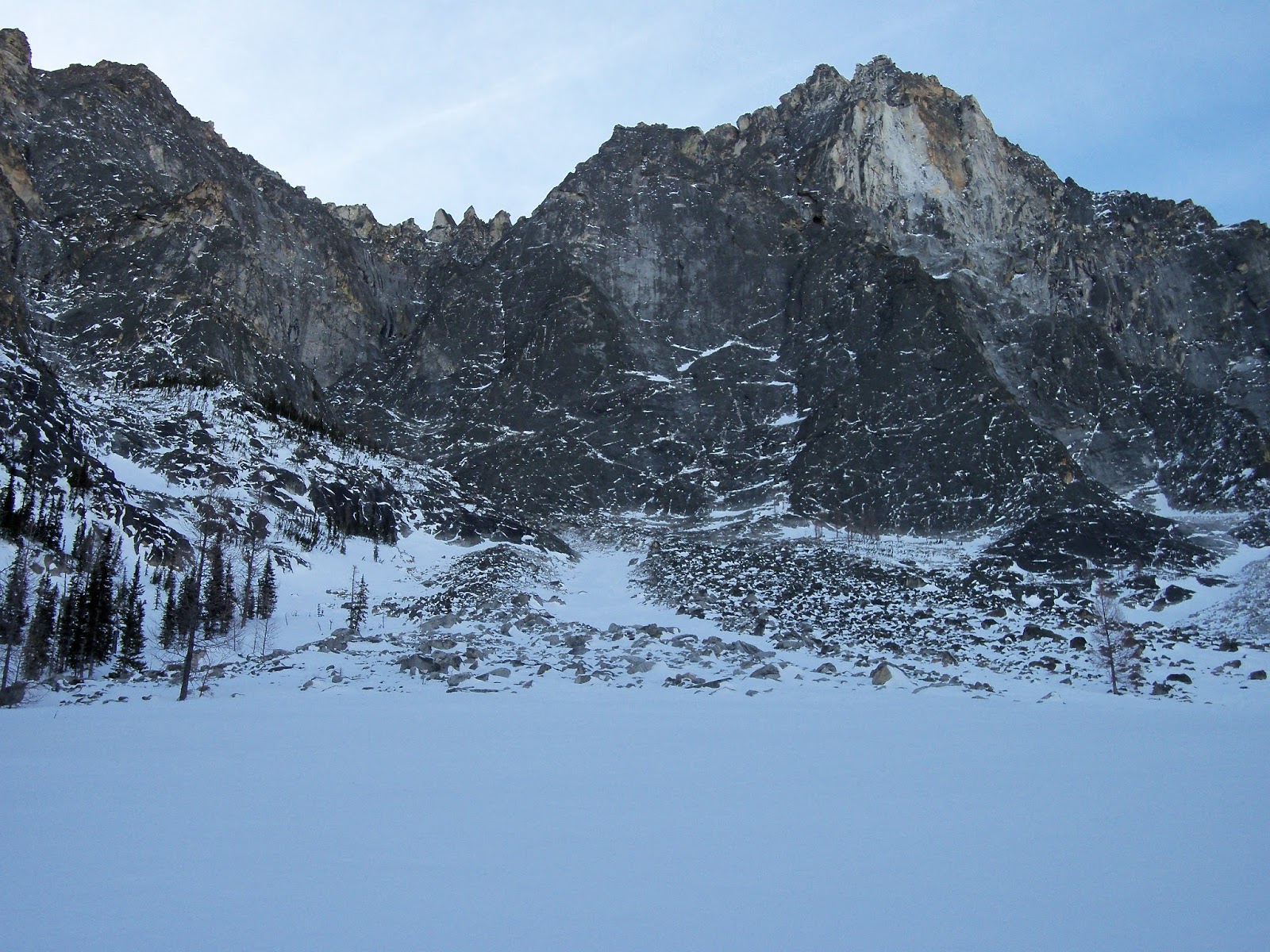
Avalanche consideration: Snow covered rock slabs: One fairly unique terrain feature in the Bitterroot range is smooth granite rock slabs that underly many slopes. These pose an elevated risk of glide avalanches, ice under snow, and thin, weird snow conditions. It seems like the avalanche science (and ability to locally forecast) for avalanche conditions is poor. My advice is to put work in researching steep ski objectives, and treating steep rock slab slopes with extra caution, particularly during periods of extended warming. Remember that in addition to elevate avalanche risk travelling on or below these terrain features, there is a risk of getting stuck in thin snow over rock slabs and being unable to get boot purchase to climb out. As a rule, from personal experience, the more time I spend in the range, the less I like being on or below rock steep snow covered rock slabs.
Lolo Peak
Lolo Peak is most commonly skied early season or after the seasonal Mormon peak road gate opens on May 16th. Access is by climbing over Carlton ridge from the Carlton ridge trailhead. The most commonly skied run is the North or Northeast face. The most popular runs are steep enough to slide, and deserve respect. There is a lot more good ski terrain in the zone, including East facing chutes and bowls South of the North summit, chutes and steep runs into the Lantern lake cirque, steep terrain Northeast of of North Lolo peak.
Sweeney
Sweeney peak is most commonly skied early season or in the spring when the road is accessible. The Sweeney road is especially steep. If in doubt, park early because access is just fine if you can make it to within three switchbacks of the trailhead. An ascent and descent of the peak by the East ridge is one of the finest moderate mountaineering outings in the range. There are three North/Northeast facing bowls along the approach ridge, all of which provide good skiing, especially the middle bowl. Sweeney peak can be used as a launching point for longer tours. Additional good ski terrain includes the South avalanche path into Sweeney creek, which was opened up by the 2017 Lolo Peak fire, vast terrain in upper One Horse creek, and at least two complex peak to creek runs on the North face of Sweeney peak.
An "around the compass" tour is an especially quality longer outing (Northwest face into One Horse, South gully from the top, then back to the summit and out). Traversing from Sweeney to Lolo in either direction is also quality outing on both skis and in summer on foot.
Bass Creek
Bass Creek competes with Gash creek for title of the best drainage for winter skiing in the Bitterroot range. The drainage climbs much faster from the valley than most other drainages, reducing the need for robust low elevation snow, and allowing skiers a quick egress. In addition, the drive from Missoula is short, and the road to the trailhead almost never snows in.
Little St. Joe
Little St. Joe is a well established and popular ski destination. The peak gets more than its share of wind, and the ski out is poor, but it is still a worthy ski destination in itself, and is a great jumping off point for bigger tours. The road is driveable for a mile past the Bass trailhead. The driving doesn't save significant time, but starting from the gate can reduce dry land walking under some conditions. Under most conditions, however, the recommended start is from the main Bass Creek parking area. Head straight up the east face, cutting switchbacks to the summer trailhead. Please detour well around the private residence at the first switchback. The route roughly follows the broad southeast ridge, and there is usually a skin track. From the summer trailhead, follow the summer trail up the southeast ridge to the summit. From the summit, two large bowls on the east face provide many ski options. The skiing is generally safe, but beware of a prominent midslope rollover into the South bowl, which is avalanche prone. There is a primitive backcountry ski cabin on the east face of Little St. Joe, roughly below the southern of the east face bowls at 6,800 feet. It is maintained by the Rocky Mountain Mountaineers of Missoula, and they control access.
The North gully was opened up by the 2017 Lolo peak fire, and is now a pretty good ski run (avalanche permitting) that can fill in most of the way down to Sweeney creek. There are three main gully systems which drop South to Bass creek. The Wilderness gully system takes off from the small saddle at 7,800 feet. It is technical, with a series of rock and ice steps, and almost never has enough snow to ski. It comes highly recommended though. First descent Ned Gall et all, 2019. The Dream gully is the major gully system that terminates in Bass Falls. It is technical, with a few mid-gully chokes and ends in massive slabby cliffs. During the first descent in February 2019, Ned Gall and Frank Preston made a climbing exit to the West to avoid the lower slabs entirely. Incredibly, they skied all of the technical steps without removing skis. During the second descent a few days later, the author negotiated the middle ice step with a single tool, crampons, and fear. It would presumably be possible to build a rock anchor to rappel this 10m step. The Presidental gully is by far the most reliable ski run on the South aspect of Little Saint Joe. It provides an adventurous, 3,400 foot descent into Bass creek. A deep snowpack is required to fill in rock slabs midway and whipper willows at the bottom of the gully, but it is a pretty good run when in condition.
The drainage which drops South to Bass creek just west of Little St. Joe has moderate skiing in the headwaters and can be accessed from Bass creek (scrappy approach), or over the top from Little St. Joe. No one ever skis there, but the skiing is surprisingly good, and one has the option to exit via the Pinball Wizard gully if stability allows. Leave the trail just past the second creek crossing and use your best brush skinning tricks to access the upper basin.
This classic Pinball Wizard gully is one of the most accessible and finest peak to creek descents in the range. The lower portion of the gully is incised and tricky with a thin snowpack, but when in condition, provides a wild and enjoyable half pipe exit to the creek. Although skiing in the gut of the gully is remarkably safe, a large starting zone hangs above the gully, and snow over smooth rock slabs above the gully itself both occasionally avalanche in a major fashion, so treat it with respect. The gully can be accessed either from the Little Lt. Joe/St. Joseph peak ridgeline (by far the standard approach) or from the parallel gully system to the east. Climbing from the bottom is not advised to avoid avlanche exposure from parties descending top down.
St. Joseph peak
St Joseph peak, or Big St. Joe, is another excellent, relatively popular ski destination, and, with caution, can be skied safely with slightly elevated avalanche danger. The southeast bowl provides the safest and most popular ski line.
Bass Creek competes with Gash creek for title of the best drainage for winter skiing in the Bitterroot range. The drainage climbs much faster from the valley than most other drainages, reducing the need for robust low elevation snow, and allowing skiers a quick egress. In addition, the drive from Missoula is short, and the road to the trailhead almost never snows in.
Little St. Joe
Little St. Joe is a well established and popular ski destination. The peak gets more than its share of wind, and the ski out is poor, but it is still a worthy ski destination in itself, and is a great jumping off point for bigger tours. The road is driveable for a mile past the Bass trailhead. The driving doesn't save significant time, but starting from the gate can reduce dry land walking under some conditions. Under most conditions, however, the recommended start is from the main Bass Creek parking area. Head straight up the east face, cutting switchbacks to the summer trailhead. Please detour well around the private residence at the first switchback. The route roughly follows the broad southeast ridge, and there is usually a skin track. From the summer trailhead, follow the summer trail up the southeast ridge to the summit. From the summit, two large bowls on the east face provide many ski options. The skiing is generally safe, but beware of a prominent midslope rollover into the South bowl, which is avalanche prone. There is a primitive backcountry ski cabin on the east face of Little St. Joe, roughly below the southern of the east face bowls at 6,800 feet. It is maintained by the Rocky Mountain Mountaineers of Missoula, and they control access.
The North gully was opened up by the 2017 Lolo peak fire, and is now a pretty good ski run (avalanche permitting) that can fill in most of the way down to Sweeney creek. There are three main gully systems which drop South to Bass creek. The Wilderness gully system takes off from the small saddle at 7,800 feet. It is technical, with a series of rock and ice steps, and almost never has enough snow to ski. It comes highly recommended though. First descent Ned Gall et all, 2019. The Dream gully is the major gully system that terminates in Bass Falls. It is technical, with a few mid-gully chokes and ends in massive slabby cliffs. During the first descent in February 2019, Ned Gall and Frank Preston made a climbing exit to the West to avoid the lower slabs entirely. Incredibly, they skied all of the technical steps without removing skis. During the second descent a few days later, the author negotiated the middle ice step with a single tool, crampons, and fear. It would presumably be possible to build a rock anchor to rappel this 10m step. The Presidental gully is by far the most reliable ski run on the South aspect of Little Saint Joe. It provides an adventurous, 3,400 foot descent into Bass creek. A deep snowpack is required to fill in rock slabs midway and whipper willows at the bottom of the gully, but it is a pretty good run when in condition.
 |
| South aspect of Little St. Joe. The Presidental Gully is the obvious gully in the center of the photo. |
This classic Pinball Wizard gully is one of the most accessible and finest peak to creek descents in the range. The lower portion of the gully is incised and tricky with a thin snowpack, but when in condition, provides a wild and enjoyable half pipe exit to the creek. Although skiing in the gut of the gully is remarkably safe, a large starting zone hangs above the gully, and snow over smooth rock slabs above the gully itself both occasionally avalanche in a major fashion, so treat it with respect. The gully can be accessed either from the Little Lt. Joe/St. Joseph peak ridgeline (by far the standard approach) or from the parallel gully system to the east. Climbing from the bottom is not advised to avoid avlanche exposure from parties descending top down.
 |
| An in condition Pinball Wizard gully from the Bass creek trail. |
St Joseph peak, or Big St. Joe, is another excellent, relatively popular ski destination, and, with caution, can be skied safely with slightly elevated avalanche danger. The southeast bowl provides the safest and most popular ski line.
The northeast face has several steep ski lines which drop 1,200 vertical feet to a bench, with good treed skiing all the way to the creek. The North face is often partially wind scoured, but provides an excellent run all the way to Sweeney creek when in condition. The south face of St. Joseph has many good ski lines, ranging from short but excellent tree lanes below the southeast ridge, to long exposed avalanche chutes on the south face proper.
The big south face chutes are very good ski runs, but they are also major avalanche performers, so treat them with respect. I think that the easiest approach to the summit is to gain the Southeast bowl from the bottom. I have not found a great way through the lowest 600 vertical feet, but I think that the best route is to work through the lowest set of cliffs East of the drainage below the face. If you nail it, you should be able to weasel through the cliffs, scrap your way up a narrow swath of threes in the middle of the nose until the slope angle lessens, then make a long ascending climb West to the bottom of the main Southeast bowl around 6,600 feet. It is also possible to climb the incised drainage as far as you can, eventually passing steep terrain on the East. As soon as the terrain mellows out, work your way up and west, eventually emerging in the southeast bowl. The Southeast ridge can also be climbed directly. Climbing is steep and tricky for the bottom thousand vertical feet, but once on the ridge, the climbing is easy all the way to the summit.
Crown point/Bass creek crags
Crown point is the craggy summit immediately east of Bass creek crags. It is prominently visible from the valley. The burned East and South faces have good long safe ski runs. They would be more popular if the approach and egress from the valley were less choked with downfall. Still, I think it is worth checking out. Crown point sports a bold ski line down the northeast ridge which drops from the exact summit. The run provides a great adventure when it is in condition, but make sure the lower elevation ice step and boulder fields are passable before giving it a go. A slightly more moderate variation is to ski the upper few hundred feet of the Northeast ridge, then wrap West into the Bass creek crags cirque. To approach Crown point, walk up the summer trail a hundred yards or so to an obvious place whre people access the creek. Cross the creek here - there are a couple of channels and there is an irrigation structure on the South shore. From there, a user trail climbs Southeast out of the creek. Follow user trails to the base of the mountains and start up the Northeast ridge. The route on the lower mountain is close to the Northeast ridge and has an intermittent user trail. There is a thick band of downfall between about 5,000 and 6,500 feet with no great route, but staying North near the ridge seems like the best option. The final 200 vertical feet of skinning to the exact summit of Crown Point is slow and exposed, with several gendarmes and cliffs to negotiate.
The cirque below the north face of Bass creek crags has several excellent ski lines. The best approach is to leave the trail somewhere in the vicinity of the small perennial stream crossing where you always have to take your skis off. Continue up through heavy brush and cliffs until the drainage opens up, then climb easily into the upper basin. Once in the basin, there are several long open chutes extending up toward the Bass creek crags and Crown point. One of the chutes can also be accessed from the South side by climbing close to the summit of Crown point and doing an exposed across two avalanche chutes on the South side, then climbing a couloir to the top of the Bass creek crag line.
There is a narrow north facing cirque sandwiched between the Bass creek crag and Lappi lake cirques. It can be skied with relatively high avalanche danger, but most of the skiing is choked with dense trees. Climb up from the bottom, starting up at or just before the Pinball Wizard avalanche runout zone.
Lappi to Bass Lake
The Lappi lake area has a variety of good skiing, and can be skied during periods of relatively high avalanche danger. There are a lot of steep rollovers, which makes high avalanche danger skiing tricky. Lappi lake can be approached at the base of open East facing meadows near the summer trail. I don't think there is really a perfectly nice way to approach, but the recommended approach is to bushwack up through unpleasant dense trees for 400 feet, climb along the base of open west facing slopes on the east edge of the drainage to 6400 feet, cross the creek, then climb a steep pitch to the West which quickly mellows out and climbs all the way to the ridge above the lake. There are several options from the lake. A short but high quality west facing couloir drops to the lake. Rolling northeast facing terrain capped by a fun, moderate bowl also sits above the lake. From the summit west of the lake, an excellent, moderate southeast facing bowl drops all the way into Kootenai creek, and the upper 1,500 vertical feet provide good skiing. There is good open burned tree skiing on the vast Southwest face. The adjacent north facing cirque to the west of Lappi lake has an excellent run all the way to Bass creek, and is the recommended exit for tours into the Lappi lake area. The bowl can be climbed from the bottom, or one can ski in from the top. Although all of the entrances from the top are steep, the safest entrance is down through steep Northwest facing trees around 7,700 feet. This cirque has several short and steep chutelets on it's western margin that avalanche frequently but look to be exciting ski runs when stable.
There is a prominent rock spire west of the two Lappi cirques which has a dramatic north facing gully which the author informally calls the Flathead couloir. It is possible to descend from the very top, but a 20m rappel is required. A descent from below the slab is recommended.
Smokey Joe (elev 8,593 ft) is the next peak west of the Lappi cirques. Its western slopes drop to Bass lake, and have several appealing ski lines. Smokey Joe's northeast face is a massive avalanche path, and is criscrossed with cliffs and ice bulges. It is a great ski run, but is also a major avalanche performer, and must be treated with respect. The northeast shoulder of Smokey Joe has an excellent, steep northeast rollover ski run as well as more moderate, high quality terrain on the southeast side. The cirque to the east has a lot of short, steep terrain.
Stormy Joe (elev. 9,008 ft) dominates the skyline west of Saint Joseph peak. Stormy Joe's south face has several striking couloir systems. The Southwest shoulder has several chutes with short rocklined sections, which are all good. The central portion of the South face is a complicated series of rock slabs and discontinuous gullies, but there are two primary gully system which go cleanly. The western gully system is non technical. The Center gully (informal name) is a complex route that has a rock slab crux at the bottom, and a long pitch of ice (WI 2) midway up and a bit hanging snowfield at the top. It is not great skiing, but does provide an engaging technical challenge. The most obvious and only classic ski line is Party in the Couloir, a striking, clean couloir on the Southeast face which terminates 800 vertical feet below the summit. There is a very complex couloir system east of Party in a couloir which involves a tricky sneak exit and sporty waterfall ice negotiation at the bottom.
 |
| Stormy Joe (left). The big V shaped snowfield (west gully) and barely-there-center gully are visible. |
 |
| Entrance to the Central gully on Stormy Joe. Bring ice tools and have an adventure. |
Bass Lake
It takes at least 3 hours to approach Bass Lake, but the terrain is abundant, and the snow is usually deep. The ski terrain around Bass lake is dominated by north Bass peak, which provides excellent, moderate open glade skiing back to the lake, or to the east into the head of Kootenai creek. The western flanks of Smokly Joe and the southern flanks of Stormy Joe all drop to the lake, and have a variety of terrain (described above).
Intrepid skiers can climb west from Bass lake and access terrain in the head of the South Fork of Lolo Creek. The Beyond Bass couloirs are two runs which drop west off the Northwest side of Point 8551. These two striking rock lined couloirs feature chokes mid-way down which require a difficult downclimb or rappel from trees (south fork), or an ice bulge rappel from a v-thread (north fork).
Kootenai Creek
Kootenai Point
From the Kootenail Parking Lot, cross Kootenai Creek and find your way onto the east ridge above the creek (with landowner - the house below the trailhead - permission if crossing Kootenai creek at the trailhead, or at the Diving Board Wall about 200 yards up canyon). Take the broad east face and ridge to the Kootenai Point Bowl, which is on the far north shoulder of St. Mary's Peak. During the approach, a high bump on the east ridge is best passed on the south via an old logging road. The Gold couloir is the recommended ski line, and the Frankincense couloir is also a less aesthetic but still worthy alternative to the Gold couloir. All of the other ski lines in the cirque are technical. The Manger couloir requires an exposed ski down to where one can rig a single rope rappel from trees. The Myrrh Couloir requires at least one 30m rappel from a large dead tree, and a WI2 ice step if climbing the route. Exiting to the creek from the base of the Gold cirque looks to be unpleasant. The recommended exit route is to climb up and west from the Gold cirque and exit via the Exit Bowl.
The Exit bowl can be skied top down, and is among the best peak to creek runs in the range. It is a major avalanche path. The lower gully required a deep snowpack and is a nightmare when melted out or completely choked with avalanche debris. But when in condition, it is a great run. From point 8,672, ski down the NW ridge, minding cornices. Leave the ridge at 8,000 feet, and ski Northeast through a steep entrance pitch into the bowl.

Kootenai creek is generally a tough drainage for skiing. The trail is long and undulating, and aside from Kootenai point, most of the good skiable lines are way up the drainage. However, there is quite a bit of terrain in the upper drainage. In the upper drainage, the terrain above all of the Kootenai lakes provide a variety of skiiable terrain, from steep bowls and chutes to more moderate and safe tree protected skiing. Also, several nice looking tree lined avalanche paths drop south to Kootenai creek from points along the Kootenai/Bass ridgeline.
Saint Mary Peak
Saint Mary Peak is a justifiably popular early and late ski season destination. The road climbs all the way up to 6,700 feet, providing easy access to skiing. Many driving epics have been encountered on the road, so treat it with respect and don't be afraid to park early. The road is open all winter, and often plowed to the first major switchback by land owners along the road. The peak gets more than it's fair share of wind. Most everyone approaches the peak roughly following the summer climbing trail. During the approach, reasonable short South facing ski runs can be taken down into McCalla creek. A series of East and Northeast facing bowls drop into upper Sharrott creek, and all have good skiing. From the base of the lowest Northeast bowl, a short climb puts one back on the trail just a few miles from the trailhead.
The East facing bowls South of the summit above McCalla lake are also good. The McCalla zone can be approached via the Saint Mary trail, or via the Southeast ridge of the cirque. From the top of these bowls, it is possible to ski a good Southwest facing tree run into St. Mary creek and/or the headwaters of Kootenai creek. The Saint Mary creek basin has an abundance of moderate tree skiing. At the head of this basin, Disappointment peak has good skiing off its Southeast face, or better yet, down its Northeast face or hidden North/Northwest couloir. Also in the St. Mary area, the short basin just West of the main peak is lined with good short runs.
Although the most popular tours appear to be one or two- run outings in the South trees to McCalla creek or any of the Northeast bowls, there are many ways to string together big days bouncing all over the mountain.
Big Creek
Although pretty much everything in Big creek has a long approach, there is enough high quality skiing that it can be worth succumbing to the slog. In the winter, it is recommended to park out at the junction with the Glenn lake road, or at the end of the plowing in big snow years if there is any doubt about driving to the trailhead since there are no reliable turnaround points with deep snow.
A primary objective in Big Creek is the Heavenly Twins. The 4,400 foot South face of the South Twin is one of the under appreciated classics of the range. The recommended route from Big creek is to approach via the drainage below the Southeast face. One can expect to encounter a sea of willows before the gully forms, but when in condition, the entire climb past the willows is enjoyable. The upper basin is a playground for skiers. To summit the heavenly Twins, gain the South ridge of the peak, contour climber's left onto the upper Southwest face of the peak, and climb to the summit. The Southwest face can be approached from Beaver creek, but it may be more expedient to use the Southeast avalanche path as an approach. The East face of the North Twin provides a difficult but worthwhile ski objective, and can be extended into magical cirque between Disappointment peak and the Twins.
There are a pair of 3,600 vertical foot South facing gullies off the South shoulder of Disappointment peak. The Disappointment gullies almost never have as much snow as would be preferable, but they both provide long and interesting peak to creek runs. It's unclear if the best approach is St. Mary creek is (not user friendly, but doable), or from the standard Southeast Heavenly Twins approach.
 |
| The Southeast path of Heavenly Twins, and the twin Disappointment gullies. |
 |
| Southwest face of the Heavenly Twins |
On the South side of the drainage, it is possible to ski most of the long peak to creek runs by approaching to Glen lake and skiing a big peak to creek line at the end of the day. Notable objectives include the Northeast face of Hidden lake peak, and the historic avalanche path off Glen lake peak and the tree lined gully just West of the historic path.
Gash Point Area
Gash Point is one of the best ski portals in the Bitterroot. And for good reason, considering the abundance of high elevation terrain, safe skiing, a relatively short approach, and winter-long road access to 5,000 feet. The most common access point is from the lower Gash Creek trailhead. In addition to the more accessible terrain, Gash provides a high elevation route to upper Bear and Sweathouse creeks. Get an early start and let your imagination run wild.
Driving Directions:
To reach the Gash trailhead, turn north off Highway 89 in Victor at the traffic light or on Fifth street. Head West about 1.5 miles until you hit a T-intersection with Pleasant View Road. Take a left and follow this road through several 90 degree bends. Be sure to stay right at the Y-intersection with Red Eagle drive. The road will eventually turn to dirt. Climb up past residences, eventually topping out at the intersection with the Bear creek Overlook road. The Montana Backcountry Alliance has workout an agreement to extend snow plowing bout a half mile beyond the final residence, and limited parking is usually available in turnouts along the road. If you decide to drive to the lower trailhead, note that a dowhill pitch, two draws, the final half mile of north facing road, and cars that get stuck during the day can all present obstacles at different snow levels. There are two trailheads, but it is advised to park at the lower trailhead since it does not take much more time to ski to the upper trailhead than it takes to drive, and the ski out to the lower trailhead is much faster than the drive down from the upper trailhead.
Approach:
From the lower trailhead, follow the skin track or summer trail to the upper trailhead (45 minutes), and continue into upper Gash Creek. T'he approach to the main bowls crosses the creek and heads up a broad ridge all they way to the base of the bowls. The approach to Gash point proper and beyond heads up the prominent broad ridge between Gash and Sweathouse creeks.
Main bowls and Gash knob
The terrain around Gash knob provides long, safe ski runs with consistently good snow. The main bowl is one of the most popular ski destinations in the Bitterroot. Aside from steep roll overs along the rim of the main bowl and a steep rollover below the western bowl, the entire area can be skied safely even during periods of high avalanche danger. There are also good runs farther to the East along the ridge, but the egress is less desirable. The main bowl can also be approached from the Bear Creek Overlook road and trail. This high route is longer, but provides a more aesthetic and high elevation alternative to the standard approach.
The slope between Gash knob and Gash point proper is littered with short ski runs. Beware of avalanches on the rollover at the base of these slopes.
Gash Point proper
A tour to the summit of Gash point from the parking lot and back is one of the moderate classics of the range. There is almost always a skin track, it is all out of avalanche terrain, and views from the summit are fantastic. The 2,800 vertical foot North face of Gash point is a good, long ski run. The safest route is on the skier's right edge of the face, especially at the top. The entire face will occasionally avalanche catastrophically, so be aware. From the base of the face, skiers can continue into endless touring terrain in the headwaters of Sweathouse creek.
A tour to the summit of Gash point from the parking lot and back is one of the moderate classics of the range. There is almost always a skin track, it is all out of avalanche terrain, and views from the summit are fantastic. The 2,800 vertical foot North face of Gash point is a good, long ski run. The safest route is on the skier's right edge of the face, especially at the top. The entire face will occasionally avalanche catastrophically, so be aware. From the base of the face, skiers can continue into endless touring terrain in the headwaters of Sweathouse creek.
 |
| The imposing North face of Gash Point proper is the primary avalanche path. Mystery chutes are the four chutes on the looker's right shoulder of Gash. |
The Mystery chutes drop off the North face of the Northwest ridge of Gash point proper. The central chute is perhaps the highest quality, but they are all good (see "Gash and the Mystery chutes in Sweathouse Creek" blog post, March 2013, for more details).
The North facing zone just East of Gash point proper harbors steep and interesting North facing terrain. The author coined the term the Hidden Gashes, but would like to be informed if there is a different consensus name. Most of the lines are steep and fairly low elevation, so timing with good conditions is much less reliable than the more traditional Gash terrain. Nevertheless, there is a lot of good skiing off the beaten track.
 |
| Hidden Gashes zone includes all of the stripes of snow and the lightly treed slope on the looker's right edge of the most prominent avalanche path. |
Bear lake basin
One could spend several dawn-to-dusk days skiing high quality lines in the Bear lake basin. Since the access is via Gash point, the Bear Lake tours usually come into condition fairly early in the year, often well before the canyons have enough snow to allow reasonable access. The lake can be reached via a 2,000 descending traverse from Gash point proper. From the summit of Gash, descend about 200 vertical feet straight south to the top of a rock outcrop. From there, make a descending traverse to the west, cutting just below the two more prominent rock outcrops. Continue the descending traverse to the lake. Bear Lake can also be accessed via the North fork of Bear Creek, but the trail is long (2 hours minimum) and undulating. From the lake, the most classic and popular objective is the North face of Sky Pilot. The North face is most commonly climbed directly. The East face of Sky Pilot may be the most difficult ski descent to date in the Bitterroot. It has been skied by at least three parties (First descent by Colin Chisolm, February 2009). Point 8839 has several big avalanche chutes on its south face and a series of attractive rock lined couloirs on the west edge of the south face, all of which are highly recommended. To return to Gash point, eat your Wheaties, then re-trace your tracks up and east for 2,000 vertical feet to the summit of Gash Point proper.
 |
| The North face of Sky Pilot takes the obvious looker's right ramp. |
 |
| Looking back at the south face of 8,830 from the summit of Sky Pilot. Sweathouse spires behind |
Sweathouse creek is most easily accessed from the North face of Gash point proper. Alternatively, the creek can be accessed from the Northwest face of Gash Point proper (tricky), or from south facing avalanche paths above Glen lake. There are a lot of long rolling slopes in the upper drainage below the Sweathouse spires. The South facing wall of the drainage is lined with excellent ski runs including the iconic Hidden Lake Peak (8,618), and a couple handful of chutes which drop South from behind the Glenn lake bowls. Any tour from Gash into Sweathouse and back is likely going to be a long but fine outing. To return to the the Gash trailhead, climb the lower 1,500 vertical feet North face of Gash point proper, exit to the left, and follow the standard egress back to the car. Theoretically, Sweathouse creek can be accessed from the bottom of the drainage, but unconfirmed rumors indicate the bushwack is stout.
Fred Burr Creek
Fred Burr takes a lot of snow to fill the approach in, but there is a lot to do once there is a reasonable mid-elevation snowpack. The drive can be done all winter. From the trailhead, the first four miles or so are on a road, which helps speed the approach up. There isn't really much skiing before the reservoir. Beyond the reservoir the trail is poor and sparsely maintained. From the reservoir, two North facing finger ridges extending from the Fredd Burr/Sheafman ridge have good east facing skiing and North facing gullies. The trail crosses the creek without a bridge shortly above the reservoir. It is advised to leave the trail and stay on the South side of the drainage until the trail crosses back.
 |
| North facing gullies just up from the Reservoir |
Point 8,469 (Burr point) is one of the primary ski peaks in the drainage. It is most efficiently climbed via the Southeast face. Getting from the Southeast bowl up to the East summit ridge is tricky, and requires stable snow and some careful routefinding, but with good conditions is an excellent, remote objective. From the exact summit, one can ski sheltered slopes Northeast into Bear Creek. From the South summit ridge, one can also access two long and spectacular South facing peak to creek gullies from the top. The Southeast face of Burr point also provides access to the quality adjacent peak to creek gully to the East, which is a good ski run and/or alternate exit from the main Southeast face.
 |
| Looking up the Southeast face of Burr point. |
 |
| Burr point showing the two prominent South gullies. The moderate Southeast face is half visible on the right. |
On the South side of the creek, the basin below Castle Crag has good skiing. The cirque is guarded by nasty re-gen, but the worst of it can be avoided by approaching as far up drainage as possible. The large cirque has vast low angle North and East facing terrain, the North gullies of Castle crag, and at least one interesting West facing couloir.
The Northwest shoulder of Castle crag has a series of excellent peak to creek runs which require deep low elevation snow and feature rock slabs in places. Most of the obvious runs have been skied, but perhaps only a time or two. Further up the drainage, there are countless peak to creek runs for those willing to overnight and/or make the long approach.
Sheafman Creek |
| Moderate terrain in the Castle Crag cirque. |
 |
| Better than it looks couloir in the Castle Crag cirque. |
Sheafman Creek sits at 6,500 feet and as a result, holds a lot more snow than adjacent drainages. Unfortunately, the gate on the Sheafman road is closed at the valley in the winter, necessitating a 5-mile approach to the trailhead. By cutting switchbacks, this can be done in less than an hour each way. The burned east face between Mill and Sheafman creeks is informally called Nipple knob. Although much of the approach is often dry, there is good skiing on both the east and north face, and one can link up an interesting tour in a moderate day.
The trail into Sheafman creek wraps north from the summer trailhead before eventually crossing the creek and climbing to a trio of small lakes at the head of the drainage. The south side of the creek is short and does not have many interesting ski lines, but the north side of the creek has several intriguing peak to creek ski runs from East and West Sheafman points.
The iconic Castle Crag dominates the head of the basin. The Northeast shoulder of Castle Crag, North couloir of Castle Crag into Fred Burr (short but very steep), and South face into Mill Creek are all recommended. The view from the top of Castle Crag is one of the best in the range.
The trail into Sheafman creek wraps north from the summer trailhead before eventually crossing the creek and climbing to a trio of small lakes at the head of the drainage. The south side of the creek is short and does not have many interesting ski lines, but the north side of the creek has several intriguing peak to creek ski runs from East and West Sheafman points.
 |
| South facing terrain in Sheafman, showing Castle crag on the left, and all of the skiable peak to creek runs from left to right. |
 |
| Lookind down canyon at West and East Sheafman points. |
 |
| North couloirs of Castle Crag. |
Mill Creek
Mill Point is best accessed from the Mill Creek trailhead. From the trailhead (snow plowed all year), walk or skin straight South off trail through the forest and the toe of the main Mill point slope, using old roads and trails where they exist (15 - 30 minutes). Shortly after crossing a series of dry draws, one will see private land and a few houses. Begin climbing, giving the houses a wide birth. You should be able to get onto a road prism which climbs up onto the lower flanks of the mountain. The goal is to gain the ridge just North of Tamarack creek. Take the road prism until it peters out, passing a decrepit shack along the way. As the road peters out just continue climbing straight west to the summit of Mill Point. It is also possible to approach from Blodgett Creek, but that approach takes longer, and the drive is more difficult in winter. The approach to Mill Point is reasonably efficient. The most common and excellent run is down safe terrain to Tag Alder lake. The Southeast face is an excellent, under appreciated objective. One can also launch West to Mill 2, or any of several gullies South into Blodgett creek (expect to run out of snow above the creek).
Farther up canyon, the most reliable skiing access begins at the Mill 1/2 gully, and each subsequent North facing gully provides access to good skiing for those willing to fight it a bit to get into the upper basins. The trail requires a good snow pack to ski, but it receives heavy enough pedestrian use to be walkable in lower snow years. On Mill 2 (8,650), the Alaska face (East face) serves up a spicy ski objective, and the Northwest gully is a hidden gem. The Mill 2/3 basin has an assortment of interesting gullies and ramps, and is capped off by the perched summit run from Mill 3 (8,807). Further up canyon, each basin and avalanche path appears to contain worthwhile ski objectives. On the North side of the creek, the South gullies of Castle crag are excellent but quite a long way from civilization.
Blodgett Creek
A summer hot bed of climbing and hiking, winter use in Blodgett drops off to a trickle of hikers, ice climbers, and rock climbers seeking out a little patch of warm winter granite. Skiing requires robust low elevation snow and the approaches are long, but there are a lot of big and interesting things to do. Although it does snow in on big years, the trailhead is typically accessible.
Canyon CreekA summer hot bed of climbing and hiking, winter use in Blodgett drops off to a trickle of hikers, ice climbers, and rock climbers seeking out a little patch of warm winter granite. Skiing requires robust low elevation snow and the approaches are long, but there are a lot of big and interesting things to do. Although it does snow in on big years, the trailhead is typically accessible.
The Blodgett creek trail is good for
skiing with moderate coverage. The trail receives pretty regular foot traffic to the bridge around mile 2.5, so consider approaching in shoes to that point to save wear and tear on feet and skis.
Lower Canyon
Blodgett is lined with good peak to creek ski runs. Most of
the big gully systems have multiple branches and variations, and one can make a full day just skiing multiple forks in each of the gully systems. Gullies in the lower canyons adjacent to the main climbing spires almost never have enough snow to exit from the trail, but can often be skied from Mill point, or by using the climbing approaches like the Shoshone approach to gain reliable snow. Avalanche paths between Mill 2 and the Blue ice bowl off 8,345 require a lot of snow, but also contain a lot of terrain. The Blue Ice bowl is prominently
visible from the lower Canyon. Climbing into the basin is tricky from the bottom, and much of the obvious open runs sit on precarious rock slabs.
North facing skiing in the lower canyon is rarely in condition and is becoming more and more congested with regeneration following the Blodgett creek fire. The Swan slab gully, Arch bowl, exit to the valley west of the Arch bowl are a few options. The Swan slab gully can be skied as a loop, approaching from the Bodgett overlook trail in Canyon creek. I have not had a good experience getting around the slabs and ice at the bottom of the run and do not recommend Swan slabs. There is also a wide open steep path that drops from 8,352, but it sits on precarious rock slabs. It seems like it's better to ski most of the North facing, lower canyon terrain top down, ending ski runs where snow gets thin, and approaching and exiting from Canyon creek.
 |
| In the Mill 2 south gully with Swan slabs behind. |
Up canyon from the Blue ice bowl, the snow is deeper, and South facing avalanche paths reach closer to the trail, making for more reliable coverage and cleaner exits. There are several excellent peak to creek ski runs, including the Southwest gully from the point above the Blue Ice bowl (entrance guarded by a tricky rock slab step which can be bypasses skier's left), Sears point South, and two gullies by the point west of Sears. The quality north couloir drops from Sears point to Sears lake. North facing terrain becomes more reliably accessible as well with lots of options.
 |
| South facing peak to creek runs in upper Blodgett from point 8,345 west past point 8,663. All excellent runs if you can stomach the long flat approach. |
 |
| Northwest side of Cesar's Palace. |
With an arduous approach and limited skiing, the Canyon Creek trail pretty much always softens morale. On the upside, the canyon sits just high enough to make the approach more reasonable in meager snow years, and the upper drainage harbors quality skiing.
Driving Directions and Access: The Canyon Creek road takes off from the Blodgett road, about two miles before the trailhead. The Canyon Creek road is hit or miss for driving in winter. The road is plowed for about a mile past the Blodgett turnoff. From there, one can normally drive to at least the first switchback. Take note that the trailhead has a poor turnaround and is shaded. If in doubt, consider parking at one of the large turnouts on the road where it turns west about a quarter mile before the trailhead. The trail undulates for the entirety of its torturous duration, so bring some extra morale. Plan three hours minimum to get to Canyon Lake
Skiing: During average to high snow years, Downing peak proper can be accessed via a boulder field just past the Wilderness Boundary. There are lots of ski options on Downing, including a long South gully into Sawtooth creek, but the access is tricky enough and terrain is limited enough that I don't think Downing mountain is necessary worth the effort. Further up canyon, one can nose through a low band of cliffs, climb to Romney creek, and ski one of several runs North toward Blodgett creek off of points 8,002 or 8,685. There is a lot of excellent skiing on the moderate slopes above Canyon and Wyatt lakes. The South face of Canyon peak is a Bitterroot classic. It drops directly from near the summit all the way down to Sawtooth Creek. It is also a major avalanche performer. Although the South face is in the Sawtooth Creek drainage, the recommended access is up Canyon Creek. From Wyatt lake, climb to the obvious col on the Canyon/Sawtooth divide, which is often guarded by a massive cornice. From the col, rip skins and traverse to the South face. Climb as high as you dare, ski as far as you like, and reverse the route to exit.
 |
| The South face of Canyon peak from near the base of the ski run. |
God bless your soul if you venture into this canyon to ski. It seems like the only reasonable way to ski most terrain in Sawtooth is shorter shots down toward the canyon during tours in adjacent drainages.
Roaring Lion Canyon
There is actually quite a bit of reasonable ski terrain in Roaring Lion, but the approach is long. The South facing side of the canyon does not reliably fill in, although there are a pair of very striking, ephemeral gullies across from the drainage below Ward 3 (point 8,799). On heavy snow years, it is possible to get out to the trail from the basin west of Ward. The White stripe gully drops off the face from the North ridge of Ward 2. The exist to the White strip requires monkeying around the gully where it cliffs out near the bottom. The basin containing Northeast face of Ward 3 and the Fin is decent. The North Face of Ward 3 has a couple of skiable runs. Farther up canyon, many ski options must exist but the approach is long.
Ward Peak
Ward Peak is a fairly popular out and back ski which can be done out of avalanche terrain.
Driving Directions and Access: Use the Sawtooth/Roaring Lion trailhead and approach via the summer trail. My experience is too light to recommend terrain, so go explore. In heavy snow years, it is possible to ski several of the north aspects into Roaring Lion creek.
Camas creek
Camas is a fairly popular ski destination, especially on the shoulders of the ski season when vehicle access is better. Camas creek is one of the only zones where snowmobiles are allowed, and mixed use is fairly common.
Driving Directions and Access: Approach from the Camas creek road. Road access varies as the road becomes snowed in during the year. The trail exit from Camas creek is steep enough to be blissfully short.
Skiing: The most common objective is point 8,766 (Camas point?) above Kidney lake. There are several good ski runs on the East through North face. Camas point is a good place to seek out powder skiing, but much of the terrain is just steep enough to merit extra consideration or avoidance with elevated avalanche danger. There are a variety of ways to approach, including the summer trail, and fireline from the Roaring Lion fire. Further up drainage, there are several other good ski runs including point 8,905 and Ward Mountain.
With stable conditions, a tour up Camas creek, down the BRIBE or one of several peak to creek runs to the North Fork of Lost Horse creek, then back up to Camas point and out is kind of a sneaky classic outing.
North Fork Lost Horse Creek
South Fork Lost Horse Creek and Koch peak
See North Fork Lost Horse creek for driving directions. The South fork trail existis but is so grown in that it is not really recommended. Also take note, there is no bridge across the main fork of Lost Horse creek so plan on wet feet unless the creek is iced over. A primary objective is the North couloir of Koch peak, or presumably terrain on all aspects up canyon from Koch. There are two couloirs, and the West branch is the most moderate and by far the most logical ski run. There are also two complex peak to creek gullies about a mile back down the drainage which provide a good challenge when filled in.
Driving Directions and Access: The established snowmobile trailhead is typically near the South Fork trailhead, but it seems to vary depending on snow depth and the particular grooming schedule of the local snowmobile club, who typically grooms Lost Horse creek road. Without specific knowledge, it seems like a reasonable tactic to stop driving where most of the snowmobile trailers have been turning around. The North Fork trail is faint at best, but it follows the best access route into the upper drainage, and roughly takes the slope break above the incised drainage on the east side of the creek. Access is reasonable by Bitterroot standards.
Skiing: Once in the basin, peak to creek avalanche paths drop south from the Camas creek, and provide a variety of excellent peak to creek runs. The south facing peak to creek runs can be logically combined with tours in the Camas Creek drainage. The south side of the canyon has many shorter options which are actually quite good, but aren't as long or striking as their neighbors across the creek.
Skiing: Once in the basin, peak to creek avalanche paths drop south from the Camas creek, and provide a variety of excellent peak to creek runs. The south facing peak to creek runs can be logically combined with tours in the Camas Creek drainage. The south side of the canyon has many shorter options which are actually quite good, but aren't as long or striking as their neighbors across the creek.
 |
| The South face of the North Fork of Lost Horse Creek photo #1. |
 |
| South face of the North Fork of Lost Horse Creek photo #2. The BRIBE gully is the major avalanche path just looker's right of center. |
 |
| South face of the North Fork of Lost Horse Creek photo #3. Camas peak is the highest peak. |
Lost Horse Creek
Lost Horse Creek is the only drainage in the Bitterroot with a road and snowmobile access. My knowledge is too limited to provide many recommendations, but there is a lot of excellent terrain on all aspects, and most of the terrain lower and mid in the drainage is too steep for snowmobilers to venture off the road. Much of the lower drainage is at low elevation, and a deep snowpack is required to make skiing accessible, however with a good snowpack there is a lot of good terrain on both sides of the drainage staring about a mile below Tenmile creek. Skate skis can be used to make relatively short work of the road, making it feasible to strike farther up this drainage than adjacent drainages, even without a snowmobile. It is possible to string together big loop tours into the North and South forks of Lost Horse creek without shuttling. South Fork Lost Horse Creek and Koch peak
See North Fork Lost Horse creek for driving directions. The South fork trail existis but is so grown in that it is not really recommended. Also take note, there is no bridge across the main fork of Lost Horse creek so plan on wet feet unless the creek is iced over. A primary objective is the North couloir of Koch peak, or presumably terrain on all aspects up canyon from Koch. There are two couloirs, and the West branch is the most moderate and by far the most logical ski run. There are also two complex peak to creek gullies about a mile back down the drainage which provide a good challenge when filled in.
I currently (as of 2025) think that the best approach to Koch is to approach via the long East ridge from Lake Como. It is an all day affair to approach, ski, climb out and egress, but it is a lot more elegant than fighting the remnants of the South Fork trail, and this approach still viable in spring after the lowest elevations are melted out. It is possible to approach Koch peak from Lost Horse creek by skiing up Lost Horse, climbing South to the crest, skiing one of several South facing peak to creek runs, climbing and skiing Koch, and exiting the South Fork.
 |
| Old route photo showing the North couloirs on Koch peak. |
 |
| Boot top powder in the North couloir on Koch peak. |
Little Rock Creek
The trailhead is several miles past Lake Como. It is not unusual to have to park either at the reservoir outlet, or only a few miles up the road. The lower portion of the trail often has a lot of skis on/off sections, but it gets better about a third of the way up the drainage. The approach from Little Rock creek lake to the upper lakes is quite easy with snow. All of the Como peaks can be accessed from the North from Little Tin Cup creek and there is good steep skiing on and adjacent to all of the sisters, but my experience is not sufficient to provide much information. Getting from the trail into the basins below the Sisters is tricky. In the headwaters of the drainage, there are several nice gullies south of the East face of El Capitan. The East face of El Capitan is one of the finest steep skiing challenges in the range. It is full value, so wait for good conditions and come prepared.
Tin Cup Creek
Tin Cup has a few big objectives, the Tin Cup chutes, and the south faces of the three Como peaks. Both are highly recommended. The Tin Cup chutes are massive avalanche performers, and are complicated by having poor snow coverage at the top of all of the gullies, making top down descents tricky at best. With proper consideration, they are some of the cleanest, longest north facing runs in the range. The South faces of all the Como peaks are great Bitterroot lines. There is a bench about halfway up the peaks, and access and skiing below the bench is challenging at best. The Middle and East peaks both have nice long runs to the bench. Driving is a bit tricky. Driving to the summer trailhead is hit or miss, and if you can't make it, it is likely that the entire approach road is too snowed in.
Chaffin Creek
The most popular objective in Chaffin Creek is the excellent Sliver Couloir of Sugarloaf peak. The route and approach are fairly self explanatory. Once can ski from the exact summit, or stash skis where the snow gets thin above the couloir and walk up to the North summit for a great view of Trapper and the surrounding peaks.
There are a bunch of other worthy objectives in the drainage. The lower drainage has several decent North facing peak to creek type lines. The East face of Little Tin Cup peak 9,617 is accessible from the Chaffin trailhead, by traversing on the main road system and dropping into Little Tin Cup creek, or preferably by climbing above the road system and skiing any of several steep runs higher into the drainage. Beware, the higher entrance runs are complex. The east face of Little Tin Cup peak is excellent and moderate, and would be a classic if access were reasonable. There are two long south facing peak to creek avalanche paths which drop from near the Little Tin Cup peak summit. They are also complex lines, so do some scouting and choose wisely.
The Shard is skiiable from the exact summit. The run is steep and exposed, but doable with good coverage and good steep skiing skill and judgement. The Southeast face of the West Shard (not from the exact summit) is an excellent run. The head of the drainage has a lot of good moderate skiing, and there is an especially high quality trio of runs above Tamarack lake off the peak just east of the Tusk. Plan at least 3.5 hours of approaching to access the head of the drainage.
By early spring, one can drive most of the way to the summer trailhead. It is typical for snow to pick up a lot in the last half mile or so, and parking just a bit shy may be the way to go.
Trapper Area
Trapper Peak has a lot of good skiing. It is typically skied in the spring, when the road starts to melt out, however the mid-winter approach from the highway is doable, and the peak can be skied all winter. A climb and descent along the summer trial is one of the finest easy mountaineering days in the range. In the spring, the recommended approach is to drive as far as you can toward the Baker lake, then approach to the lake on the summer trail. From Baker lake, head south and gain the ridge above the lake via a short, steep chute (this is the normal summer climber's route). From there, it is smooth sailing all the way up the broad east ridge to the peak. Return via Gem lakes. There are several gullies on the North side of the peak which are clearly visible from the highway, including the classic main North gully off the exact summit. One can climb back out, or you can ski down the drainage another thousand vertical feet or so, and climb a couloir back to the ridge above Gem lake.
Also in the Trapper/North Trapper cirque, the southeast face and couloir of North Trapper peak is a great mountaineering challenge. The run goes out of condition fairly early in the spring, and beware of underlying rock slabs that threaten to send glide avalanches into the couloir from the Southeast face. Farther down the drainage lie a handfull of rock and tree lined north gullies including the Oh My God chute which begins just below the top of point 8,992, and a pair of beautiful clean rock lined couloirs.
There are several good ski lines above Baker and Gem lakes. The Gem lake couloir is almost always guarded massive cornice. Treat it with respect, and plan on getting a bit creative if you ski it from the top. The adjacent moderate Gem lake ramps to the East of the couloir is also an excellent ski run.
The the North side of North Trapper peak has three distinct cirques, each containing one distinct ski line. The Northeast ramps off the Northeast shoulder of the peak has an excellent lower couloir which is choked by an ice bulge at 2/3 height. One can continue by exiting the couloir to the west and following ramps to the ridge top. I think this ski run may still await a complete descent from the ridge top. ]The next cirque west is split by Hidden couloir, a clean and long rock lined couloir which tops out immediately Northeast of the striking North ridge of North trapper. It is a dazzling couloir.
The Northwest gully of North trapper peak has a long rock step which requires easty 5th climbing and a rappel on the descent. The upper gully is always wind scoured, but it is a long line that is skiiable from just a few hundred feet below the summit.
The trailhead is several miles past Lake Como. It is not unusual to have to park either at the reservoir outlet, or only a few miles up the road. The lower portion of the trail often has a lot of skis on/off sections, but it gets better about a third of the way up the drainage. The approach from Little Rock creek lake to the upper lakes is quite easy with snow. All of the Como peaks can be accessed from the North from Little Tin Cup creek and there is good steep skiing on and adjacent to all of the sisters, but my experience is not sufficient to provide much information. Getting from the trail into the basins below the Sisters is tricky. In the headwaters of the drainage, there are several nice gullies south of the East face of El Capitan. The East face of El Capitan is one of the finest steep skiing challenges in the range. It is full value, so wait for good conditions and come prepared.
 |
| The East face of El Capitan in excellent condition after the first? descent. |
Tin Cup Creek
Tin Cup has a few big objectives, the Tin Cup chutes, and the south faces of the three Como peaks. Both are highly recommended. The Tin Cup chutes are massive avalanche performers, and are complicated by having poor snow coverage at the top of all of the gullies, making top down descents tricky at best. With proper consideration, they are some of the cleanest, longest north facing runs in the range. The South faces of all the Como peaks are great Bitterroot lines. There is a bench about halfway up the peaks, and access and skiing below the bench is challenging at best. The Middle and East peaks both have nice long runs to the bench. Driving is a bit tricky. Driving to the summer trailhead is hit or miss, and if you can't make it, it is likely that the entire approach road is too snowed in.
 |
| The Tin Cup chutes. |
 |
| South faces of Middle and East Como peaks. |
The most popular objective in Chaffin Creek is the excellent Sliver Couloir of Sugarloaf peak. The route and approach are fairly self explanatory. Once can ski from the exact summit, or stash skis where the snow gets thin above the couloir and walk up to the North summit for a great view of Trapper and the surrounding peaks.
 |
| Sugarloaf peak. The Sliver couloir cleaves the cliffs at the top of the obvious open couloir. |
 |
| Early/first descent of the Sliver couloir, skied from the exact summit of Sugarloaf peak. |
The Shard is skiiable from the exact summit. The run is steep and exposed, but doable with good coverage and good steep skiing skill and judgement. The Southeast face of the West Shard (not from the exact summit) is an excellent run. The head of the drainage has a lot of good moderate skiing, and there is an especially high quality trio of runs above Tamarack lake off the peak just east of the Tusk. Plan at least 3.5 hours of approaching to access the head of the drainage.
 |
| Complex south facing lines off Little Tin Cup peak. |
 |
| Route photo for the Shard. This route is not really recommended, but it goes. |
Trapper Area
Trapper Peak has a lot of good skiing. It is typically skied in the spring, when the road starts to melt out, however the mid-winter approach from the highway is doable, and the peak can be skied all winter. A climb and descent along the summer trial is one of the finest easy mountaineering days in the range. In the spring, the recommended approach is to drive as far as you can toward the Baker lake, then approach to the lake on the summer trail. From Baker lake, head south and gain the ridge above the lake via a short, steep chute (this is the normal summer climber's route). From there, it is smooth sailing all the way up the broad east ridge to the peak. Return via Gem lakes. There are several gullies on the North side of the peak which are clearly visible from the highway, including the classic main North gully off the exact summit. One can climb back out, or you can ski down the drainage another thousand vertical feet or so, and climb a couloir back to the ridge above Gem lake.
 |
| Trapper peak, North couloirs. |
 |
| The Southest face of North Trapper peak in good condition. |
 | ||
| Good mid-winter conditions at the start of the skiing on the Southeast face of North Trapper peak.  Photo: Dave Glueckert
|

 |
| The Gem lake couloir and Gem lake ramps. Gem lake is just out of view below the picture. |
 |
| The Northeast ramps is along the sun/shade line in the prominent gully. Hidden couloir is tucked behind the prominent rock ridge. |
 |
| Below the North face of North Trapper peak. The Northwest gully is hidden on the left side of the photo. |
 |
| Looking down the upper Northwest gully of North trapper peak. |
There are a bunch of high peaks and intriguing North facing couloirs along the ridge crest West of Trapper that can be accessed in spring by almost summiting Trapper, then continuing West, including an absolute splitter couloir on the North face of West Trapper peak.
Boulder Creek
Park on the West Fork Highway or just up the road which is signed for the Sam Billings Memorial Campground. To approach Boulder Point lookout, East Boulder Peak and Boulder Peak head up the road for a quarter mile or so and gain the east face. Continue west past School Point to the Boulder Point lookout, East Boulder Peak, or Boulder Peak. All these lines can be accessed from the canyon floor as well. The Boulder Creek trail is fair and tends to hold snow.
Boulder Point Lookout
Several steep gullies drop north from the Lookout to the creek. They require a deep snowpack. They are also bisected by cliffs, so plan accordingly.
East Boulder Peak
Several iconic couloirs and Bowls drop north from East Boulder Peak to Boulder Creek. The Blue Ice bowl is the most moderate. The Goddess and Mary couloirs are both big, complex and very good. The Jane couloir, on the western edge of the Mary cirque, is also very good but does not really top out on the ridge. Both sit on top of rock slabs and are also major avalanche performers, so approach with extra caution. There are several other couloirs in the Mary cirque.
Boulder Peak
Boulder Peak is most easily accessed via the east ridge and southeast face from East Boulder point. The south face to Nelson Lake and southeast face provide moderate and long runs. The lower northeast face can be reliably skied from about 400 vertical feet below the summit by climbing up from the creek. The Northeast face can be skied from the summit but it is steep enough that it is an extreme objective. There is a very steep and narrow couloir on the northwest face of the peak which merits further exploration.
South faces
Several aesthetic south facing gullies exist. On an average snow year, the good looking gullies with reliable snow start between Crow and Slide Creeks. Moderate climbs up Crow and Slide creeks provide access to Trapper and East Trapper peaks.
Other notable options
Boulder Point Lookout
Several steep gullies drop north from the Lookout to the creek. They require a deep snowpack. They are also bisected by cliffs, so plan accordingly.
 |
| Gully from Bolder lookout. Note the cliff mid-height. |
East Boulder Peak
Several iconic couloirs and Bowls drop north from East Boulder Peak to Boulder Creek. The Blue Ice bowl is the most moderate. The Goddess and Mary couloirs are both big, complex and very good. The Jane couloir, on the western edge of the Mary cirque, is also very good but does not really top out on the ridge. Both sit on top of rock slabs and are also major avalanche performers, so approach with extra caution. There are several other couloirs in the Mary cirque.
 |
| The Mary couloir cleaves the dark cliffs just left of the center of the photo. |
 |
| The Goddess is the couloir in the middle of the picture. The left gully has a major ice flow and is heavily guarded by cornices. |
Boulder Peak
Boulder Peak is most easily accessed via the east ridge and southeast face from East Boulder point. The south face to Nelson Lake and southeast face provide moderate and long runs. The lower northeast face can be reliably skied from about 400 vertical feet below the summit by climbing up from the creek. The Northeast face can be skied from the summit but it is steep enough that it is an extreme objective. There is a very steep and narrow couloir on the northwest face of the peak which merits further exploration.
 |
| The northeast face of Boulder Peak. |
 |
| From right to left, Boulder Peak, Mary Couloir Cirque, Goddess Couloir. Blue ice bowl around the left skyline. |
South faces
Several aesthetic south facing gullies exist. On an average snow year, the good looking gullies with reliable snow start between Crow and Slide Creeks. Moderate climbs up Crow and Slide creeks provide access to Trapper and East Trapper peaks.
 |
| South facing terrain. Crow Creek and Slide Creek are visible. Trapper and East Trapper Peaks are visible on the sky line. |
Other notable options
 |
| Just up canyon from the northeast face of Boulder Peak. |
Suggested routes. Stars indicate especially high quality tours.
Classic Peaks/long tours in Bitterroot (north to south)
*Lolo Peak (spring)
Sweeney Peak (spring)
* St. Joseph Peak, Southeast ramp
* Bowl Bounce tour, Bass Creek
Anything in Bass Creek
* St. Mary's (spring)
Heavenly Twins - South avalanche path from Big Creek
*Glen Lake - Northeast face/ridge toward Big creek, then climb back to approach trail
* Gash Proper to Sweathouse creek (many options to make this into a big long day)
Fred Burr - Burr point (many options for a nice two to three run tour)
Sheafman to Fredd Burr loop (climb NE shoulder of Castle crag from Sheafman and exit Fred Burr
* North face Sky Pilot from Gash point/Bear Lake
Mill 1, 2, 3 (many ways to link this area together)
Canyon Creek headwaters (many ways to link up a nice tour in the upper drainage)
* El Capitan, East face (steep skiing testpiece)
Como peaks - Ski all three South faces
* Sugarloaf Peak, north gully
Chaffin Creek headwaters (many options to combine a couple of different runs)
* Trapper peak, north gullies (spring)
Bitterroot Peak to Creek classics (north to south)
* Pinball Wizard gully
Bass Creek Crags/Crown Point
Little Saint Joe - North gully
Saint Joseph Peak - South Gullies
* Kootenai Point Exit Bowl
*Glen lake historic avalanche path (particularly avalanche prone)
Glen lake South gully to Sweathouse creek
*Gash proper to Sweathouse creek
Mystery Chutes
Fred Burr creek, Burr point
Castle Crag - South Face
Blodgett Creek (many options - in most cases it is necessary to walk to Sears point)
Canyon Peak south face to bench above creek (Canyon creek approach recommended)
*North Fork of Lost Horse - many options
Lost Horse creek - many South facing options in upper drainage (snowmobile approach)
Tin Cup Chutes (particularly avalanche prone)
Trapper Peak area - Oh my God chute
* Goddess (particularly avalanche prone)
Mary or Jane couloir in Boulder Creek accessed via Boulder Point
Safe/high avalanche danger places:
Little St. Joe
*Crown Point (skiing in the burn) - call me crazy, but I think this is the most underrated safe skiing location in the range. Yes, the in/out is not great, but the skiing is good and very safe!
*Lappi Lake
* Gash Point
Castle crag - North cirque from Fred Burr (long approach)
* Camas Creek
Mill Point (needs a lot of snow for ingress/egress)
Nipple Knob (high point between Mill and Sheafman creeks)
Ward Peak
Rough indication of trail quality for skiing in the Bitterroot, from good to bad
Good
Bass Creek
Camas Creek
Chaffin Creek
NF Lost Horse Creek (needs a lot of snow)
Fred Burr Creek
Sheafman Creek (long approach)
OK
Big Creek
Mill Creek
Canyon Creek
Blodgett Creek
Roaring Lion Creek
Boulder Creek
Tin Cup Creek
Bear Creek
Bad
Trapper Creek
Little Rock Creek
SF Lost Horse Creek
Sawtooth Creek
Kootenai Creek
Cayon Creek on your bad list?!
ReplyDeleteYes. The Canyon Creek approach is terrible! The only thing it has going for it is a moderately higher elevation than adjacent dranages.
DeleteHave you ever toured up the Fred Burr drainage?
ReplyDeleteYes. The approach is long and the trail above the lake is pretty rough, but there are several good South facing peak to creek runs starting about half a mile past the lake and a North facing gully system just east of the drainage below Castle crag. All reports of accessing Castle crag from Fred Burr have not been positive (I think Sheafman is better).
Deletelost horse access:obsevation pt.:comos and el cap are better approached via tin cup/curley lake.little rock cr. tr.'up ridge to obvious run to trail or even cr.know about cabin n.fork of tin cup?for el cap'ss.w. and west face.peace.
ReplyDeleteBryan - I'm very interested in more information about what you've done here. Any chance you could email me?
ReplyDeletelogan.jackson1@gmail.com
DeleteJess D, Kevin and I skied the east face of sky pilot from the summit through the top cliff band and out the skiers right gully in April 2014. The steep turns above the gully were terrific. If I was to do it again I would skip the cliff and instead ski the broad spine from where it meets the ridge to maximize the good turns and minimize risk. The the runneled exit reduces the quality of the objective but hard to avoid. Great memories in the bitterroot!
ReplyDeleteI thought I recall you all doing that. Nice one! I wonder if your party, Colin's and my solo in April 2009 were the only descents to date?
Delete