Thursday, April 21, 2016

Camas to North Fork Lost Horse Creek

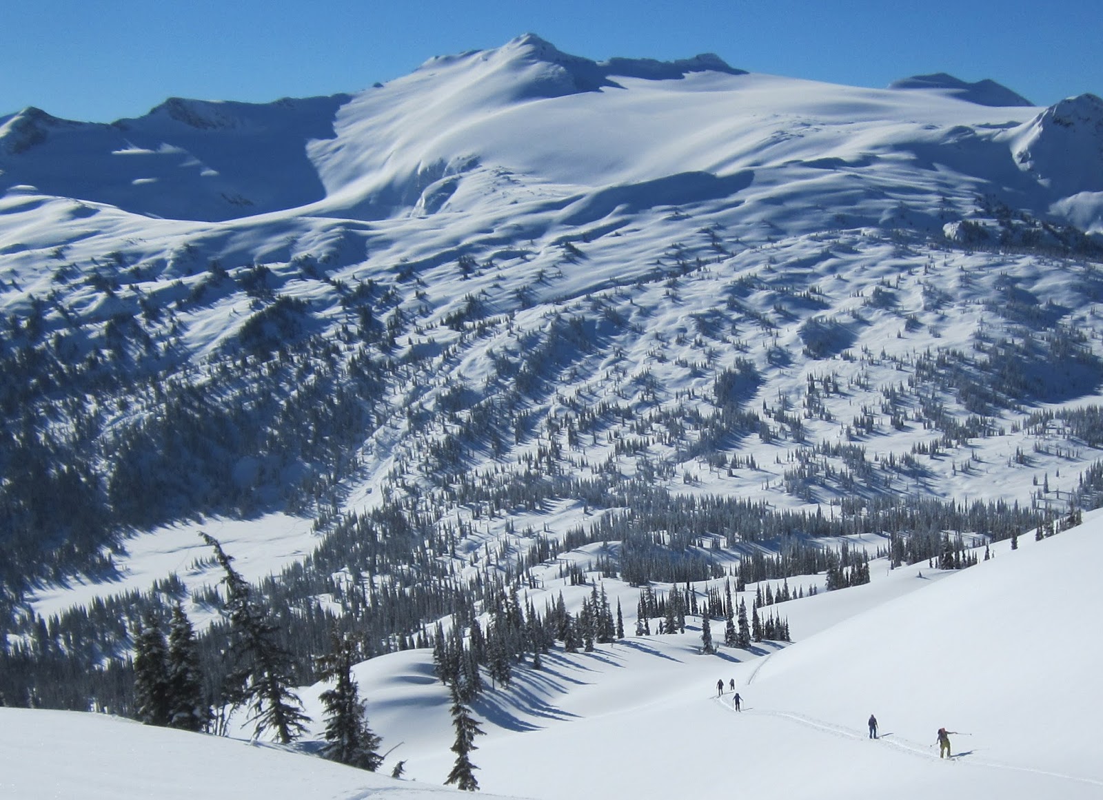
With snowline marching up the mountainsides and a barely-freezing-at-night-scorching-during-the-day forecast, I cajoled Ben and Leah into a 4 am start to do a Camas/North fork loop before the snowpack fell apart.  We ended up having a fantastic morning.  I dropped Leah and Ben off at snowline on Camas, then drove and jogged the shuttle.  By incorporating a tempo effort into the run portion of the shuttle, I was able to catch them below Camas lake, and we all cruised up to West Camas peak 8905 by high noon.  The only bummer about the approach was seeing the entire drainage shredded by snowmobile traffic.
Leah and Ben nearing West Camas peak.
Since the snow was still intact, and it was to be a one run day, we took our time on the summit before dropping the 3,000 vertical foot BRIBE gully (Best Run in Bitterroot Ever) in sticky but otherwise tasty corn snow.  Intermittent snow during the exit slowed us a bit, but we had all day to negotiate it, and the going was never too bad.  Once we were back on the North fork of Lost Horse trail proper, it was just long slog down the faint trail and Lost Horse road back to the car. Every additional day that Leah gets to ski is a successful day in my book, and it is always good to get out with Ben. By the numbers, one classic ski run and about 4,500 feet of climbing in about 9 hours  at a casual pace with lots of breaks.
Skiing the top of the BRIBE gully.
Ben about half way down.
Things getting interesting on the exit.  We had about 30 minutes of
challenging intermittent snow before switching to easy hiking.
Thoughts
While this was a relatively short and perhaps not “blog worthy” outing, I chose to post because it is a worthy loop for Bitterroot skiers to consider.  There are multiple south facing runs off the back side of West Camas, and the runs further up the drainage are some of the better peak to creek lines in the range.  Beware of avalanches in winter, of course.  It would be easy to tack another run or two along the way to make it a longer day. There is a substantial shuttle from Camas to Lost Horse creek, but the entire loop could be done on foot by parking somewhere between the National Forest boundary and the Lost Horse climbing parking area, and approaching Camas via cross country travel and the southerly Camas road (Note: this is not the standard access road for Camas creek, it is the one that peels off left at the mouth of the standard Camas road).  At the end of the day, just slog a few extra miles back to the car and Boom, you have just completed a nice big loop through the beautiful Camas drainage.

Thursday, April 14, 2016

Taylor Hilgard traverse on skis


The south face of Hilgard at dawn during the Taylor Hilgard traverse.
The Taylor Hilgard group in the Madison range is a special place.  The peaks are the highest in Montana outside the Beartooth, and the crest is remote, surrounded by outlying mountains and long trail approaches in all directions.  The terrain is rugged yet user friendly, and best of all, chalk full of classic ski routes.  And the range is home to a robust grizzly population – I have seen sign every time I have visited outside the middle of winter.  My brother and I “cut our teeth” here over a decade ago during a five day trip where we skied most of the high peaks despite poor conditions.  And I have been itching to get back ever since.  Little did I know that everything would come together for one of the best days I have had in the mountains in years.

Since this was a solo outing, I devoted the entire previous day to the 45-mile shuttle.  Getting in position involved five hours of driving, five miles of running, hitchhiking through Yellowstone, and fifteen miles of road biking.  Fortunately, it went off flawlessly, and I was in camp by late afternoon. 
Content at camp the day before.

After a relaxed evening and a few hours of sleep, I was off at 2:45 am. I approached Hilgard via the Beaver Creek road and Avalanche creek.  The pre-dawn goal was to stay happy and get in good position by daybreak, so I relaxed, checked the map frequently, and motored up to Avalanche lake by first light.  The climb out of Avalanche creek was steep and icy, but all skinnable. The first rays of sun illuminated the peaks as I crested the ridge and schussed a short run down to Lake Eglise.  It was going to be a good day.  
Sunrise!
Psyched on the Avalanche/Hilgard creek crest.
The ascent of Hilgard went quickly.  I had to employ spikes and an axe, but the snow was consolidated enough for easy climbing. The low 4th class rock steps high on the peak were snow covered and straightforward.  The summit knob is technically skiable, but I opted out and downclimbed about 250 vertical feet before clicking into skis and skiing the lower East face and chalky North couloir.  It was pretty cool to summit the highest Montana peak outside of the Beartooth with winter conditions.
Looking south from Hilgard. Spot the Tetons?
Top of the skiing on Hilgard. More casual than it looks.
Traversing below Hilgard.
Dutchman went quickly.  After a hot skin in intense morning heat and quick jaunt up the south plateau, I investigated the north couloirs.  To my delight, the central couloir went cleanly from just below the summit knob.  After a quick bump up to the summit sans skis, I skied the north couloir with nice chalky snow.  Next up was Echo, which was similar to the previous ascent, just longer and warmer, and with goats to follow.  Echo’s open Northeast couloir was in great condition, and I cruised down it before embarking on a mile plus low angle traverse to the base of Expedition pass.  Feeling the altitude and heat of the day, I took a long break to refresh.  
Looking down the excellent North couloir of Dutchman.

The day warming up on the climb to Echo.
Expedition basin view from Echo. With skis.
It is a long way from Echo to Imp, but well consolidated snow allowed for two fast traverses before and after Expedition pass, and the west facing ascent of Imp was still firm enough for easy skinning. The bootpack up Imp’s southwest ridge was a bit slow, but it was fun to weave a line through steep snow and loose rock.  I summited the west knob about two hours ahead of schedule.  The east knob is actually higher, but I prioritized fluid movement over elevation technicalities.  I did drink the last of my water on the summit, resolved to find water below Koch or be subject to a desperately dehydrated climb to Koch.  The North couloir of Imp was great, with more smooth chalky snow, followed by rolling moraine skiing down to treeline, followed by a long traverse through broken terrain and mushy snow to the creek.  
Dehydrated shadow at the top of Imp. Koch in the distance.
OK that was fun. At the bottom of Imp's North couloir.
When I arrived at the creek, I could hear water running below the snow, so I skied down drainage a hundred feet or so until I found an opening.  I took another long break in the shade, pounding a liter of water, eating two burritos, and psyching up for the final 2,000+ foot climb to the summit of Koch. Usually, I am happy to settle into a hard pace and grind out the final climb of a long day, but my legs and body didn’t really have it this time and resorted to steady slogging and lots of GU. Must have been the elevation. I summited Koch around 5 pm, well ahead of schedule and glad to be done climbing.  It was late and my legs were tired, but I could not have been more satisfied. The best ski line is down the direct east face, but I didn’t want to deal with refreezing snow. So I cruised the smooth, open southeast face.  The exit was surprisingly slow.  I guess it is 10+ miles back to the car, so I should have expected it.  The heat of the day had turned the snow to isothermic mush below 8,000 feet, and I spent more time than I would have liked face down in the snow, wallowing in facets.  Fortunately, there were ski tracks to follow. The flat seven miles of road to the Nine quarter circle ranch and my truck went by in a monotonous but beautiful seventy minutes.  
Tired and happy mountain dude on Koch.
On Koch, looking back to Hilgard, the little black horn on the far horizon.
Isothermal mush on the exit.
This was one of my best days in the mountains ever.

Thoughts
Amazing day and route.  This and the Mission traverse are the finest "out there" length outings I have done in Southwest Montana. The traverse logically strings together all of the high peaks in the group, the skiing is excellent, the setting is grand and remote, and there are no throw away sections, aside from the long approach and longish egress. Even though elevation gain is moderate, the full traverse is a bit daunting in length, and a few variations could tighten it up to a more doable length. Skipping Dutchman on the East would be easy and quick.  Skipping the Hilgard summit would save time.  A Hilgard/Echo loop, returning to Beaver creek on the Expedition basin trail, would be a top notch day in the mountains, and would not require a shuttle.  The Hilgard to Echo loop could also leave time for a run from the ridge above Earthquake lake into Avalanche creek instead of slogging up Beaver and Avalanche creeks.  

Amazingly, I could see old ski tracks most of the day. I would later learn that it was a group of Bozeman locals including Bobby Downs, Brian Clubber, and Josh Apple, who did a slightly longer overnight trip the previous week.  Nice line! And it was nice to follow tracks during the Taylor Fork exit. Also, thanks to Blake Votilla and Inge Perkins who completed a similar traverse last year, and got me fired up to give it a go.

Here are two route screen shots.  Note the orientation is NOT North to the top.
Route Part 1. Avalanche creek to Imp.  Most of the Beaver/Avalanche approach is not visible.
Route Part 2. Echo to exit.  The exit down Tumbledown is not visible, but it roughly follows the summer trail and road.
Statistics
Route: Up Beaver creek road, up Avalanche creek (in drainage, not on trail), Climb and ski Hilgard east face and north couloir (did not ski from summit), climb and ski Dutchman North couloir (did not ski summit knob), climb and ski Echo Northeast couloir, Expedition pass, Climb ski Imp North couloir from west summit, Climb and ski Koch southeast face, down Tumbledown creek and Taylor Fork to car.
Approximate total elevation gain:  10,600 feet
Length: 30 miles done in 16 hours, 40 minutes
Accomplices: No
Put in:  Beginning of Beaver creek road
Take out: M.P. 4.5 on the Taylor fork road
Fuel: Burritos, bars, gel, perpetum, 4L water. Averaged about 150 cal/hr.
Equipment:   Dynafit Nanga Parbat skis, Scarpa Alien boots, double race poles, race skins for the road (not worth it), Alu crampons and axe, extra sunscreen. Headlamp with extra batteries, basic emergency kit.
Equipment left in car to save weight: Avalanche gear, whippet (wished I brought it), ski crampons, helmet, warm gloves, warm hat:  
Tricks of the day: Going to sleep at 7 pm in order to feel rested. Taping feet before setting off to prevent any chance of blistering. Mellow, steady pace all day with adequate breaks to keep everything happy.
Number of ski runs: 6
Number of classic ski runs: 4
Fatigue factor (1-10): 8 (note, 9 is virtually impossible to exceed in a non-race setting)
Stoke factor (1-10): 10
Memories to suppress:  Sunburned lips, dehydration before the epic water stop below Koch.
Friday, March 25, 2016

Blanket Glacier Chalet 2016

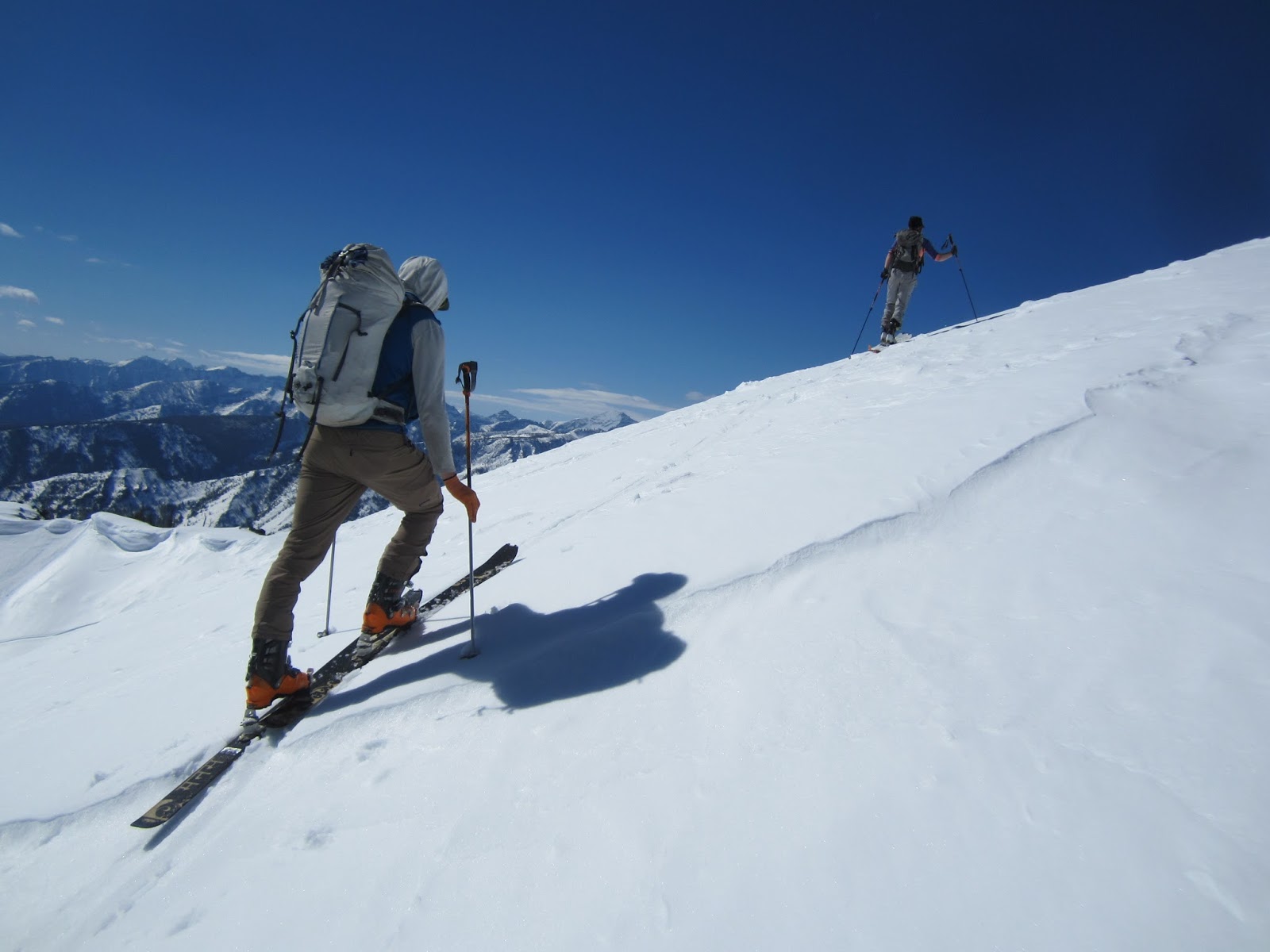
Excited on the climb to the Castor/Pollox col.  Blanket peak in the background.
Leah and I were treated to another excellent hut trip in Canada at the Blanket Glacier Chalet.  Conditions were good, with three days of powder skiing, one day of getting shut down in the alpine by visibility, and two days of clear skies at the end of the trip.  We were able to take advantage of cold temperatures and excellent tree skiing at the beginning of the week, and when the skies turned blue, energy levels and stability were adequate to have a few excellent days of exploration, including skiing the 4,500' Big Apple avalanche path from the summit with good powder.  The crew was great, and there were many laughs, sauna sessions, and delicious meals at the chalet. Even though we skied solid days every day, the pace and overall demeanor relaxed, and it was also nice to come home ready to jump right back into training and dreaming of the next big adventure.

Days 1-4: Castor/Rodeo; Whiteout shut down; Christmas Trees; Monster/Full Airtime slide path,
Grey conditions as we flew in.
Group skinning to Castor.
Leah cruising down Rodeo.  Super nice run.
After our whiteout debacle, we found improved visibility on Pollux.
The group climbing for an evening spin on Rock and Roll.
We spent a lot of time doing this.  2,000 foot tree runs with good powder.
Leah in the excellent, 3,000'+ Airtime.  Doesn't look like much from the photo,
but it was primo. One of the best of the trip.
Climbing out of Airtime as afternoon flurries roll through.
Chad on an evening Christmas tree run.
Day 5: Big Apple slide path

Leah at the col.
Frank heading out to the Big Apple, pointy peak on the skyline.
Oh Canada! Open powder fields on Big Apple.
The climb out of Big Apple was hot and gloppy, but we didn't care.  Photo: Nick Cooskey
Bonus Echo run on Big Apple.
Day 6 - Blanket/Vortex/Zipper/Blanket

Excellent Geronimo run from the summit of Blanket peak.
Frank sporting a tutu with style.  Blanket peak. 
Final climb to the top of the Vortex.
I took an alternate line on the Vortex which ended up being super nice.
Photo: Nick Cooskey
I took off at the end of the day and tagged on Zipper and another Blanket peak run.
Here, Zipper was tracked from heli skiers, but there was plenty of fresh snow on skier's right.

Friday, March 11, 2016

2016 Jack n Jill race at Teton Pass Ski Area + bonus tour

Teton Pass Ski area did did a great job hosting the Jack 'n Jill randonee race for the third consecutive year. The challenging 5,000 vertical foot course is full of skin tracks, alpine scrambling, a summit, and big, off piste runs.  There was a good showing this year, with at least fifty people toeing the line for the combined Rec/Pro division start.  A lemans start had me third off the line, and I settled in to the first climb behind Ben Parsons and Jason Mills.  My body was feeling merely OK, and it was more work than I would have liked to maintain my goal race effort half notch below lactate threshold (read: hurting but not boiling over).  In any case, I just tried to be efficient and not think about how much damage I was inflicting so early in the race.  The two leaders took a 30-second wrong turn, and we all emerged at the top of the cat track more or less together.  We all moved well through gusty winds on the way to the bootpack.  Technical stuff typically plays in my favor, and the scrambling was sufficiently loose and tricky to partially close the gap to Jason.  


The start. Ben and Jason are off the line.  I am just striding off in the center of the photo. 
I had anticipated taking it somewhat easy on the downhills to prevent re-tweeking my ankle, but I abandoned that plan, skiing all out, which allowed me to get about a minute ahead on the excellent summit to base area ski run.  Sure enough, about a third of the way up the second climb, Jason was on my tails, then 10 seconds ahead to the skin track, then about 45 seconds ahead to the bootpack.  At this point, Ben was perhaps 4 minutes out in front, and everyone else was out of sight arrears, so it was a battle for second place. 

The second run off the shoulder of the peak was good, and I was able to move past Jason by aggressively skiing the sticky, tricky quad-frying sun warmed snow.  Based on how things were going, I knew the last climb was going to be a battle, so after sucking down some calories, I settled in at a barely sustainable death pace, checking over my shoulder periodically.  I was hoping for a fade on Jason’s part, but instead Jason closed the gap, passed, then put in a good kick to the top. I was able to find a few last energy reserves and roughly match his kick, and after a double double skin rip, I was just a few seconds behind out of the transition.  It was go time, and I once again let the skis run.  Back seat, barely in control, don’t fall and re-tweek the ankle, but fast.  It was enough to pass Jason for the last time, and a minute or so of furious tucking and double poling got me over the line with an adequate 5 second buffer.  Thanks for the great race, Jason. 

In terms of performance, I didn’t really feel great at the start, but objectively, my body hasn’t really accepted intensity well for a few weeks, so if anything, perhaps I am not in top shape for racing.  This seems to happen each spring – not sure why.  Aside from a horrid third transition, everything went super smoothly.  I tried racing without a water bottle to save weight, and I didn’t suffer from lack of fluids, so I will probably keep doing that for sub-2 hour races.  It is also nice to have the ankle back to 95% strength in a ski boot.  And finally, it was nice to see some new and old faces on race sticks.  John, Katie, and Jen,– glad you made it!  Results here.

There was a five hour window between the race and awards, so I went exploring.  I wrapped around the south side of the resort on roads and trails, and was near the headwater of the North fork of Waldron creek in about an hour, and I just did a big push to the summit of Mount Lockhart.  Summit views were exceptional, no surprise since Lockhart is completely surrounded by the countless peaks of the Bob Marshall Wilderness.  Both the NE and SE faces looked appealing, but I opted for the SE.  It was a great run – big open upper face followed by a series of open rolling gullies back to Waldron creek.  I was having a lot of fun, and fueled the energy into another quick climb back up to the East shoulder of Lockhart.  

Looking up into the headwaters of Waldron peak.  
Looking south from Lockhart to Old Baldy.
I skied the SE bowl, which was also good, if not as striking as the previous run.  With awards starting in about an hour, I devoured a few calories, sucked down the last of my water, and pointed the skis uphill to the top of the resort.  The climb was wonderful – easy skinning, blown off alpine meadow walking and talus scrambling to the summit on legs which were totally shot from 5k vert of racing followed by 5k vert of enjoyable exploratory touring.  In fact, I couldn’t help but smile for much of the climb, thinking about how fortunate I am to be able to move efficiently through the mountains on skis.   The top to bottom run in the resort was enjoyable, and the post-race party was fun. Great day.

False summit of Lockhart run.

Wednesday, March 2, 2016

Scratching around on Stormy Joe

I was able to take advantage of great weather and a flexible work schedule to do some exploring in Bass creek on a random week day in March.  There is typically only another month or so of good low elevation coverage in the Bitterroot, so it always seems prudent to check as much stuff off the list as possible this time of year.   The plan for the day was not at all refined: head out with ice tools and crampons with hopes of skiing some new lines on Stormy Joe, then fill out the rest of the day with whatever looked good.  
Stormy Joe South face.  Party in the couloir and another interesting couloir
wind their way through the cliffs on the right side.
I skied the central gully which opens up and tops out just right of the summit.
The second run took the V-shaped snowfield which leads up and right to the high point.
he run to the left of the cliffs is also much better than it looks from the photo.
Surprisingly, I was last skier out of the trailhead with a 6:45 start from the car.  Always nice to see other skiers getting after it on such a nice day.  The three hour (to the minute) skin to the lake was uneventful, and I just settled in and enjoyed the sunrise.  My legs were still cooked from racing the previous evening, and it was nice to just cruise at an easy pace. From the lake inlet, I skinned out a ways to get a better perspective on a couloir that roughly splits the South face of Stormy Joe.  I still couldn't see much, but there was no reason to think that it would not go, so I started up.  The business started only a few hundred feet above the lake, with a short rock step to bypass an ice bulge in the couloir.  After re-joining the run and booting another few hundred feet, I finally got a look at the central ice bulges which comprise the middle  hundred vertical feet or so of the couloir.  The ice was fat and in great shape, so I climbed it at something like easy WI2.  It was great fun - easy, secure climbing.  I have not ice climbed yet this year, so I just took my time, getting solid tool and crampon placements the whole way.  From the top of the ice, I was able to skin the majority of the upper snowfield to the summit ridge.  The ski down the upper couloir was relaxed with good snow and a moderate pitch.  I didn't really find any way to bypass the ice, so I had to bust out the tools and crampons and downclimb the ice, which was fun.  It was also slow because I am a poor ice climber.  From the base of the ice, I skied the middle third of the line, hopped a little 3' bulge, and skied it out to the lake.  
Improbable.  Looking up the couloir from the bottom.
Looking up a few hundred feet of easy rolling ice.

About half way up the ice.
Skiing near the top of the line.
The second line was directly to the west.  It is much more straightforward, with an easy small ice bulge at the bottom, an interesting slabby pinch, and a big open upper snowfield.  I was able to skin most of the run, and was up and down it in less than two hours.  I topped out on the actual summit, which makes it my fourth summit of this obscure little Bitterroot peak.  The ski run was great. 

On the summit of Stormy Joe, excited to be skiing new runs in the Bitterroot.
Back at the lake, I decided to try to climb the back/west side of the massive avalanche path just below and south of the lake outlet.  Aside from some demoralizing, gloppy skinning, the terrain linked up, and I was on top of the run in about an hour.  With a little time to spare, I skied a short chute along the skin track before punching back up the track.  The avalanche path exit run was fun.  The entire bowl is a major avalanche performer, and the headwall is unforgiving and steep, but the snow was stable, and I felt pretty good about center punching this massive line all alone.  The schuss out the trail was quick as always, and I returned to the car in 11 hours, 30 minutes after 10,000 vertical feet of skiing.
Bonus run.  Love me some ski tracks.
Getting ready for the last run, with St. Joseph peak dominating the background.
The last run took the center of the bowl (photo taken in the morning during the approach).
It has the potential to avalanche catastrophically, so skier beware.