Monday, April 2, 2018

North Trapper new routes


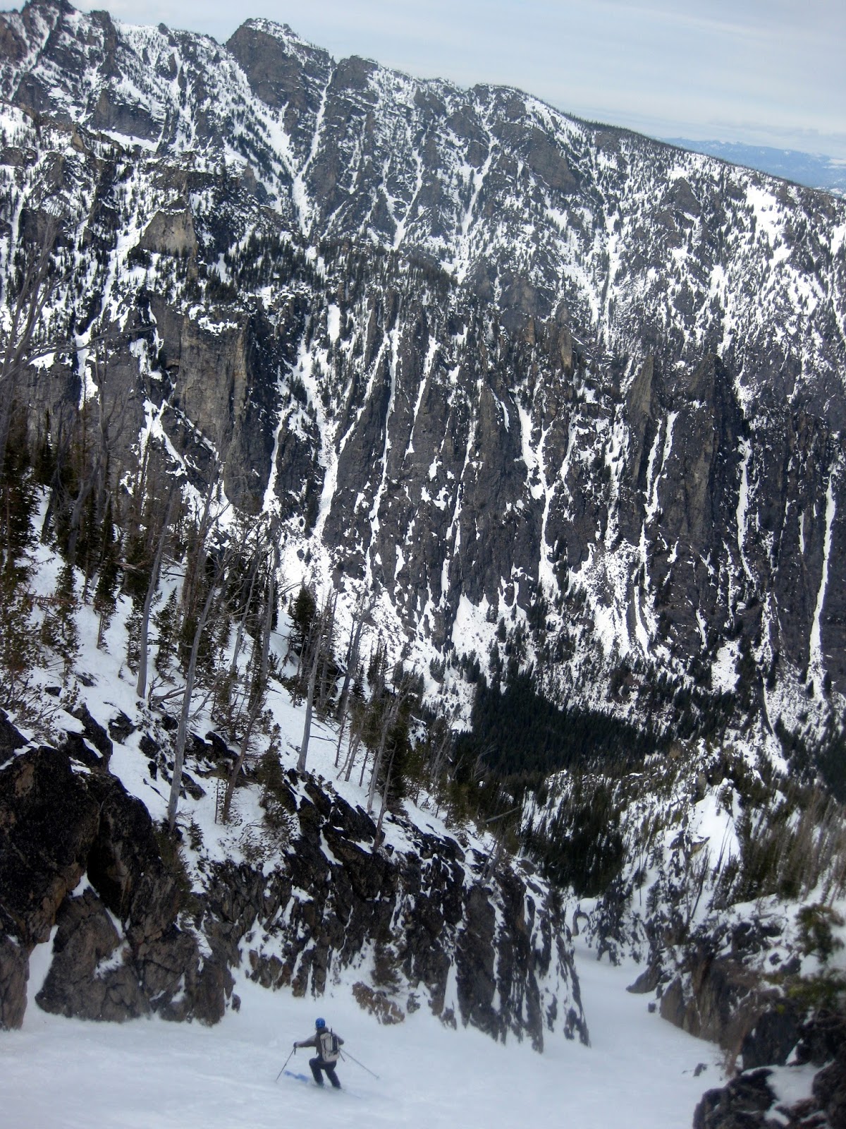
Ned skiing Hidden couloir.
Ned was kind enough to join for an exploratory mission to the Trapper group.  It was potentially unwise to roll the dice on something new when good conditions in the Bitterroot will only last another few weeks, but fortunately we got lucky.

The approach up Trapper creek was worse than I remembered.  The trail is choked with downfall, and we completely lost it after the creek crossing.  The climb into the cirque is steep and complex, but we were able to nose (and routefind by map) our way remarkably easily.  To my dismay, freezing level was way up at 7,000 feet, but conditions were good and stable above there.

The stream crossing was just one of the many delights on the approach.
Our first line was the Northeast ramps off the Northeast shoulder of North Trapper.  This gully and face always looked too broken and complex to pique my interest, but it was great fun as a mountaineering objective.  After booting the 1,000' clean opening couloir to a showstopper ice bulge, we traversed west onto a hanging ramp system.  From there, it was a long wallow to the top.  We were stymied 20 vertical feet from the ridge top by nipple deep sugar and my lack of climbing head.  The skiing was great. A short 55 degree headwall got us down to the ramps, which were exposed but moderate, and the couloir was great fun, with good chalky snow.  Thanks to Ned for his competence in getting this line done safely.  At the bottom of the run, we stopped for lunch and made a plan for the remaining two hours.
The Northeast ramp line is in the sun/shade gully. Hidden couloir is in the,
you guessed it, hidden gully just right of the most prominent rock ridge.
Approaching the Northeast ramps.  Photo: Ned Gall
Ned climbing the ramps.
It's not all glamor. Ned slightly defeated in his wallow hole, putting skis on.
First steep turns above the moat at the top
of the Northeast ramps. Photo: Ned Gall
Turning the corner into the couloir.
Ned ripping the better and longer than it looks couloir.
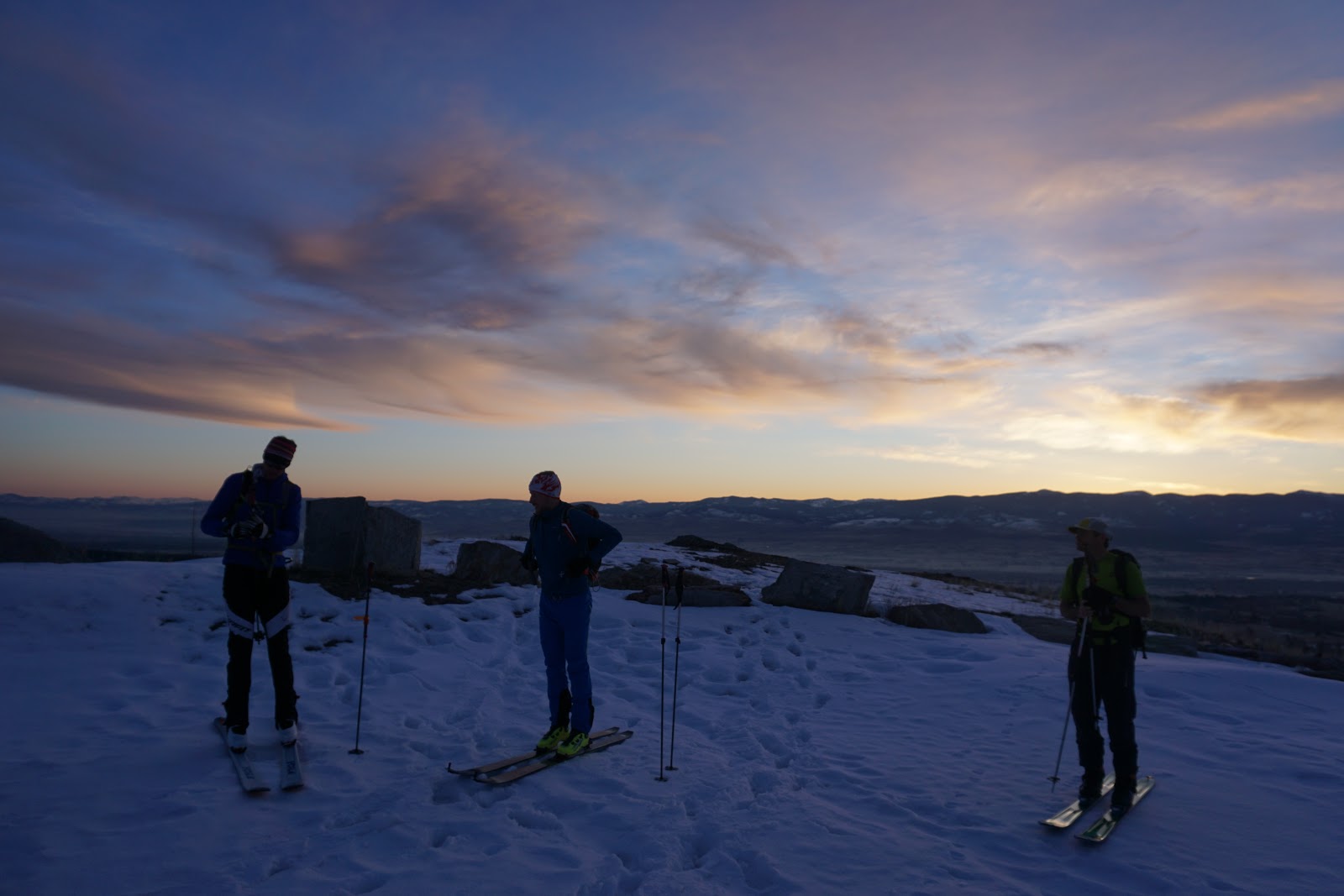
Just coming off a terrible four weeks of pneumonia, I had made it clear that I would keep it mellow and head out after one run if necessary.  Fortunately I felt good enough to do another run, so we traversed to the next cirque west to "have a look". The traverse was interesting, but we eventually made it.  To my absolute delight, the cirque headwall was split by a clean 1,200 foot couloir.  Up we went.  The couloir was moderate enough that we were able to skin about half of it, and the booting was easy enough.  From the point of highest skiable snow, we walked up to the crest and were treated to a jaw dropping view of the Antonilli ridge on North Trapper and the Cave lake cirque.  Skiing Hidden couloir was a treat. So much fun.  The ski down below freezing line was OK, and the exit was slow and schwackey, but we made it.  About 7,000 vertical feet, done in ten hours car to car.
Ned climbs and marvels at beautiful granite walls.

Majestic North Trapper view.
Skiing Hidden couloir.
Thoughts
These are great lines.  Hidden in particular is one of the longer rock lined couloirs I can think of in the range. It is also moderate and objectively fairly safe.  I would probably ski the area classics like Sugarloaf, the Tin Cup Chutes, Trapper North Gully, North Trapper Southeast face, and the Goddess first, but after that, these lines are highly recommended when there is enough snow to get in and out.  It was delightful to get out skiing again.  Fingers crossed on a few more Bitterroot adventures before the low elevation snow melts.

Sunday, April 1, 2018

Castle shoulder tour

I teamed up with a large group of Missoula's finest to shake out the daylight saving cobwebs and do more exploring in the Bitterroot.  We took advantage of having two vehicles to do a short shuttle from Fred Burr to Sheafman.  In retrospect, one could just do the tour from Fred Burr, but it was fun to go point to point.  The snow was heavy and somewhat forgettable, but both ski runs were good, and it was fun to tuck ourselves under the commanding rock face at the base of Castle crag. I was sick, so tanks to everyone for all the trailbreaking and putting up with all my coughing and wheezing.
Sunrise! (All photos: Conor Phelan)
Stable enough pit above Knack lake.
Climbing to Castle crag.  Spectacular spot.
At the bottom of the Castle crag run.
Nearing the top of the second climb. I had wanted to sketch up the ramp on looker's right,
but time and conditions did not allow.  Maybe next time.
Starting our second run.  John exhibiting magnificent euro flare. 
The classic Fred Bur reservoir view while exiting.
The tour. Up Sheafman to base of Castle Crag NE ridge, down NE shoulder into Fred Burr.  Up to ridge on Northeast flank of Castle crag, down North to the creek. Out Fred Burr.

Thursday, March 8, 2018

Big Creek is for Big Tours. Glen to Heavenly

Heavenly Twins and my second run gully on the looker's left side of the bowl.
Looking glorious.
It was all but impossible not to scheme a few big link ups during our fabulous Glen lake tour last week, so with a mint weather day in the forecast, I went back mid week with the goal of ticking off a few more safe must-ski runs in the area.  I left the car, parked at the Big/Glen road intersection, at first light.  It was pretty nice to have a skin track for the first half of the approach, and I enjoyed watching the sunrise and getting caught up on a podcasts.  Fresh snow had covered our old track up high, but it was still able to top out on my intended variation into the peak to creek avalanche path behind Glen lake in about three and a half hours at my happy pace.
Pretty sunrise during the approach.
Snowmoblie tracks in the Wilderness.  Not acceptable.
I skied a northwest facing gully into the main path.  It is hard to see the whole line from the top, but I guessed correctly, and the ice choke in the bottom went without issues, so I was psyched.  Aside from a big water stop at the bottom of the run, the rest of the run was dreamy.  I also found a much improved stream crossing, so my emergency pair of socks spent the day happily stashed in my pack.
Through the choke on the first run and glad it went.
The first run.  Great skiing.
The goal for the rest of the day was to ski peak to creek runs, the bigger the better, so I headed up the open gully below the Heavenly Twins.  About mid-path, I struck out straight West and gained the top of my intended line,  There are two entrances, and I figured I'd try the direct one.  To my dismay, the pinch was not filled in well enough to ski, but a fairly straightforward 20 foot downclimb got me through the difficulties.  Unfortunately, the snow was quite poor, ranging from sun saturated slop to icy runnels so chunky debris.  Ah well, at least it is a spectacular line, done in good style from the top.
The second run, from the top, with feelings that it might not go.
Downclimb!
A bit of schussing back down the summer trail had me back at the base of the Heavenly Twins avalanche path.  I was a bit mentally tired, but kept it together and started pushing up the 4,400 foot climb to the summit of the Heavenly Twins.  After a lot of grinding, I made my sixth lifetime summit of the Heavenly twins.  I downclimbed about thirty vertical feet of windblown talus before putting skis on and making the monster descent to the creek.  Snow was re-freezing, but everything was skiiable, and it would have taken something exquisitely terrible to wipe the huge grin off my face from such a physically challenging and beautiful day in the mountains.
Looking out at the upper half of the Heavenly Twins run.
The descent begins behind the summit cliffs and wraps into the visible bowl.
The upper part of the Heavenly Twins was a little sharky.  Still more skiable than it looks.
Turning the corner, excited to ski a lot of breakable crust.
Totally acceptable skiing near the bottom of the Heavenly Twins run.
The egress down Big Creek is kind of long, and I was quite tired, but a nut butter packet, half cup of water, lots of hollering to keep moose at bay, and a lot of double poling and sidestepping were all it took to get out to the car 2 hours and 20 minutes after summiting the Heavenly Twins.  Something a little over 12,000 vertical feet, done in 11 hours, 40 minutes.  It was a big day by my standards.
Bushwacking. Protect your eyes and face and get some.
The badness only lasted a hundred yards or so.
Thoughts
The Bitterroot peak to creek window is always narrow, and it was great to check a few more runs off the list.  At 4,400 vertical feet, the Upper Southwest to South face of the Heavenly Twins is one of the longest clean fall line runs in the Bitterroot range.  To my surprise, the bushwack was only about 15 minutes, and the entire lower gully was full of snow and fun to ski.  If it got skied more frequently, I might even go so far as to call it a Bitterroot classic!  A long but potentially rewarding day would be to climb the Heavenly Twins via the South face, ski any of the big Southwest gullies, then climb back up to the South ridge and ski the monster run out to Big Creek.  This tour would allow for a lot of high quality skiing, and would minimize the canyon slogging up Big Creek and Bad bushwacking in Beaver Creek.

On a technical note, I speculate that the Northwest couloir variation to the Glen lake peak to creek and complete Heavenly Twins Southwest to South face link up were both first descents.  I also believe the peak to creek west of the Twins was a first descent.  As always, I would love to hear of others skiing these lines, and am especially curious about the Heavenly Twins.  
Monday, March 5, 2018

Glen Lake Peak to creek

What had started out as a planned ski date with Leah quickly snowballed into a trip with a solid group of five friends.  We headed out to Glen lake with hopes to ski whatever avalanche conditions would allow.
All smiles on the approach with the Heavenly Twins and St. Mary peak behind.
Eben, styling improvised sunglasses.
I tried out a slightly different mid elevation route on the mandatory long approach to the lakes, and it was OK, but I am still not sure it is the optimal route.  In any case the morning was clear and beautiful, everyone moved well at an enjoyable conversational pace, and we were on top of the bowl above about 4.5 hours after leaving the car.  We did see snowmobilers riding in the Wilderness over on Gash.  Unfortunately, a 911 call was insufficient to raise law enforcement.  Bad form.
Leah and Natalie schussing through the burn toward Glenn lake.
We took two short runs in the bowls above the lake and dug a couple of pits before heading over the top to check out the big 4,000 foot peak to creek run which drops to Big Creek.  Pit results had a moderately well bonded layer of concern 40 cm down, so we bypassed the two cleanest gullies in favor of a less wind loaded entrance.  Dropping in blind, I managed to totally botch the line into the main bowl and actually had to skin up briefly to traverse to a suitable exit.  But I eventually found it and directed the group through safely.  The rest of the run was amazing.  We skied excellent powder to about 5,500 feet, then navigated fun stream bottom skiing and thick but doable alder and downfall bushwacking down to the creek.  It was a great run, and it was amazing to catch it in top to bottom powder. The creek crossing was tricky, but we only had one person fall in, so it could have been worse.
Looking down the ski run.  We entered about 100 yards down the ridge skier's left.

Jeffrey heading down to Big Creek.

Leah skiing as the descent began to get interesting.

Expect an adventure in Montana, even when conditions are as good as they get.
The entire egress took a full three hours, but we ground it out slow and steady, returning to the car at dark.  There are quite a few scrappy but potentially interesting couloirs in the same cirque which could merit a return trip.  This line has an unforgivingly exposed entrance and requires a lot of snow to be good, but when in condition it is a highly recommended adventure. The first descent party climbed this run from the bottom, but I think it is best done in this manner as a loop.  Thanks to everyone for such a fun day, and to our friends in town for watching our little one.  About 6,000 vertical feet, done in about 9.5 hours car to car.
Photo taken on a different outing.
We skied the biggest avalanche path, entering near the sun/shade line.

Tuesday, February 27, 2018

Morrell Mountain powder exploration

I finally made it out to Morrell mountain for a solid day of solo ski exploration.  Yurtski is situated high on the mountain, and tales of a mandatory snowmobile approach coupled with mixed reviews of the terrain kept me away for years.  As it turns out, I was woefully misinformed.  Foot access is reasonable enough, and the terrain is awesome!
Hard to see tracks, but my first and second runs are the first and second layers of the mountain.
All three faces shown can be skied to a convenient point where two gullies meet at 6,000 feet,
from which it is efficient to set one skin track and crank out powder skiing.
I rallied out of town at 5:30, started skinning from the Seeley trailhead at dawn, kicker skinned flat roads for a long hour and a half, made the long climb up one of the West ridges, dug two pits, and topped out four hours after leaving the car.  I started the day off by skiing two long west facing runs, which had the added benefit of recycling my skin track.  To my surprise, I saw a party of five on the summit ridge and decided to follow their tracks down an excellent powder run on the East face.  From the basin, I headed to the main summit of Morrell.
First run. Super fun steep burned tree skiing.
Second run.  A better than it looks moderate avalanche path.
Big air in the gully at the bottom of the first two runs. 
Climbing for more.
 The rest of the day was spent on the main peak, skiing the South face (perfect powder),  North face (surprisingly poor rimed snow with terrible visibility), and the West ridge to exit (OK, but I don't think this is the best exit).  The weather deteriorated at the end, and I bonked a little on the last climb, but the weather and snow were so much better than forecast that I was not in a position to lodge a credible complaint.  I was pleased that the exit only took 90 minutes from the summit of Morrell to the car.  10,200 vertical feet done in 10 hours, 54 minutes car to car.
Excellent powder skiing dropping east from the ridge.
Climbing for more after a good run on the South face of Morrell.
Weather deteriorating as I prepare to ski the North face.
That special feeling you get when the snow is blowing so hard you can't see and you just bonked.
 All in all it was a great day.  Although a snowmobile would save up to two hours of trudging, foot access is not too bad, the driving is straightforward, and there is a lot of terrain even if the avalanche danger is a reasonable Considerable.  I will be back.
The day.