Saturday, November 5, 2016

Ninemile high points

I have tended to shy away from trails in the Ninemile, citing long road drives, short trails, and poor trail maintenance.  But, by biking from the valley, the peaks of the Ninemile become engaging outings with sub-30 minute drives from Missoula.  Since my poor broken big toe is still on the mend from an unfortunate growler-to-toe accident, it seemed prudent to mix a lot of biking into these outings.  No worries, because I have always enjoyed time on a bike.

Ch-paa-qn + Edith preak road loop
I rolled out from the bottom of the Sixmile road in the dark on a foggy Saturday morning.  By daybreak, I had passed the Ninemile ranger station, and was well up the Edith peak road.  There were a lot of hunters, but I figured a bright blue shirt and blinking bike light should be sufficient to identify myself as a human.  Sunrise was spectacular, especially with the valley shrouded in undercast.  It was fun to grind away at a moderate pace, and I was at the Reservation divide less than two hours after leaving the car,  After a quick transition to running shoes, I ran the Reservation divide trail to the base of the peak, then slip slid my way up through bear grass and frosty talus to the summit.  Ch-paa-qn has one of the most striking views around, especially of the Missions and Flathead valley, and the undercast added to the drama.  A bitter wind on the summit was not sufficient to dampen my spirits.

Sunrise!  It was a lot more striking in person. 
Summit view out to the Missions.

Thumbs up while looking South along the Reservation divide.
Summit view looking down the Ninemile to the Bitterroot and Graves creek ranges.
In deference to big broken left toe, I took my time carefully descending frosty talus to the trail, and made it without a single toe stub.  The run out to the road was fun.  From the trailhead, I skimmed along muddy roads for a few miles toward Edith peak before layering up for the cold downhill ride to Sixmile.  With my mountain bike out of commission, I was on the cross bike, and was not looking forward to bone jarring ride down. But it went quickly enough, and I was soon spinning out the last few miles to the truck.  4.45 at steady aerobic pace.  30++ miles.

Thoughts
Adding a bike component to the outing shortens the drive to 25 minutes from town, and makes it a more fulfilling outing. There are a ton of good road loops in the Sixmile/Ninemile.  Just doing the Edith peak road loop would be a very good 3 hour circuit, but it is only one of many good road circuits. I need to do Ch-paa-qn from the house some day as a grand loop, riding to Ravalli, jamming up to the Reservation divide from the east, and returning to town via the Edith peak and the frontage road.

Three lakes peak + Ninemile tour
I was able to take an afternoon off from a busy work schedule and play.  With peaks of the Ninemile largely below snowline, I decided to park at the Ninemile house, bike a bunch of flat dirt road to the head of the drainage, and run Three lakes peak.  The ride up the drainage was fast and delightful, aside from being chastised by a hunter for not wearing orange (I assumed a biker clad in neon green was sufficiently visible).  After a quick bike to running shoes transition at the trailhead, I started jogging up.  Montana Trail Crew runners cleared the trail last year, and it is still in good running shape.  Soon enough, I had climbed to Burnt Fork pinnacle, traversed the beautiful high single track to the peak, and hiked snowy talus to the west summit.  It was another beautiful day to be out.
Rolling a few miles in.  Three lakes peak looking white in the far distance.
Still a long way to go on the bike.
Cruising the trail out to Three lakes peak.
Looking out to the Missions.
Looking south along the Reservation divide to Ch-paa-qn and the Missoula valley.
The return to the bike was fun, running freely, and chasing the sunset.  To my surprise, the deproach bike was much faster than the approach (I didn't think 500 vertical feet in 20 miles would make much of a difference), and I was back at the car in plenty of time to watch the Cubs crush the Indians to win the World Series.  6.35 at a steady aerobic pace, 50 miles plus or minus.  I can only imagine how stunning this outing would be in early October before the cottonwood leaves have fallen along the creek, and when the larch have just turned brilliant yellow.
Fall in the upper Ninemile during the egress run.
Last rays of sunlight on the ride out.
Back at the car.  Not even dark!  psyched.
Stark mountain + Rennick access road
Looking south down the Ninemile to the Missoula valley from the summit of Stark mountain
After a morning of cheering Leah on at the Elk Ramble 15k, I was able to sneak out for the afternoon.  With limited time before dark, I decided to hit up the Ninemile one last time.  I ended up driving five miles or so up the drainage to the bottom of the Rennick access road and biking from there.  The dirt road to the trailhead is slow and frustrating in a car, but it was pure joy on a bike.  I was running in a little under an hour from leaving the car.  The trail to Stark was also pure joy - basically 4,000 vertical feet of steep but runnable grade from the trailhead to the top.  I did it in a push, and was on the summit well ahead of schedule.  
Dirt road riding to the trailhead.
Nearing the lookout.
A long shadow, Ninemile valley, Ch-paa-qn, and the Missions.
 The run down was faster and smooth, and an uneventful bike ride out had me back at the car about an hour faster than anticipated.  Really nice way to spend a perfect fall afternoon.  I didn't do any mileage checking, but probably a little under 30 miles and 5k vert, done in 3.48 at a bright aerobic pace (I went a little too hard today).


Saturday, October 8, 2016

Blue Mountain 30K, 2016

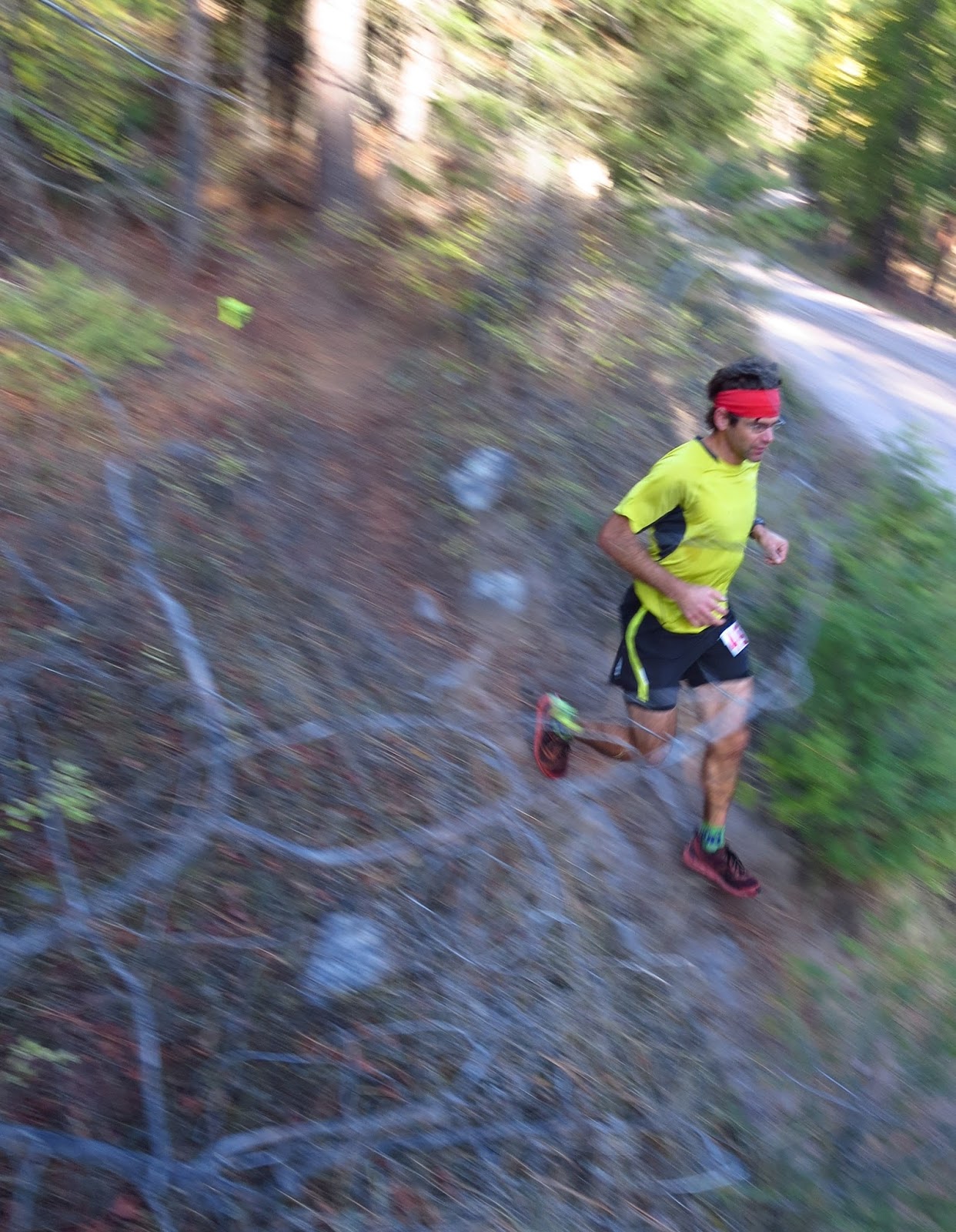
Mile 7.  Photo: Kyle Story
I once again had a great time running the Blue Mountain 30K.  I showed up well rested and surprisingly prepared for a 6-week old father thanks in large part to Leah’s support.  I was excited to race, and soon enough we were off.  The pace in the lead group felt about right, so I settled in a pack of four, moving briefly into the lead before settling into a comfortable 3rd place, which I would hold for the entire first climb.  

Running with the lead group early on.
At the top of the first climb, Nicole Hunt and I passed Michael, and I took the lead at the first aid.  I pushed the downhill at a smooth and fastish pace, which I hoped would be enough to put a small gap on my pursuers, but to my minor dismay, they held in and even closed the gap a bit on the climb to the second aid station.  It was great to see my family at the second aid, even though I just rolled through.  The remaining climb to Hayes and run down to the last aid went OK, but Nicole remained a stubborn 30 seconds back.  Ready to either secure the lead or go down trying, I decided to push it as we both fired up the last climb.  The effort was sufficient to finally gain a small gap to the top, and I rolled as fast as my legs would go to the finish.  I almost took one spill, and cramped once, but kept it together, crossing the line appropriately whopped, about four minutes faster than my previous best. Nicole came in about two minutes later, having broken the women’s course record (I think).  Thanks for Runner's Edge, Mike Foote, and the Hellgate team for putting on another great race.

Milton (on bike) was nice enough to provide encouragement and traffic control near the finish.
Happy Storyberg family at the finish.
In terms of analysis, the race went well. The field was small, and even though I had a good run, a similar performance would not even yield a top 30 finish at the Rut.  But a win is a win, I guess, and it did feel like race with constant pressure from Nicole.  Preparation was a lot different in the past (more biking, more Vo2 max work, targeted strength work on a few weak muscle groups, less running volume, less sleep), but a consistent, extended block of training translated well to good race performance.  Looking forward, I am excited to take a little break then return to hard efforts in late fall with renewed psyche. 

Sunday, July 24, 2016

Scapegoat - Echo to Mineral Hill run

A free mid-week day materialized in late July, and I was able to check out an entirely new-to-me corner of the Scapegoat. With time and intellectual energy pointed toward domestic pursuits, I pretty much just rolled out of bed earlyish, grabbed my running stuff and a map, and just went for it, hoping for the best.
The route, and a fence from the road. Echo, Iron, Unnamed, and Mineral hill from right to left.
It was a fun day, and I was cruising up the well graded Dry fork trail less than two hours after leaving the house.  After an hour plus of movement, I emerged on the northwestern flank of Daly peak and began the overland journey.  It was interesting, if not a bit slow, to climb along the edge of an old wildfire and see the remnants of what looked like a fairly expansive hand suppression effort.  Before too long I was above the fire, and a consistent push put me on top of Daly peak a little over two hours into the day. Racing the heat, I kept moving all day, stopping only to refill water, fill my hat with snow to keep cool, and occasionally snap photos. The traverse to Iron and Echo had more krumholtz schwacking than ideal, but it wasn't too bad clad in bushwacking socks.  

Echo from Iron mountain.  The going became less scrappy as the day progressed.
Unnamed and Mineral hill from Iron mountain.
From Echo, the going became more clean and elegant, and I enjoyed moving easily over the uncomplicated terrain.  From an unnamed summit just south of Windy pass, I dropped over a thousand vertical of steep grass and scree to the pass.  I ended up following the system trail North out of Windy pass for a few minutes before starting the climb to Mineral Hill  A good solid push up the south ridge put me on the final summit, roughly 7k of climbing into the day, still feeling pretty good.  The return to the car was surprisingly quick and pleasant.  I was able to stock up on snowmelt water, and a few stops at water crossings to manage heat allowed for a comfortable exit on a very hot day. The trail was surprisingly runable and enjoyable, especially near Windy pass.  The Bob is ecologically complex, and it was interesting to drop from the sub alpine to the valley through old burns, spruce, larch, lodgepole, ponderosa and aspen stands.  This being the first longer outing since a minor foot injury, I took it easy, and everything felt great all the way to the car.  About 7 hours car to car at a moderate, steady effort.
On Mineral Hill, ready to head home.
Looking back at the traverse.
Nice trail running on the way out.
Thoughts:  I think this is a fun loop, but it is a little too scrappy and the peaks are not commanding enough for it to quite rise to the status of must-do.  Still, a great day and fun to explore a new wild corner of the Bob close to town. I think running the shuttle is simplest, but a bike or car shuttle to the Bear creek trailhead to eliminate the weird return around Cooper lake.

Sunday, July 17, 2016

North Trapper, Cowboy ridge loop for time

Leah and I spend a glorious weekend in the southern Bitterroot, and on the first day I did the classic North Trapper/Cowboy ridge/Trapper circuit for time.  This is one of the only high quality established alpine routes in the Bitterroot, and I have been wanting to give it a hard go for several years now. I have not been climbing recently, and the thought of quickly downclimbing past rappel anchors seemed a bit arrogant. But, the technical difficulties are not too bad, so I decided to give it a go, with caution.

I left the car at a hard but reasonable pace, and just stuck to it all the way past Baker, Middle, and Gem lakes, and up to the notch at the top of the basin.  The descent to the N. Trapper basin is relatively complex, with two couloir systems and some routefinding and tricky downclimbing, but I made it in without botching anything too badly.  The ascent of N. Trapper went quickly, and it was fun to romp up the clean slabby lower flanks of the peak.  The upper peak went quickly, and I was on one of my all time favorite peaks well ahead of schedule.

From the summit, I embarked on the traverse.  Accepting my rusty climbing skills and head, I took my time and tried to just move in an efficient, unhurried fashion through the traverse.  Even though it felt like I was moving slowly, I only botched one section and ended up pushing through the technical portion of the traverse in reasonable time.  I also found a new sneak around the second chimney, further ironing out bugs in the route.  I made up a lot of time on the non-technical climb to Trapper peak since my legs still had quite a bit of pep.  From the summit, I promptly lost the trail on the South side, but made adequate time off trail.  Once on the familiar faint climber trail above Baker lake, I just ran it out down to the lake, then out to the car.  A minor foot injury the previous week left me with no confidence to push the pace, so I ended up just cruising it in, feeling great. Total time 3 hours, 38 minutes car to car from the Baker lake trailhead.  This was an absolutely delightful outing in the most alpine region of the Bitterroot.

The rest of the weekend was spent camping, hiking, and enjoying time with Leah.

Thoughts:
First off, I forgot my camera, so apologies for the lack of images.  Even though there is not a lot of technical climbing, this is a great alpine route full of easy 4th class climbing, exposed ridgeline traversing, and tricky-ish routefinding.  For those uncomfortable with routefinding, it is very much worth bringing a rope and very light alpine rack with slings.  There are typically rap slings at each of the west side chimneys for belays or raps.  As for time/effort, I was pushing at a hard pace, but it was never super desperate or painful.  I probably lost 10 minutes total to routefinding blunders, and took the entire last downhill fairly easy to preserve my left foot, so there is room to go faster.  Still, everything went flawlessly, and I am confident that this is a quick time, if only through a small triumph of efficiency.

Beta:
Here is a very crude route description of the Cowboy traverse from N. Trapper to Trapper.  The route is of similar difficulty in the reverse direction.  The main takaways are that one is on the crest except for three spots North of the saddle, and the obvious cliff section South of the saddle, all of which are fairly intuitive:

From the N. Trapper summit, traverse south on the crest several hundred feet until it drops off steeply, and a minor sub ridge drops off to the west.  Downclimb west into an obvious gully system.  After about 100 feet of easy downclimbing, you will be on a small ledge with a large chockstone step directly below.   There will usually be rap slings above the chocksone. The chockstone can be downclimbed back down to the gully system (10 feet of easy 5th), but it is easier to traverse south on the ledge and downclimb a shallow ledge system.  Once on the lower ledge system, follow it back South to the main ridge.  Continue on the main ridge system until you encounter another steep drop on the crest. This can be easily bypassed on the west via an obvious vertical chimney.  There will usually be rap slings here.  The chimney is vertical for about 20 feet, but it is secure.  Once below the chimney, continue south on ledge systems to the crest.  Shortly before reaching the N. Trapper/Trapper saddle, one final steep step is encountered.  The easiest bypass is a narrow ledge/gully system on the East side which drops from the crest almost 100 feet north of the step.  It is likely that you will have to backtrack a bit to find it, but it is the easiest way down.  The alternative is to make a few exposed slab moves just east of the crest, then downclimb a 4th class chimney east of the crest.

From the base of this step, one can scramble to the saddle, then up easy west facing ledges to a large grassy plateau.  From the top of the plateau, the cliffy lower half of the North ridge of Trapper peak is bypassed on the West.  Take a sandy ledge system down and across the west face (several ledges go).  Stay on the easiest ledge system for several hundred feet until you arrive at a large open gully/ledge system which climbs to the skyline ridge.  This system is past most of the sheer west facing cliffs of the lower North ridge of Trapper, and just before the ledge systems shut down farther out on the west face.  Work up this open gully/ledge system, following the line of least resistance all the way to the crest.  From the crest, it is an easy 300 vertical foot class 3 climb to the main Trapper summit.

Splits for future reference:
Baker lake: 0.17; Notch ~0.45; Base of North Trapper 1.00; N. Trapper summit 1.35; Trapper summit 2.45; car 3.38

Thursday, July 7, 2016

8th and 9th annual Warren Wallow

The 8th Warren wallow went undocumented last year, so this post will encompass two outings, both of which were splendid.

8th Wallow - Tamarack version
After a relaxed day of spectating the Double Dip and biking in Pattee canyon, Jeff and I drove out to the Carpp lake trailhead.  I have always wanted to camp at the trailhead to ease the morning start, and doing so was every bit as pleasant as I had hoped.  Temperatures never dipped below freezing, so we set off at first light in order to do most of our skiing before noon.  Instead of using the normal Carpp lake approach, we hiked out to Tamarack lake and skied the best looking of the couloirs in the cirque.  Aside from a little scree sneek at the top of the fan, the run was enjoyable.  From the lake, we made a long bootpack to the upper reaches of Porter ridge, then slogged up the Southwest face of Warren to the summit.  It was a long climb, and we may have donated a running shoe to the mountain gods (a story in itself), but neither of us were in a hurry and it was kind of fun to grind up well over a thousand vertical feet of loose scree in ski boots.  The normal North face route skied well, and we tacked on the exit couloir to Upper Carpp lake.  In keeping with recent tradition, these were my last turns of the year, and they were great. Much to my chagrin, I started feeling quite terrible on the hike out.  Little did I know that I would spend the next 12 hours on the couch sleeping off some ungodly stomach bug.  It was good to explore some new ski terrain while keeping the Warren streak alive, and thanks to Jeff for a great day, and for the tasty breakfast burritos.

In keeping with the lazy nature of summer skiing, neither of us had a camera or tracked our vertical, but rest assured we skied enough, and the day was beautiful.

9th Wallow - Maloney solo version
I made a solo push out to Warren on a drop dead gorgeous Sunday in mid June.  With a respectable start from town, I was jogging out of the trailhead before 8:30 am.  Aside from a couple of silly and painful 10 minute lactate threshold efforts, the approach was casual and delightful, and I was on the summit of Warren well under 3 hours from leaving the car.
Warren from Upper Carpp lake.
The North face skied as well as I have ever seen it, with consistent snow top to bottom, and a convenient sneek around the choke that was in the sun and not icy.  To my surprise, as I was snacking at the pothole lake, a lone runner popped up on the horizon, and within just a few minutes joined me at my snack spot.  Turns out it was Mike Wolfe, who was out for a few hours during a family backpack trip.  Always fun to see great people in the mountains.
Ready to ski Warren's classic North face run.
A Wolfe in its natural environment.
For my second run, I climbed a snow strip looker's left of the standard North face, which ties in to the lower couloir system on the Wiggler run.  It is more exposed to rock and ice fall than ideal, but I moved quickly through the exposed bits, and was soon on top of the Wiggler exit couloir.  The couloir was great fun.  With a few extra hours to burn, I kept working deeper into Malloney basin, skiing two shorter runs between Warren and the next peak east before calling it a day.   I may have missed the trail on the way out, but eventually found it and ran out to the car with a big grin on my face, tired and content from another great last ski day in the mountains.
Second run in the lower Wiggler couloir.
Excited to check out some new terrain in Maloney basin.
Maloney basin skiing.

More Maloney basin skiing.
Hmmm. That looks fun. Always something to come back for.