Saturday, October 31, 2015

Southern Madisons - Monument group and Skyline ridge

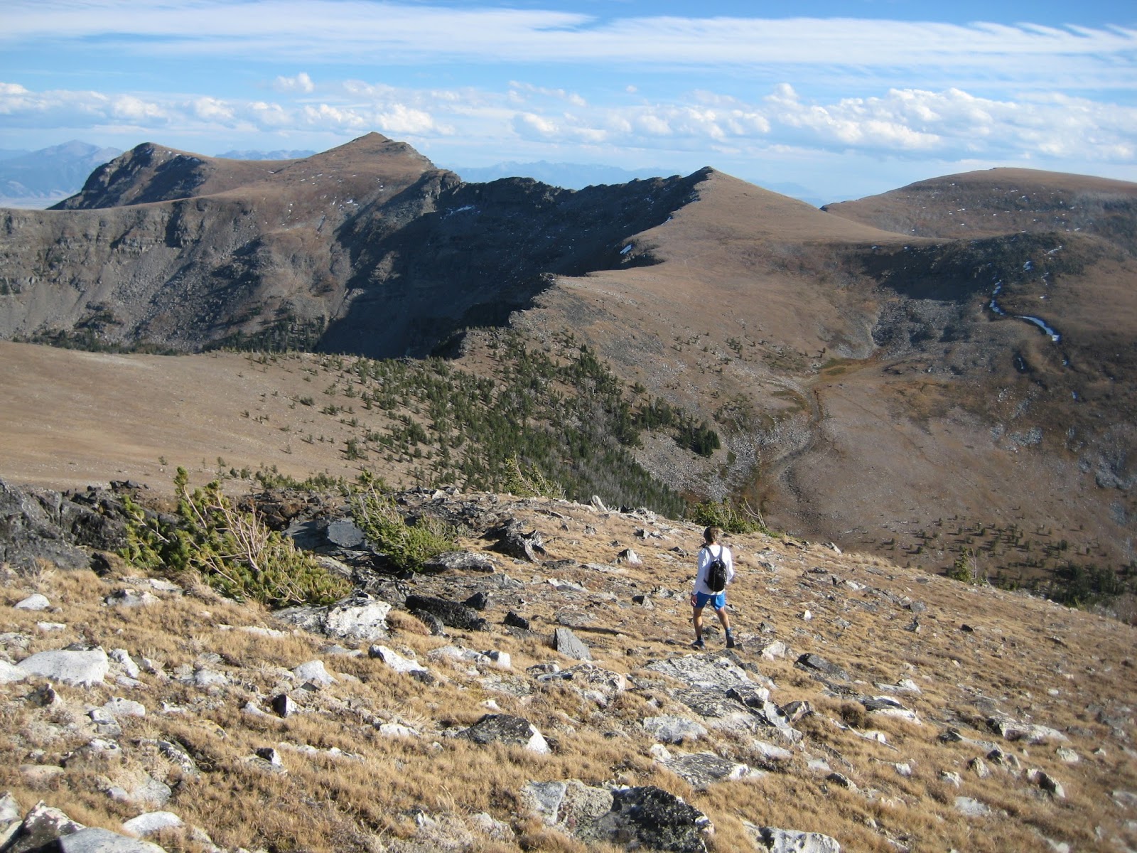
Andrew and Jeffrey were able to join me for the first two days of an extended weekend trip to the Southen Madisons.  We spent the first day doing a big loop on the western boundary of Yellowstone National Park from Sage creek. We rolled out shortly after sunrise and worked our way up to treeline.  Although it was a perfectly clear day, it was cold and blustery, and we would be occasionaly hit by remarkably intense icy gusts.  On the edge of the park, we saw a small herd of elk, a huge flock of goats at the head of Bacon Rind creek, and two seperate hunting parties on the trail.  The ridge to Redstreak was enjoyable, punctuated by clean, rolling terrain and one drop down off the crest for water. With some extra time in the day, we bumped out and back to Whites, marveling at the huge flock of goats in the headwaters of Bacon Rind creek.
Andrew running early in the day.
Cruising over unnamed peaks shortly after leaving the trail.
Jeffrey closing in on Redstreak.
The Skyline ridge traverse was quick at first, then slower as it became more scrappy and technical. The whole thing took less than two hours, and in no time we were on Sage peak.  It took a long time descend to the trail, and an even longer time to run the ten miles out to the car.  I kind of sandbagged how long the run out was going to be, and if it was possible to mutiny, it probably would have happened.  Fortunately, the easiest way out was to just run, so we stuck together, running steadily and working our way through the mess of trails caused by hunting camps.  With 30 miles under our belts, we returned to the car remarkably worked, considering there were two more days of adventuring ahead.  Fortunately a big dinner and long nigh sleep lay ahead.
Looking out to Sage with the Taylor Hillgard group in the background.
Unflattering photo of me nearing the top of Redstreak.
Looking back to Redstreak and the Skyline ridge.
The next day, we were hoping to do an Echo-Hillgard traverse. Spitting sleet coupled with fatigue from the previous day sapped our motivaton to push it, so we did a loop up to Expedition pass, through Hillgard basin, and down the Avalanche creek trail. The traverse looks really good, and I need to go back. 
Hillgard basin, as the weather began to improve. 
Camping in basic but complete comfort.  Love Montana.

Wednesday, October 21, 2015

Tobacco Root traverse


Sunrise. Beauty.  Gratitude. Andrew heading to Little Granite.
I grew up staring at the Tobacco Roots, as they dominate the western skyline from Bozeman. I have also been fortunate to spend quite a bit of quality time in T Roots kicking around on skis. Having not spent much time in the range in summer, it seemed like a great challenge to do a complete traverse, simply starting at the northernmost peak and heading south on the crest until there were no more mountains. Andrew was also able to make the trip happen with short notice, so after a bittersweet morning in Missoula, I headed over, dropped my truck off in South Meadow creek, and biked the 30 miles to our meeting point in Harrison.

Car to Granite
After a night sleeping under a full super blood moon, we headed off at 4:30 am by headlamp.  We got a little turned around in the dark above Mason lake, but we kept pointing things uphill and summited Hollowtop at first light.  An extended sunrise cast its rosy glow for almost an hour as we followed easy terrain over Jefferson and Horse.  The traverse over Little Granite is a bit craggy, but it was still fast, and the big climb up Granite was quick.  By this point, we had settled into a pattern of Andrew leading the climbs, and me leading most of the downhills and tricky terrain, since I was more familiar with the route. The day was turning out to be every bit as beautiful and fun as I had anticipated.
The view from Hollowtop.  The moon was out but it was still dark.
Sunrise from Jefferson.
Still sunrise as Andrew descends from Horse mountain.
Andrew moving. Little Granite in the background.
Minor technicalities on Little Granite.  Hollowtop in the background.  Photo: Andrew
Granite to Bradley
We dropped off the crest to Granite lake for water, then bypassed an unnamed peak before making the climb to Lonesome.  The terrain became somewhat more scrappy from Long to Thompson, but it was still moderate, and it was fun to see the Bell lake terrain in summer.  We summited Thompson still feeling good and enjoying the day.  It was a long but moderate trek to Branham.  We stayed true to the crest over Branham, and ended up negotiating extensive loose 4th class terrain.  Andrew managed to roll a rock onto his knee.  Fortunately he didn't fall, but the impact ended up slowing him up a bit for the rest of the day. After an hour plus of technical scrambling, it was nice to eventually top out on Bradely and look south to easy rolling plateaus.
Looking down the South ridge of Branham and on to the southern third of the traverse.
Interesting terrain on Branham.  Photo: Andrew
Getting technical on Branham (Not as steep as it looks).
Bradley to car
From Bradley, the traverse just bops along on high plateaus, so we settled in cruised over Lady of the Lake, Belle point, and a few unnamed peaks.  Andrew's knee didn't allow him to run, so we walked with purpose. Aside from one knee, we were both still feeling great.  It was my first time in this portion of the range, so it was good to scope some ski terrain for future trips.  At the southern terminus of the range, we summited one final unnamed peak before  scooting down to treeline and on to the truck, arriving a little ahead of schedule.  The shuttle and drive back to Missoula were both long. In fact, I got way too sleepy to finish the drive, and spent the night in the back of my truck on Homestake pass.  It was a small price to pay for an impeccable day in the mountains.


Andrew on the plateaus of the southern Tobacco Root.
Approaching the final peak of the day.  Photo: Andrew
Andrew on the final, unnamed summit.  A bit tired and a lot satisfied.
Thoughts
I think this was a great traverse, and I thoroughly enjoyed the experience. There is no escaping the fact that the range lacks wild character in comparison to adjacent ranges, but I still really enjoy the time I have spent there, and it is always impressive to see the old mining remnants.  Also, it is still pretty wild up on the crest. Although the route was not as long as I had anticipated, the complete traverse is still a substantial undertaking.  Most of the terrain is moderate, and one could make the whole thing easy 3rd class bypassing Branham. We did it in a long 15 hours, and it could easily go an hour faster.  A South to North ski traverse would be nothing short of epic, and I need to get back and make it happen sometime.  It was fun to share the day with Andrew. It was his first time in the range, so he got a full introduction. For stats, 10,000 vertical feet and 14 named summits.  Not sure on the mileage, but probably in the 20-25 mile range. 

Monday, September 28, 2015

Castle Crag and Sheafman points

Leah on the upper ramparts of Castle Crag.
Leah and I were finally able to link up Sheafman points and Castle Crag, a loop that I have been meaning to do for a very long time. On the heels of an excellent out and back run to Sky Pilot the previous day, we set out a leisurely pace, working our way up the drainage and enjoying early signs of fall. We left the trail just before the second creek crossing and climbed into and up the main gully seperating East and West Sheafman points.  A quick jaunt put us on top of East Sheafman, and another quick traverse put us on West Sheafman.  There is quite a bit of boulder hopping and mild bushwacking on the way to the West Sheafman/Castle pass, and we passed the time by discussing Leah's new work with the Global Landscapes Initiative.
Aspen are rare in the Bitterroot, so it was especially exciting
to catch a few trees displaying their full fall colors.
Our ascent route to the Sheafman points.
Someone needs to go ski this thing and invite me along. 
Leah boulder hopping between the Sheafman points.
Back in familiar terrain, we made the easy choice to continue to the summit of Castle crag via the normal southeast ridge route.  It was a big push, but we did it, and were soon oggling at what is one of my favorite views in the range.  The descent to Knaack lakes and subsequent jog out were quick and enjoyable.  Aside from being a bit scrappy between West Sheafman an Castle crag, this little link up was everything I had hoped for, and it was wonderful to spend a perfect fall weekend out in the mountains with Leah.  At a casual pace, we did the circuit in under 10 hours hours car to car.
Looking to Castle Crag from West Sheafman.
Leah powerhiking up granite slabs below Castle Crag. 
Psyched for another Castle crag summit


The route.  The first few miles of the Sheafman trail are not shown.

Thursday, September 17, 2015

Rattlesnake Traverse in summer

Classic Stuart photo showing most of the traverse to Murphy Peak.
Murphy is the peak on the left skyline.
I was able to spend a mid-week afternoon out in the mountains enjoying our backyard Wilderness playground. I left the truck parked at Snowbowl and biked back down the dirt road to Grant Creek, then up to Ravine.  It felt somewhat cavalier to leave the trailhead at 2 pm, and more than one person just shook their head when I mentioned I was going to end up at Snowbowl. I was on the cusp of getting sick, but just ignored my body and ran fairly aggressively up to Stuart. I went out to the summit, then continued on the trail to Mosquito.  I did take one major wrong detour off the trail, but corrected soon enough and proceeded to the summit of Mosquito, where I downed most of the remainder of my water, slowly coming to the realization that the second half of the traverse was going to be a thirsty one. 

Big Lake and beyond from Mosquito.
After less than a mile, the trail drops to Glacier lake, so I left it and walked easily to the summit of Sanders peak.  The terrain between Sanders and Murphy is fairly rugged, but I worked through it, generally staying just west or south of the crest.  I bypassed large portions of the ridge crest on the Northwest ridge of Sanders, on the scrappy rugged ridge west of West Sanders, and on one notably unappealing gendarme on the East ridge of Murphy.  I also made one substantial routefinding blunder by climbing West Sanders, as it would have been faster and more pleasant to bypass the entire peak on the south.  It was fun puzzling through, and I was soon on top of Murphy, sipping the last of my water.  The traverse to Point 6 was delightful (it always is), and the descent of Snowbowl via Second Though was quick and to the point.  I returned to the car a few minutes under 6 hours, promptly downed a liter of water, and quietly celebrated a fun little afternoon of running and adventuring. Also, the outing didn't exacerbate my sickness, so I'm psyched.

Getting into the technical and scrappy bits beyond Sanders.

A little tired and a lot excited on Murphy.

The final section from Murphy to Point 6.

Shadow dancing on Point 6.
Thoughts
This is a great outing, and it should be repeated often in summer and winter. The shuttle is super easy, and it all flows together quite nicely.  The route could be tightened up to a simple 5 hour affair, especially if you start at Snowbowl and skip the summits.  Go to it. As often as possible!

Tuesday, September 15, 2015

Sweeney to Lolo traverse

Bypassing gendarmes about half way through the traverse.
On one of the smokiest days of the year, Leah and I did the Sweeney to Lolo traverse.  I have been meaning to do this one for a long time, and it seemed reasonably prudent to give it a go with the optimistic thought that we might be above the smoke. And we were... for the morning at least. Since a primary goal was to stay as high as possible, we did the full Carlton to Sweeney car shuttle, which took over an hour on both ends, and could be truncated by parking down at Mill creek and stopping lower on the Sweeney road.
Plateau cruising west of Sweeney.
The hike up to Sweeney was quick and enjoyable. Much to our delight, the smoke had cleared significantly, and we were able to see peaks of the southern Bitterroot and sort-of-kind-of not choke on smoke for a few hours. The traverse to Lolo was new to me, and we just nosed our way through it, staying on or near the ridge the entire way except the corner where the Sweeney ridge abuts the crest of the range (which we bypassed on the north). I found the route to my liking, with lots of easy scrambling intermixed with open plateaus and some krumholtz to keep things appropriately scrappy. We hit the main Lolo summit about 2.5 hours after leaving Sweeney peak, and the North summit not much later.  The smoke rolled in during the egress, but was not bad enough to smother our spirits after a good day in the home range.
Leah descending from Sweeney peak.
Weaving around scrappy trees with Lolo peak in the background.

We were back in the smoke by the time we hit the North summit.
Thoughts
This is a good outing.  With the full car shuttle, it is only a few hours longer than doing a simple out and back to Lolo peak. No matter how you skin the shuttle cat, it is very reasonable day as long as you run the downhill trail sections.  Although I believe detailed route description is available on Summitpost, the routfinding is intuitive.  7.5 hours car to car at a moderate pace, except the ridge scrambling, which was relaxed.

It doesn't take a lot of imagination to wonder if starting the day farther afield (Bass creek?  St. Mary's to Heavenly Twins?!) would make for a worthwhile long outing...