Tuesday, December 17, 2013

Scratching around behind St. Mary peak

After years of scheeming over maps, I finally made it out behind St. Mary peak in the Bitterroot for a grand day of exploration.  The day started off well, with a simple drive to 5,500 feet and a 30-minute skin to the summer trailhead.  From the trailhead, I followed a skin track on the summer trail, cutting switchbacks, roughly to treeline below the peak, then made an akward, skins-on descending traverse into the unnamed lake at the head of McCalla Creek.  A quick skin up St. Mary's south bowl me in new ski territory less than three hours into the day.  First up was a good 2,000 vertical foot run into the head of Kootenai creek, transitioning from scrappy west-facing glades to a moderate and enjoyable wide open gully system down toward Kootenai.  
About half way down the first run, with good views out to
Bass and Stormy Joe peaks in Bass Creek.
From the lake, I climbed further west, with hopes of returning to the basin via a low angle hanging snowfield and couloir system that looked appealing on the map.  The hanging snowfield skied well, but the lower couloir was too slabby for my liking, so I bailed upward, and traversed to the skin track and a retreat-style ski back to the.  From there, I made a pair of interesting but shorter ski runs at the head of the cirque, the first of which was an excellent little couloir that was relatively wind buffed and stable - certainly the best run of the day.  From the south shoulder of St. Mary's, I skied the south bowl, then forged a low route directly to the last switchback on the St. Mary's road.  I'm not sure if the low route is worth doing again - it took a lot of akward traversing and a little log hopping, rock bashing, rock slab skimming, and thick forest survival skiing to piece it all together, but it was a good adventure, and the entire retreat only took 90 minutes.

Looking down the upper half of the second run, once again with views out to Bass Creek.
Looking back at St. Mary peak and potential ski lines.
Nice little couloir on the third run.
Looking back up at the third run,  another random little Bitterroot gem.
The fourth run.
The photo doesn't do it justice, but the wind was absolutely howling
as I skied the south bowl of St. Mary peak.
One doesn't have to stay out very late to see the sunset this time of year.
It was satisfying to finally get out and stretch the legs a bit.  The snow quality was poor, but I had a blast making routefinding decisions on the fly by intuition, and it felt great to be tired at the end of the day.  By the numbers, the day was something around 9,000 vertical feet, 9 hours car to car, with 40 mph winds and a 100% satisfaction factor.  For ski gear nerds, I used Scarpa Alien ski boots, and it was pure joy running around the mountain in super light boots.  I also took some super light Millet trekking pants out for their maiden voyage, and they performed well, perhaps even better than spandex, if such a thing is possible. The Bitterroot certainly needs more snow, and snow stability is still suspect, but overall it is shaping up to be a great ski season.

Friday, November 29, 2013

Nepal


Sunrise on Manaslu.
Leah and I spent three weeks in early November trekking in Nepal.  We hiked around Manaslu in 14 days and also had a few days in Kathmandu to wander the streets, sample food, and visit ancient Hindu and Buddhist religious sites.

The trek was incredible, both culturally and visually, and sharing it with Leah was an experience I will remember vividly for the rest of my life.  With a flexible itinerary, we were able to get off the beaten path a few times, and the highlight of the trip was spending the night at the Serang Gompa, a Tibetan Bhuddist monestary perched a day's hike off the main trail.  An unseasonably cold snowstorm caused about a third of our fellow trekkers to turn around at the base of the Larkya La pass (5,213 m).  Fortunately, with a little patience and some very cold toes and fingers, we were able to squeak over without incident despite deep snow and bitterly cold temperatures.

Each day brought new insights into Nepali life, and I found the people's warm spirit, aesthetic sense, and intricate and deeply religious life fascinating and inspiring.  Physically, it was also a perfect opportunity to take a full 3 weeks off from running, which has allowed a whole host of minor overuse injuries to clear.  A complete description of the trip would be too long, so for now, so a few photos will have to suffice for now.
Nepali man winnowing grain in Bhaktapur.
Evening walking on the second day.
Walking up to Sringi Himal Gompa.  After 6 hours of arduous walking,
we reached the monestary and spent the night at the base of the background peak.


Nepali woman cooking dinner in Prok.
Pungyen Gompa view.
Pungyen Gompa at the base of Manaslu.
Little Tibetan girl, at home in the snow and cold.
Ice-cold Samdo village and a blustery Manaslu at sunrise.
Day hiking toward the Tibet border with the Laryka mountains behind.
Enjoying Larkya La pass with our guide.
The view from the teahouse in Bamthang.
Bodnath stupa at dusk.

Sunday, October 27, 2013

Mission Traverse, V.4

A beautiful view out to Greywolf peak and the No Fish Lake basin from Lowary.
On Saturday, I returned to the Missions for my fourth full Mission traverse.  Typically, fall produces just enough snow to make traverses like this too tedious, but this year is different, with deep and consolidated snow making for quick snow travel and efficient easy mixed climbing.  Since McDonald peak is closed from July 15 to October 1, the stars seemed aligned for a rare window of good conditions for the traverse.  Doug and I failed on a short Mission traverse last weekend, so it was great to return and complete it.  I was happy with the route this time, as it was direct enough to hit all the hilights, but bypassed the most difficult climbing.

I set up the bike shuttle on Friday night, which was foggy and generally unplesant, but it also meant that I was able to get plenty of sleep and still be running by 5 am.  I was not feeling any pep whatsoever in the legs, and walked most of the way up to the upper trailhead from the canal.  I followed the old, grown in user trail up from the summit all the way to the peak, hiking moderately and waiting for daylight.  I forgot how much downfall is on this trail, but what is a Mission adventure without an oversized helping of bushwacking? Daylight arrived just in time to illuminate the way on the Northwest ridge of Sheepshead, which was snow-free enough to scramble without crampons.  Donning crampons on the summit, I scrambled down the East ridge, then slogged out to McDonald and climbed the Northwest face.  This was my 5th McDonald summit for the year.  I can't get enough of that mountain.
Checking out the shadow of the Missions out in the valley from Sheepshead.
The McDonald summit view, with East St. Mary's lurking in the background.
 I had not previously decided how I was going to tackle North Glacier peak, but since I was already moving slowly, I opted out of unknown difficulites on the north face, and instead descended the East face of McDonald all the way to Icefloe lakes before bypasing North Glacier alltogether via the sneak ramp up to Lake of the Clouds.  The climb up to South Glacier was long and difficult.  The snow slogging was slow, my legs still had no pep, and I was about an hour behind schedule.  I arrived on South Glacier at 2:30 pm, a little overwhelmed but still feeing good.  Underprepared, Doug and I were stymied on this climb last week.  This time, it was an easy romp up with crampons and an axe.

Glissading low on the East face of McDonald.
Easy mixed climbing and snow slogging in running shoes and crampons.
The traverse to Mountaineer peak over the Garden wall is probably the hilight of the traverse, and this time was no different.  I even found a sneak ramp exit alternative to the Northwest couloir of Mountaineer peak, which means that with diligent care to routefinding, the entire traverse technically goes at a very stout class 3.  From the summit of Mountaineer, the terrain moderates, and it was nice to move quickly for a change.  I used the normal bypass around the gendarmes south of Mountaineer, and just east of Lowary, which adds as much as an hour, but makes the climbing much more reasonable.  I decided to go for Lowary, which is an unnecessary addition to the logical route, but it is a beautiful peak, so why not?  Also, I shared the summit of Lowary with Chris on a remarkable ski day several years ago, so it was good to return and think about Chris' wild spirit for a few minutes.
Looking back at Glacier peak and the Garden wall.
Beta:  this is where I left the Garden wall and traversed onto the west face of Mountaineer.
It is where the ridge steepens significantly.
Note, this is south of the prominent gendarme in the foreground.
Beta:  Looking across the traverse ledge on the West face of Mountaineer.
I exited via the ramp on the right, but it is also possible
to climb up the couloir to the upper West face of Mountaineer.

Looking back at the easy but exposed sneak ramp on Mountaineer peak.
Looking south from Mountaineer peak toward the moderate south half of the traverse.
Back on the ridge.  I bypassed gendarmes on the foreground on looker's right.
 From Lowary, 40 minutes of effort had me on East St. Mary's, tired but content.  The evening run down from East St. Mary's went smoothly, even with a tempremental left quad, and I was back at the car just before dark.
On East St. Mary's peak, ready to head home.
 Thoughts
I know it might be too long to ever become popular, but I still think that the full Mission traverse is the finest long outing around Missoula.  The line is definitive, logical, challenging but not technically difficult, committing, and aesthetic.  It is also wild, and is always an adventure.  I can't wait to go back, although after our failed outing last week, I am pretty excited to return next summer for a North Glacier - East St. Mary's traverse, which is about 3 hours shorter, and stays just outside of the Grizzly Bear Conservation Zone, meaning that it is open all summer.

Statistics
Total elevation gain (based on topo map): 12,400 vertical feet
Time out:  15 hours, 40 minutes
Accomplices: None
Put in:  Canal on the Ashley Lakes road
Take out:  East St. Mary's Reservoir
Route: Up Ashley lakes road to trailhead, up old user trail to Sheepshead, up Sheepshead via Northwest ridge (Class 3/4).  Down East ridge of Sheepshead, up Northwest face of Mcdonald peak.  Down East face of McDonald to Icefloe lakes, up ramp to Lake of the Clouds and up West face to South Glacier peak.  Down ridge to Garden Wall, across Garden Wall and up to Mountaineer.  South along ridge/pleateau toward Lowary, down to Fissure glacier, up to saddle between Lowary and East St. Mary's.  Up and back to Lowary, up East St. Mary's via northeast face/ridge.  Down east ridge and down climber's trail to St. Mary's reservoir.
Equipment of note:  Running shoes, crampons and an ice axe, no helmet, winter gloves, winter hat, or map to save weight.  Also no bear spray - I yelled a lot.
Sustinance:  About 3L of water (critical snowmelt refill halfway) and 3,000 calories of gels, nut mix, Snicker's and bars.  One  Hammer fizz tablet.
Fatigue factor (1-10): 9
Stoke factor:  9 (Note:  virtually impossible to exceed 9 if skis aren't involved)
Memories to suppress:  Dark, foggy bike shuttle on Friday night.  Re-aggrevating a persistent strain in my left quad.  Plastic crampon attachments digging into my ankle balls.   Actually, I should take care of that, so it probably isn't a memory to suppress. 

Sunday, October 20, 2013

The Furlough Diaries

Aside from completing a bunch of errands around the house and being dismayed with Republicans on a daily basis, I was able to get out for several enjoyable outings during the government shutdown.

Day 1: Doug and I ran the Post Creek/Eagle Pass loop in the Missions.  After a remarkably beautiful jaunt up Post Creek, fresh snow and encroaching brush had us soaked and cold.  We made a short push toward Calowacan, but were thwarted by fresh snow and slippery conditions.  The run out was great, except someone has thrown a bunch of slash on the Eagle Pass trail.  It would be easy to re-clear the trail.  Public service day, anyone?
Doug, running down from Eagle Pass.
Doug:  "I think this looks like prime Grizzly habitat"
Brian:  "Yeah, I've seen bear tracks every time I've been up here"
Doug:  "HEY BEAR!"
Day 2: Ran the Double Dip course in 1.49.  Feeling great, even with the longish run yesterday.  I strained my lower quads running hard downhill, which would plague me for almost two weeks.

Day 3: AM - biked the Snowbowl Overlook loop.  I have been trying to go under an hour on this loop for a while, but missed it by about 5 minutes.  Next time!
Bundled up for a frosty downhill on the Overlook trail.
PM - Easy 2- hour run around Blue Mountain with Leah on a gorgeous fall afternoon.  Running with Leah is really fun.

Day 4: Cider Press in Kalispell

Day 5: Jewel Basin Hike with Leah.  We did a fairly long loop, ending with Mount Aeneas, and didn't run a single step.  It was great.  We saw several parties whose Glacier National Park plans were derailed by the government shutdown.

Day 6: The Furlough Memorial tour.  Blue Mountain, Point Six, Sheep Mountain, and University Mountain in a day.  Fantastic day.  See blog post.  The only downside was that I re-strained my left quad, and set the stage for a cold.
Not even noon and looking haggard during the Furlough Memoroal tour.
Day 7-10:  Off due to sickness.  Did a bunch of errands, cooked squash minnestroni soup, and drank endless cups of tea.  Ran a short and gorgeous North Hills loop on Friday.

Day 11:  Bike Woody Mountain from the house.  I rode up from Bonner, which, in retrospect, is impossible without trespassing for about 100 feet.  I also rode up through the West Riverside fire, which was fascinating.  The ride down to Marshall Canyon was enjoyable, and it would be worth returning sometime to run Woody Mountain from Marshall Canyon.  I re-strained my left quad, which was demoralizing.

Leah and I drove to Leavenworth.  On the way, we stopped at Lookout Pass and ran a short loop in the St. Regis Basin.  Spectacular fall colors, and did I mention, running with Leah is really fun?

Days 12-14: Leavenworth climbing with Leah.  Neither of us have been climbing much, so we just climbed a bunch of moderates.  The best day of the trip was a jaunt up the standard route on Careno Crag (10 b), followed by a trio of quality easy 5.10 pitches in the vicinity of the upper buttress.  The weather was stellar, and it was nice to get out of town.

Day 15: Not wanting to re-aggravate my strained left quad, and still feeling the after effects of the cold, I went for a moderate, gorgeous fall run in the Rattlesnake.  I ended up running Wallman/Spring/Curry/Turn and burn/Ewok in a casual 2 hours.

Bonus round:  On Saturday, Doug and I attempted a Glacier peak to East Saint Mary's Mission traverse.  We were thwarted by ice and snow on the ridgeline, which was too bad, because with a light axe and crampons, it would have been a long, engaging, and rewarding outing.  We ended up trying to bypass north Glacier and Mountaineer peaks on the east side, but were thwarted by deep snow slogging and exposure.  We ended up retracing our steps, arriving back at the trailhead over 9 hours after leaving.  I kid you not, the run down from Lucifer lake was a blast, and I would recommend Lucifer lake as a 2-5 hour run for those who enjoy steep trails and adventure.  Fortunately, we were able to hitch a ride back to our car, which saved us over 10 miles of road running.
Doug bailing in the Missions.  Lake of the Clouds and McDonald peak in the background.

Also, I am doing time trials on Sentinal, in preparation for the hill climb, if I sign up.  I went out on Thursday and tied my record of 23.45, using poles, before continuing out to University and Hellgate.  While not competitive for the podium, it would be a great challenge to try to push it under 23 minutes on Sunday.

Tuesday, October 8, 2013

The Furlough Memorial tour


Looking back to the valley from Point Six at high noon, about half way into the day.
I'm sure most ambitious Missoulians have schemed about logical linkups on the expansive trail network close to town.  For example, check out Bill Martin's audacious RMVQ efforts which are all major extensions of my route.  I attempted a shorter link up two years ago, but was thwarted by fatigue and total brake failure coming down Sheep Mountain.  With a faster bike and a more comprehensive knowledge of the local trails, I picked a logical link up of peaks around Missoula that could be completed in a long day.  I did as much running as possible to minimize the strain of lugging a bike uphill, and added a few additions to the shortest possible route to keep things fun, mainly climbing Butler creek, descending the Beargrass highway trail, and going over Ravine instead of returning to the valley after Point Six.  Since I am on the furlough plan, there wasn't really any good excuse not to give it a try, so I headed out at 5:08 am, headed for Blue Mountain.

The climb up Blue Mountain was fun.  As per normal, I rode up the 3.04 trail, then up the Blue Mountain road to the gate.  I kept the pace slow and just enjoyed the dark.  From the gate, I donned running shoes and ran the last few hundred vertical feet, following the old horse trail.  The sun cast a fiery red pre-dawn light on the eastern horizon as I topped out (7:20 am).  It was going to be a good day!
I ran, then rode down the Blue Mountain road and took trails down through the recreation area.  A strong inversion kept temps reasonable for most of the descent, which was key since I didn't bring many warm clothes.  By crossing the McClay bridge, I was able to keep limit the Reserve street riding to about two miles during the long slog through town.  Also, I stopped at Albertsons for donuts, coke, yogurt and a banana.

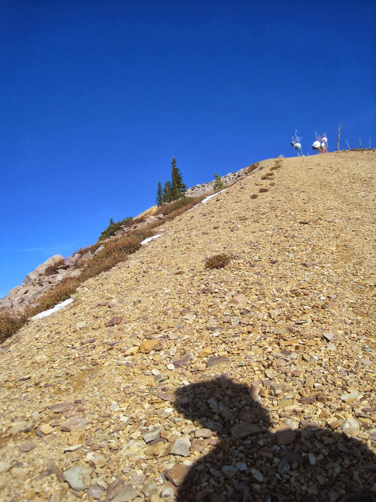
Even with the impeccable morning weather, the climb up Butler to the top of the Griz chair was the psychological low point of the day.  It is just a super long and steep grind, and I was experiencing a weird shooting pain in my left knee and calf.  But I made it, and was happy to switch to running shoes for a jaunt out to the summit of Point Six (11:50).  I rode the awesome Beargrass highway trail, then cruised down the Snowbowl road before refilling water in Grant creek.  Maybe it was the GU, or maybe it was just the beautiful day, but something switched during the climb up the Ravine trail, and I had nothing but a good time cranking away on the moderate switchbacks, and I had a huge grin on my face riding effortlessly down into Sawmill gulch.
A shadow closing in on the top of Point Six.
Quick break on top of Ravine.
I refilled water again at the base of the Woods gulch trail and started up Sheep Mountain (2:28).  I had hoped to start up about an hour earlier, but the day was proceeding flawlessly otherwise, so I was in good spirits.  This was my eighth excursion up Sheep Mountain, and I resorted to maximum efficiency tactics, biking to within about 1,000 vertical of the top of Blue point, and running from there.  Once again, I felt great on the climb, and was able to go round trip in just over four hours.  It was fun to run into Blake on his bike high on Sheep Mountain, cruising around in the snow.  He gave me some food, which saved me from bonking.  Thanks Blake!.
It was clearly going to be a dark voyage up University mountain, so I stopped in at Rattlesnake Market for a few bars and some warm water before riding out to the Hellgate canyon trail.  The sun was setting as I started up the trail (6:50), and I just settled in for a steady, dark climb to the top.  Topping out, I was greeted by a stiff east wind and the beacon casting an eerie rotating beam of light on the trees.  It was time to head home.  Not wanting to risk cramping, I took it easy coming off University, and was soon back at the bike.  A two-mile jaunt through town had me back at home (9:05), excited for beer, warm soup, and bed.
Hazy fatigue celebration on University mountain.
Thoughts:
I like my route, and everything worked out well.  As of this morning, I have no desire to do it again, but maybe some day?  Another fine link up would be to add Mount Dean Stone and eliminate Blue Mountain and/or Point six, which would necessitate more biking, but would take about 20 miles off the slog through town.


Statistics
Total elevation gain (based on topo map): 17,900 vertical feet
Total distance (best estimate):  104 miles
Trip length: 15 hours, 57 minutes, door to door
Accomplices: None
Put in/Take out:  My house
Route: Out to Blue Mountain, up and down Blue, out to Butler creek, up Butler to Point Six road, up to Point Six, down Beargrass highway and Snowbowl road, up Ravine, down Sawmill gulch, up and down Sheep Mountain via Woods gulch, up and down University mountain on foot via the Hellgate Canyon trail.
Equipment of note:  Running and biking shoes, winter gloves, running shorts instead of biking shorts (my butt is sore), light wind gear top and bottom, no puffy jacket.
Sustinance:  About 5L of water (many refills) and about 4,000 calories.  Lots of gels, and Perpetum, three granola bars, salami, three donuts, two king size Snickers bars, yogurt, a banana, one bottle of coke, Hammer fizz.  Also, I treated all my water, so ended up consuming about five iodine tablets
Fatigue factor (1-10): 9.5
Stoke factor:  8 (Note:  virtually impossible to exceed 9 if skis aren't involved)
Memories to suppress:  forgetting my cell phone, weird shooting pain in my left knee and calf while biking, ending in the dark. 

Sunday, September 29, 2013

Yellowstone Running

Happy runner in Yellowstone.
Leah and I escaped to Yellowstone for a weekend of running and camping with Missoula friends. On the first day, we ran Electric peak from the Glen Creek trailhead. This superb 20-mile outing had us running endless smooth trail on the approach, then scrambling the clean, engaging southeast ridge in full gusty winds. Electric peak is certainly the most commanding peak in the Gallatin range, and it was great to share my third voyage to the summit with Leah.  The run out was equally enjoyable, and Leah was gracious enough to let me run over Snow pass and directly back to Mammoth among bugling elk and down through the expansive Mammoth hotsprings. The evening was spent soaking in the Boiling river and relaxing.

Leah starting the long run in to Electric Peak.
Leah floating down the Southeast ridge of Electric peak.
The Missoula crew, heading to the Boiling river.  Photo: Amy Groen
On Sunday, we ran Mount Holmes. Feeling the effects of the previous day and the Rut the previous week, Leah opted out of the summit, so we parted ways about half way into the run, and I made a hard summit push. Having only been to the summit in the winter, it was good to return and see the area without full snow cover. Thanks everyone for making the trip happen.
Mount Holmes.  I ran up the trail, which circles around the backside of the peak,
then descended directly down the talus ridge on the left back to the trail.

Friday, September 20, 2013

The Rut 50k 2013 race report

Leah and me, all smiles at the finish line.  Photo: Amy Groen

I  had a blast racing in the inaugural Rut 50k race at Big Sky last weekend.  I went in with mixed expectations:

Positives
Good training base
The course has a lot of climbing, which suits my style
Good taper, good sleep the night before, and good rest the previous week

Negatives
I had never run more than about 25 continuous miles
I had never raced more than a flat half marathon
I was testing out new shoes
I am almost guaranteed to get too competitive, go out too hard, and spend the rest of the race just trying to hold things together.

It was raining at the start, but the race organizers let us run the original course, so we all started out in the rain.  I lined up in the second row, which in retrospect saved me from the traffic jam farther back in the pack.  The pace up the initial trail was bright, and I let about 10 runners break ahead and kept it way under control.  At the top of the first descent, I was immediately passed by about 5 people blazing down the steep, loose singletrack.  Resolved not to push it too hard on the downhills, I let them go.  Fortunately, I was able to keep them in sight, and reeled them in through the rolling terrain after the first aid station.  I was able to move well on the long, moderate climb to the tram base, easily passing several people.  I arrived at the tram base in about 10th place, a little worried that I had pushed the first half of the course too fast, but otherwise feeling great.

Climbing to the Tram dock.  Photo: Crystal Images
I stopped to switch socks at the aid, but it took too long, so I only switched one.  A quick run down from the tram base and traverse put me on the Bonecrusher climb to Lone Peak.  Once again, I was able to climb well, and passed 4 people on the climb, including Doug Brinkerhoff.  I arrived at the summit in great spirits, fully energized by the cold, misty wind and beautiful alpine exposure.  Little did I know that the descent would be the toughest part of the race.  My lack of technical descending skills was made plain as I was passed by about 5 runners on the long off trail drop.  In addition, my inner thighs and calves started cramping, so I kept it slow, stretched several times, and tried to ignore all the runners fading into the distance.  I also crashed hard on the descent, bruising my ankle and scraping the tip of my nose.  Oh the shame!

Fortunately things turned around once I got back on the road, and I was able to reel in Tim Hartmuller ever so slowly.  Eventually, he stopped to fuel, we ran within 10 seconds of each other to the base of the Africa climb.  I was feeling strong at the start of the Africa climb, so I pushed hard, dropping Tim, and, much to my surprise, fully reeling in Jesse Langner, who had been about 3 minutes ahead of me at the base of the Lone peak descent.  I moved quickly through the aid, and was out about 30 seconds ahead of Jesse.  Battling cramps, I took the intial steep trail slowly, but was able to push hard as the trail flattened.  By the time I reached the base of the final short climb, Jesse was nowhere to be seen, and both Casey and Mark were at least a minute ahead.  I felt great once again on the final climb, but was unable to reel anyone else before crossing the finish in 6.09.

I had a great remainder of the afternoon, watching friends come in.  Of note, Leah had a great run, coming in just over 8 hours, much faster than her time goal.  I think we are both hooked on this running thing.  I would like to keep running races like this.  With a consistent training base this summer, my body is finally capable of comfortably running longer distances.  For racing performance, I just need to get better at running, especially downhill.  Also, the thrill of racing against fast competitors is absolutely addicting.  A big thanks to Mike Foote, Mike Wolfe, and the Runner’s Edge for organizing the event.
Team Missoula, looking tough at the finish line.  Photo: Amy Groen
One other item:  shoes.  I used Hokas for the race, and aside from delivering a massive instep blister, they worked well.  I attribute my relatively strong showing in the last third of the race in part to reduced pounding from the Hokas.  However, the shoe last is too wide for my foot, they are slippery and unstable on rugged off trail terrain, and they allow for sloppy, heel strike running on the downhills, which is not the direction I want to take my running.  I’m currently of the mindset the Hokas are good for long trail runs, but that conventional shoes are better and more stable for off trail and scrambles.  Similar to powder skis versus skinny mountaineering sticks, or a full suspension bike versus a stripped down hardtail 29er, I have consistently been drawn to gear that is agile in the mountains for both aesthetic and performance reasons.  In any case, I’m excited for some cool fall weather and the opportunity to get out see what works.  I’m sure there will be many crisp mornings, vibrant fall colors, new mountain vistas, and reflective moments along the way.

Monday, September 16, 2013

Bear to Big Creek traverse

A winter view in the summer.  Bear Lake and the Sweathouse spires from Sky Pilot.
I received a text over Labor Day weekend from James who had just completed the Ranger group traverse in Big Creek.  Inspired, I ran out of the Bear Creek trailhead at 8:30 am a week later, hoping for a logical extension to James' traverse.  The end result was a run up Bear Creek, a ridge traverse from Sky Pilot around the head of Big Creek and the Ranger peak group, and a run down Big Creek.  I did not do my due dillegence with trip research, so I pretty much just winged it, which was not a bad way to explore another magical corner of the Bitterroot.

The day started off with an hour long bike shuttle from Big to Bear creek. From the trailhead, the run up Bear creek to Brian lake was relaxed and fast enough. I filled water bottles just above the lake before pushing up to the pass and scrambling to the summit Sky Pilot.  Having visited Sky Pilot many times in the winter, it was rewarding to see a familar view without snow.  For future reference, the scramble up Sky Pilot from Bear Creek was quite enjoyable, and would make a great ~5 hour out and back run/scramble.  A quick descent and climb put me on the summit of the peak above East Fork lake in good spirits.  However, a preliminary look out to Ranger peak revealed a characteristically complex and slow ridgeline, so I mentally prepared for a long, scrappy grind before setting off.  The ridge turned out to be every bit as slow as I had feared, but I worked it out, making many deviations on the east and west sides, and fighting a little bit more scrub brush than desired.  In retrospect, it would have been faster and perhaps more elegant to drop to the Pearl lake group and bypass most of the ridgeline on the east.

Looking out to Ranger peak from the point above East Fork lake.  This is going to be slow.
Soon enough, I was on Ranger point, and the traverse to Ranger peak was clean and ejoyable, as was the knife edge ridgline down to Old Stormy.  I managed to find a trickle of water before Old Stormy and took a generous break, downing well over a liter of water before heading down to Big Creek lakes.  I was able to follow rock slabs most of the way to Big Creek lakes, and a surprisingly short and tame bushwack was all that was required to regain the lakeside trail.  From the inlet of the lake, I refilled water for the last time and started down the trail.  James had told me that the Big Creek trail was fun running, and I certainly agree - lots of techy but runnable sections in the upper few miles, then miles of buffed trail through dark old growth Cedar forest.  I had a blast cruising out, and was even a little reluctant to see the car at the end of the day.
Looking back to Sky Pilot from Ranger peak.
Looking east to Big Creek lake and the Heavenly Twins from Ranger peak.
I never tablulated stats, but the run was at least 20 miles on trail with perhaps 5 miles and about 4 hours of scrappy ridgeline traversing, and 7,500 vertical feet of so of climbing.  I ran at a brisk but moderate pace, and was out for 9 hours, 36 minutes, not including the 1 hour bike shuttle.

The route is in yellow (red and white are ski routes).
Happy feet at the car.
Viva la Bitterroot!