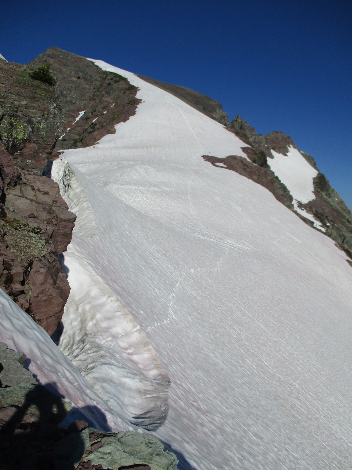
I finally traversed the alpine crest of the Swans from Swan peak to Morrell mountain. The trip was just as challenging as I had feared, and more beautiful than I could have imagined.
 |
| High in the Swans. |
Day 1: Conor and I rolled out from the Squeezer creek trailhead at first light after a good night of sleep. The trail has been cleared this year, so we made good walking time to the lakes, and reasonable time to the summit. The traverse into the head of Lion creek was slightly more challenging than a week ago, with firmer snow at the cruxy pinch, and less easy snow for glissading. Nevertheless, it went quickly enough. I modified our route to Lion pass, dropping way off the ridge to the main trail shortly after the nice alpine tarn walking deteriorated. This blue collar variation still had a lot of beargrass and general slowness, but it worked well enough, and we were soon plodding up to Lion pass, then walking a good trail above the lakes in the head of Palisade creek. This is the section where my stomach rebelled the previous trip, and it was simply marvelous to be moving easily and happily.
 |
| Steep hiking in Squeezer creek. All photos of me are taken by Conor Phelan. |
 |
| Over Swan peak, and into the head of Lion creek. |
 |
| Nice off trail hiking in Lion creek. |
 |
| Conor near Lion pass. |
We kept plodding to Owl peak, worked our way down the scrappy West side, and plodded through a few hours of nondescript but passable easy bushwacking to my previous bail point. The Union alpine section was awesome. We weren't really tired yet, and it was fun to just kind of float along. I tried a different descent off the unnamed highest peak. Unfortunately, it was terribly loose and scary, and took us a lot of time. Next time I will try going even farther down the east ridge before turning south to get off this vexing peak. We returned to the ridge for the last few peaks before Smith creek pass. The day was getting late, and Conor was OK with conceding the summit of Cooney peak, so we descended to a treeline camp directly below Cooney. As would be the trend each day, we arrived at camp at dusk, ate a few cold food calories, and immediately tucked into sleeping bags for the night. I slept well.
 |
| Interesting loose and steep downclimbing coming off Owl peak. |
 |
| Heading into the alpine near Union peak. |
 |
| In the fun stuff near Union peak. |
 |
| Looser and more terrible than it looks downclimbing near Smith Creek pass. |
 |
| Sunset at the end of Day one. |
Day 2: We were up at first light and walking by 6:30. Conor's ankle was very stiff, but fortunately it loosened up, and he was able to continue with me to his planned exit point at the Holland lookout. It only took an hour to get up to the crest, and we were soon cruising along the immaculate section above the Albino basins. Conor was nervous about the exposure, so we worked through all of the tricky bits together. Conor also spotted a pair of bears grazing on moths in the basins west of Albino. The morning was delightful, and we summited Holland by mid morning. Now in familiar terrain, we worked over Buck and Woodward, and were soon at Conor's departure point. It was sad to see him depart, but he still had to get out and run a 20+ mile bike shuttle before driving home. I dropped down to the trail and jogged down to upper Holland lake, taking a few stops to refill water and cool off in the creeks.
 |
| Conor getting things rolling on day two. |
 |
| On the long exposed ridge leading up to Holland peak. |
 |
Conor at the technical crux of the ridge north of Holland peak.
Easy climbing but very exposed. |
 |
| On the standard descent off Holland peak. |
On tap for the second half of the day was a rather audacious plan to traverse the Clearwater group, and I immediately got to work walking briskly up the trail to Gordon pass, then off trail to the base of Carmine, then up clean rock slabs to the summit. I topped out on Carmine at 3 pm, ready for more impeccable ridglines! Much to my surprise, I saw a lone figure scratching his way up Carmine. It ended up being a Missoula acquaintance, and it was interesting to compare notes as our paths crossed. Also to my surprise, I started getting some twinges in my right quad. I was of course immediately concerned, and cut out all downhill running. Wolverine came quickly enough, as did Ptarmigan point. My quad was definitely tweekey, but it seemed manageable. There is one easy 5th class chimney step on the North ridge of Ptarmigan peak which was more challenging than I remembered. I had hoped to find a work around, but didn't, and ended up just carefully working through the easy 5th class chimney with suspect rock. This 20 foot step is substantially more difficult than anything else in the Clearwater group, and I need to go back and puzzle out an easier route, It must exist. Anyway, at this point, sunset was only an hour away, and there is a lot of ground to cover on the way to Fisher, so I walked over the summit without stopping. Fortunately, all of the tricky routefinding decisions on the traverse to Fisher went down without a hitch, and I pulled up onto the summit ridge of Fisher just after sunset. I was too knackered to mess around with unknown terrain in the dark, so I immediately dropped into the headwaters of Babcock creek without climbing the last 100 vertical feet to the exact summit.
 |
| Trail running to Necklace lakes. |
 |
| Through Holland creek, ready to climb Carmine peak. |
 |
| On Wolverine, looking to Ptarmigan point and peak. 4 pm and still a long way to go. |
 |
| Nearing the North ridge of Ptarmigan peak. |
 |
| Finally closing in on Fisher. |
My quad was quite painful on the descent to camp, and I had to to a lot of compensation with the other leg. After a quick tasty bite dinner (heavy but delicious), I went to bed fairly worried about completing the trip the following day. I didn't sleep as well the second night because a buck deer spent much of the night ranging around my bivy site and I was worried he would eat my shoes.
Day 3: I was up at first light again, walking before 6. To my delight, my quad was much better, and it seemed reasonable to proceed as long as I used poles to compensate on downhills and didn't run. The first hour through Grizzly basin was magical. As soon as the terrain got complicated, I made a series of routefinding blunders that cost me almost two hours. To make a frustratingly slow morning brief, I did a lot of nasty sidehilling in Morrell creek, and monkeying around in the steep rock steps just before Crescent. Nevertheless, I summited Crescent by late morning.
 |
| An hour into the day. Sunrise in Grizzly basin. |
 |
| More early morning light in Grizzly basin. |
 |
After too much slow going in Grizzly basin, I finally topped out on the ridge near Crescent.
And promptly spent about two hours monkeying my way there |
Concerned with finishing in one piece in the daylight, I bypassed both Marshall summits and proceeded straight to Pyramid peak. It took a while to get there, but I was in familar terrain. From Pyramid, a quick bop down to Pyramid lake had me ready for all new country on the traverse out to Morrell Mountain. I had planned to skip Divine peak on the unmaintained trail that eventually connects to Youngs pass, but somehow got on the wrong trail. By the time I realized my error, I was on the wrong side of Divine. I made a snap decision to just punch it up to the summit and figure out the rest of the route from there. So I did. Fortunately, I could clearly see the correct trail from the summit. A quick descent put me on the trail and the home stretch. By this point, eight of my toes had blisters on both the tops and bottoms (my ring toes were mercifly spared, don't ask me why), so each step was accompanied with a nice little stab of pain. But blisters heal, my quad was feeling good, and I was going to finish one way or another. The fiveish miles of trail were actually quite pleasant. There was a lot of water, and I stopped a few times to re hydrate and keep the shirt soaked. The mental break from routefinding was refreshing, and it was fun to see a lot of new country. Soon enough, I departed the trail and hopped on the extended North ridge of Morrell at the headwaters of Blind Canyon. Aside from the extremely sad state of my toes, the ridge to Morrell was fun and fast. My energy was good, and the high points started clicking off quickly one after the other. Soon enough, I was on Morrell mountain proper, chomping my last Gu Chomp, and generally enjoying the last little bit of foot powered travel. A quick hobble was all it took to return to my bike, stashed near the lookout cabin. I had left my car at the Seeley creek trailhead in case I had to bail, but the 15-mile bike ride took less than an hour, and provided a nice little cool down from the adventure. Back at the car, it was delightful to finally sit down and gingerly peel socks off blistered feet. It was even better to make it home and see the family, since three days away from our little one is about as much as I can handle these days.
 |
| At the pass between the Marshall summits, looking back to Crescent. |
 |
| On Pyramid. Morrell mountain finally visible in the distance. |
 |
| Blistered trail walking on the way to Morrell. |
 |
| Celebration number one on Morrell, 15 minutes from the bike. |
 |
Celebration number two back at the bike.
My feet hurt like a bugger, and I was more than ready to coast it in to the car and excited to see my family. |
Thoughts: What an incredible trip. It was amazing to see so much wild country, and I had an absolute blast. Being a little burned out on racing, it was gratifying to complete a challenge that tested my physically and psychologically with an adequate buffer of safety. I did not complete the route in perfect style, bypassing both Cooney and Marshall peaks, and not summiting Fisher. I am personally satisfied with the trip, but there is a lot of room for someone to improve on my route in terms of time and style.
It was a little bit disconcerting to end the trip so smashed physically, but I learned a little bit about durability, and only had to take one day off of walking, so no worries. My body has been a lot healthier this summer than last year, and it is wonderful to be able to be able to put in long efforts like this. Overall recovery timeline was similar to the few long ultras I have done: back to walking in a day, back to easy runs in three days, back to moderate workouts in a week, about two weeks to to full physical recovery. Three weeks out, I'm still not mentally recovered, which is fine. A huge thanks to Leah helping with the shuttle, and for all of the support in allowing this trip to happen.
The route itself was pretty awesome, however all of the connecting segments require blue collar schwackery, and detract from the overall quality of the outing (Swan to Lion pass, Holland lookout to Carmine, Fisher to Crescent, Divine to Morrell). Fortunately, each alpine section makes its own nice long day trip.
I need to statistics, but it was around 60 miles, and around 28k vert. I was out for sixty one hours, and spend 43 hours moving.