Tuesday, May 31, 2016

Scapegoat - Red Mountain

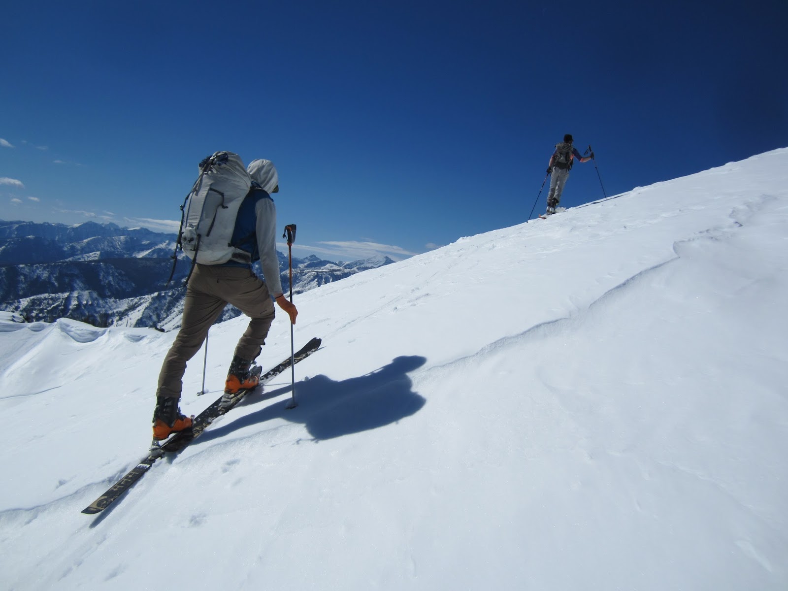
Jeffrey walking to the summit of Red Mountain.
I have always wanted to spend more time in the Bob Marshall, so it seemed fitting to explore the area around its highest peak on skis.  My first trip was on a cold, blustery day in mid May, hoping for a reasonable morning weather window that never materialized.  As such, I used a wonky low elevation approach to Red mountain before climbing the Southeast face to a point just below the summit ridge. Stymied by a blustery, miserable whiteout, I bailed, and the remainder of the day was spent skiing various shorter runs on the way back to the car.
Time to head back to the car after getting shut down by weather.
Tail firmly tucked between my legs.
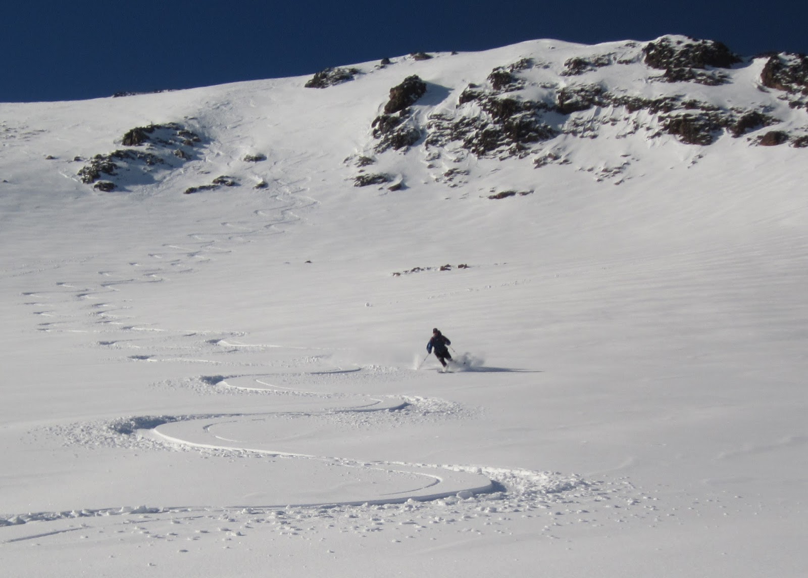
A week later, much improved weather allowed a direct climb to the summit.  The approach route is somewhat convoluted, but it isn't actually too far, just a bit bush wackey and awkward in spots. With nicely refrozen snow, Jeffrey and I climbed to the top of Red mountain in under three hours via the south ridge.  We rallied an early start, so snow on the Northeast face was still frozen, but it was not too steep or scary, and I had a blast.  Firm conditions made for a quick walk back up, and we traversed to the next peak south (Blonde mountain?) before dropping into the cleanest couloir on the Southeast face.  The run was great. The face has four nice couloirs, and a return trip is warranted.
At the bottom of the Northeast face of Red Mountain.
At the bottom of our second run on Blonde mountain.
The couloirs in the cirque are better than they look in the picture.
We followed bear tracks to the top of our short third run, which would have been better if we had enough time to extend it another few hundred feet to its logical terminus.  Instead, we exited stage right for a final climb to the basin which would most cleanly deposit us near the car.  One last enjoyable run was followed by a long shuss to the end of the snow, which was remarkably smooth.  We were both feeling relaxed at the end of the day, and just walked back to the car in about an hour from snowline in running shoes. It was satisfying to return to this nice high corner of the Scapegoat and have such a remarkably effortless day.
Climbing to our fourth run, with our third run in the background.
Looking down our fourth run.
Our egress route is visible along the bench on the skier's right side of the basin.
End of the snow.
Between the long drive, shorter runs, and slightly awkward approaches and egresses, the Copper creek area a little off compared to other Missoula spring skiing locales.  In addition, about half of the skiiable terrain is open to snowmobiles, and it appears they hit it pretty hard well into the spring.  However, there is a lot of terrain, and the climate (drier) and spring snowpack (more wind consolidated/better potential for good corn) are reason enough to keep it on the radar, especially as the road opens up in May, and on days when conditions closer to Missoula are sub optimal.  Finally, while Red mountain is the technical high point, the skiing is no better than more easily accessible options closer to the car.  For stats, a little over 6k vert, done in about 7 hours car to car.
Grizzly tracks.

Thursday, May 5, 2016

Swans - Holland Peak to Lake traverse

Last few steps to the lookout.  We were tired, but barring
consumption by bear, another excellent new traverse was in the bag.
I was once again able to convince Andrew and Jeffrey to join for an adventure into new ski terrain, this time along the high crest of the Swan range.  I have completed this and longer traverses in the summer, but was excited for a day of stringing together striking runs on skis.  We left a dreary and cold Missoula in the evening evening, and did the straightforward car shuttle before nodding off for the night. We started hiking by headlamp at 5 am after an adequate night of sleep. I wasn't feeling the pressure to charge in the pre-dawn, but even with my slower pace, we crested the range at 8 am, just three hours after leaving the car.  Thanks to Andrew for putting a track in from the car to the crest of the range.
Jeffrey climbing above lower Rumble lake in the morning.
Beta - My preferred snow route is up this open couloir, which bypasses upper Rumble lake entirely.
Andrew gearing up in front of Holland.
From the crest, I prefer to ski a short run to the east and avoid nasty hanging glide slabs on the summer South ridge route.  The snow was firm but enjoyable, and we were soon on our way up Holland peak's SE face.  It was pretty cool to see an old set of two ski tracks on our route.  Folks getting after it - I love it.  Andrew and Jeffrey were still setting a stout pace, so I settled in and tried to stay close.  We were on the summit around 9:30.  The SE was just soft enough for great skiing.  We took an abbreviated run to the tarn, then did a long traverse below the NE face of Buck mountain.  We crossed several impressive sets of grizzly tracks on the traverse.  I blindly lead us over two low cols onto the SE face of Buck.  Fortunately, the route flowed well, and we skinned easily to the summit.  This route was much easier than climbing the N ridge of Buck.  We skied good corn for 1,900 vertical feet all the way to upper Terrace lake.  It was a great, casual run.
Jeffrey at the bottom of our first access run.  Note massive (bigger than it looks) glide avalanche activity behind him.
This is common, and we gave it a wide birth.
Andrew starting down Holland peak.
Andrew and Jeffrey coming up Buck.
First few turns off the summit of Buck mountain.  Photo: Andrew Mayer
I had originally planned to climb through a steep col to peak 8,485, but threatening cornices and a touch of apathy had us deciding to bypass the peak on the east and head straight to Rubble lake, then peak 8,450. It was a good decision, as the bypass was efficient, and the entire climb was delightful.  We summited way ahead of schedule, and as a result it was decided to ski an aesthetic North couloir all the way to Woodward lake.  The couloir was excellent. First descent (not that it matters)?  The snow deteriorated well before the lake, but we skied the full run anyway.  I would like to return to 8,450, since there are good looking ski runs on each of its N, E, SE, SW, W and NW aspects!
In the upper North couloir on 8,450.  Photo: Andrew Mayer
With just one climb to go, we took another nice long break at the lake, which included an extended water getting mission.  It is a long way to the Holland lookout, and I didn't really have a route in mind, so we nosed our way up the line of least resistance.  The last push (roughly up the summer trail) had a lot of sloppy snow, but we pushed through without too much discontent.  From the lookout, we were only able to ski a thousand vertical feet before running out of snow. Fortunately, we were able to hop directly from snow to the summer trail, and an hour of easy running got us back to the car.  The day checked in right around 11,000 vertical feet, done in about 11.5 hours point to point moving at a stout pace with long breaks.  Great day.
Don't fall in!  Tricky water getting.
Holland lookout, with the missions in the background.
It was surprising how well this line linked up.  Every ski run was good (except the short run from the lookout), and the climbs were for the most part very straightforward and efficient.  One could make the outing shorter by not climbing Holland, and by skiing Southwest from 8,450, either directly to the foothills trail (bushwack of unknown heinousness required), or about half way to the valley before traversing to the summer trail.  With good weather and stability, a simplified outing would be less than 8,000 vertical feet and doable for an "average" touring party.  One could also do an excellent Holland SE/Buck SE/8,485 NW loop all from the Rumble lake trail head.  And, it is hard to not wonder if a Smith Creek pass to Holland lake on skis is realistic.  For gear, I used my heavier TLT 5/BD Revert setup.  This was a huge mistake, as I struggled all day to keep up with Andrew on his light setup.  At least I was able to get new school and butter my turns on the downhills.

Sunday, April 24, 2016

Bass Creek to Lolo Traverse V.2

Looking back at our runs on St. Joe and Pyramid Butte
(obvious open face) from the west ridge of Sweeney.
Andrew and I did the Bass to Lolo traverse on a warm Sunday in mid April.  The goal was to build on a previous traverse, skiing off Bass peak and the Pyramid Buttes instead of bypassing them via high passes.  In order to get it all done by dark, I suggested a painfully early start time. Andrew was game, and after an abbreviated night of sleep, we were hiking at 4 am.  The approach in the dark was nice, and we were at the base of big St. Joe at first light.  We kept shoes on and scrambled just east of the creek which drains the Southeast face.  Since the snow was firm, we kept the runners on to within about 1,500 vertical feet of the summit.  Andrew was setting a brisk pace, so it was a quick skin to the summit.
Sunrise skinning on St. Joe.  Photo: Andrew Mayer
Andrew leading the charge on the summit ridge of Big St. Joe.
We skied the North face, which after some rock and sastrutggi negotiation, ended up harboring surprisingly good powder.  This face is scoured much of the winter, but there was enough late season snow for it to be an incredible 3,000 foot peak to creek run. Maybe a touch icy at the bottom, but not too bad.  I refilled water in Sweeney Creek, and we were off up the south face of Pyramid Butte.  Andrew was still blazing away, so I just settled in and followed his tracks.  Our pre-dawn start paid off, as we were able to get up the big south face before the day warmed up too much.  I was not sure what we would be able to ski off the top, but fortunately my preferred line, the Northeast face, skied really well.  Small hanging face to soft powder skiing through alpine larch to a nice powdery exit couloir.  Great stuff.  We were on a roll, way ahead of schedule, and enjoying the day.

Andrew skiing the north face.
A happy Brian cruising the North face. Photo: Andrew Mayer
Climbing low on the South face of Pyramid Buttes.

Andrew dropping into the unknown on Pyramid Buttes.
It ended up just being great, straightforward top to bottom skiing.
An uneventful climb put us on the west ridge of Sweeney peak.  Andrew pushed up to an unnamed high point, and I was content to relax for a few minutes and take it all in.  The rolling run down to One Horse lake was not as striking as the previous two runs, but it had good skiing all the way to the lake.  It is a bit of a push from One Horse to the summit of Lolo, but we had both done it before, so we put our heads down and got it done.  From the summit, we still had plenty of time, so we skied the Lantern lake couloir to the lake, then continued down another few hundred vertical before putting skins on for one last warm climb to Lantern ridge.  I was mildly concerned about missing the unmaintained Lantern ridge trail on the exit, but found it and followed it like a hawk down to snow line.  Since the Mormon creek road is still closed, we had to get all the way down to the valley, but it only took an hour of relaxed jogging on the Lantern ridge trial to reach the car. We ended up climbing and descending something north of 12,000 vertical in almost exactly 12 hours at a stout but sustainable pace.
Andrew dropping into Carlton creek.
Cheesey photo on Lolo peak.
Andrew skiing good spring powder below the Lantern lake couloir on Lolo.
Rolling out to the valley at the end of the day.
I understand that the Bass to Lolo traverse is a big day, but it flows well enough to be doable, and should get done more often. The one major caveat is that it is fairly committing, since backtracking from North of the Pyramid Buttes would take a long time. There are many possible variations, but this high route had such amazing skiing that it is hard to imagine a more elegant line.   The upper reaches of Sweeney creek are wild and magical, and it is awesome to spend time in such a wild place so close to town.  

Thursday, April 21, 2016

Camas to North Fork Lost Horse Creek

With snowline marching up the mountainsides and a barely-freezing-at-night-scorching-during-the-day forecast, I cajoled Ben and Leah into a 4 am start to do a Camas/North fork loop before the snowpack fell apart.  We ended up having a fantastic morning.  I dropped Leah and Ben off at snowline on Camas, then drove and jogged the shuttle.  By incorporating a tempo effort into the run portion of the shuttle, I was able to catch them below Camas lake, and we all cruised up to West Camas peak 8905 by high noon.  The only bummer about the approach was seeing the entire drainage shredded by snowmobile traffic.
Leah and Ben nearing West Camas peak.
Since the snow was still intact, and it was to be a one run day, we took our time on the summit before dropping the 3,000 vertical foot BRIBE gully (Best Run in Bitterroot Ever) in sticky but otherwise tasty corn snow.  Intermittent snow during the exit slowed us a bit, but we had all day to negotiate it, and the going was never too bad.  Once we were back on the North fork of Lost Horse trail proper, it was just long slog down the faint trail and Lost Horse road back to the car. Every additional day that Leah gets to ski is a successful day in my book, and it is always good to get out with Ben. By the numbers, one classic ski run and about 4,500 feet of climbing in about 9 hours  at a casual pace with lots of breaks.
Skiing the top of the BRIBE gully.
Ben about half way down.
Things getting interesting on the exit.  We had about 30 minutes of
challenging intermittent snow before switching to easy hiking.
Thoughts
While this was a relatively short and perhaps not “blog worthy” outing, I chose to post because it is a worthy loop for Bitterroot skiers to consider.  There are multiple south facing runs off the back side of West Camas, and the runs further up the drainage are some of the better peak to creek lines in the range.  Beware of avalanches in winter, of course.  It would be easy to tack another run or two along the way to make it a longer day. There is a substantial shuttle from Camas to Lost Horse creek, but the entire loop could be done on foot by parking somewhere between the National Forest boundary and the Lost Horse climbing parking area, and approaching Camas via cross country travel and the southerly Camas road (Note: this is not the standard access road for Camas creek, it is the one that peels off left at the mouth of the standard Camas road).  At the end of the day, just slog a few extra miles back to the car and Boom, you have just completed a nice big loop through the beautiful Camas drainage.

Thursday, April 14, 2016

Taylor Hilgard traverse on skis


The south face of Hilgard at dawn during the Taylor Hilgard traverse.
The Taylor Hilgard group in the Madison range is a special place.  The peaks are the highest in Montana outside the Beartooth, and the crest is remote, surrounded by outlying mountains and long trail approaches in all directions.  The terrain is rugged yet user friendly, and best of all, chalk full of classic ski routes.  And the range is home to a robust grizzly population – I have seen sign every time I have visited outside the middle of winter.  My brother and I “cut our teeth” here over a decade ago during a five day trip where we skied most of the high peaks despite poor conditions.  And I have been itching to get back ever since.  Little did I know that everything would come together for one of the best days I have had in the mountains in years.

Since this was a solo outing, I devoted the entire previous day to the 45-mile shuttle.  Getting in position involved five hours of driving, five miles of running, hitchhiking through Yellowstone, and fifteen miles of road biking.  Fortunately, it went off flawlessly, and I was in camp by late afternoon. 
Content at camp the day before.

After a relaxed evening and a few hours of sleep, I was off at 2:45 am. I approached Hilgard via the Beaver Creek road and Avalanche creek.  The pre-dawn goal was to stay happy and get in good position by daybreak, so I relaxed, checked the map frequently, and motored up to Avalanche lake by first light.  The climb out of Avalanche creek was steep and icy, but all skinnable. The first rays of sun illuminated the peaks as I crested the ridge and schussed a short run down to Lake Eglise.  It was going to be a good day.  
Sunrise!
Psyched on the Avalanche/Hilgard creek crest.
The ascent of Hilgard went quickly.  I had to employ spikes and an axe, but the snow was consolidated enough for easy climbing. The low 4th class rock steps high on the peak were snow covered and straightforward.  The summit knob is technically skiable, but I opted out and downclimbed about 250 vertical feet before clicking into skis and skiing the lower East face and chalky North couloir.  It was pretty cool to summit the highest Montana peak outside of the Beartooth with winter conditions.
Looking south from Hilgard. Spot the Tetons?
Top of the skiing on Hilgard. More casual than it looks.
Traversing below Hilgard.
Dutchman went quickly.  After a hot skin in intense morning heat and quick jaunt up the south plateau, I investigated the north couloirs.  To my delight, the central couloir went cleanly from just below the summit knob.  After a quick bump up to the summit sans skis, I skied the north couloir with nice chalky snow.  Next up was Echo, which was similar to the previous ascent, just longer and warmer, and with goats to follow.  Echo’s open Northeast couloir was in great condition, and I cruised down it before embarking on a mile plus low angle traverse to the base of Expedition pass.  Feeling the altitude and heat of the day, I took a long break to refresh.  
Looking down the excellent North couloir of Dutchman.

The day warming up on the climb to Echo.
Expedition basin view from Echo. With skis.
It is a long way from Echo to Imp, but well consolidated snow allowed for two fast traverses before and after Expedition pass, and the west facing ascent of Imp was still firm enough for easy skinning. The bootpack up Imp’s southwest ridge was a bit slow, but it was fun to weave a line through steep snow and loose rock.  I summited the west knob about two hours ahead of schedule.  The east knob is actually higher, but I prioritized fluid movement over elevation technicalities.  I did drink the last of my water on the summit, resolved to find water below Koch or be subject to a desperately dehydrated climb to Koch.  The North couloir of Imp was great, with more smooth chalky snow, followed by rolling moraine skiing down to treeline, followed by a long traverse through broken terrain and mushy snow to the creek.  
Dehydrated shadow at the top of Imp. Koch in the distance.
OK that was fun. At the bottom of Imp's North couloir.
When I arrived at the creek, I could hear water running below the snow, so I skied down drainage a hundred feet or so until I found an opening.  I took another long break in the shade, pounding a liter of water, eating two burritos, and psyching up for the final 2,000+ foot climb to the summit of Koch. Usually, I am happy to settle into a hard pace and grind out the final climb of a long day, but my legs and body didn’t really have it this time and resorted to steady slogging and lots of GU. Must have been the elevation. I summited Koch around 5 pm, well ahead of schedule and glad to be done climbing.  It was late and my legs were tired, but I could not have been more satisfied. The best ski line is down the direct east face, but I didn’t want to deal with refreezing snow. So I cruised the smooth, open southeast face.  The exit was surprisingly slow.  I guess it is 10+ miles back to the car, so I should have expected it.  The heat of the day had turned the snow to isothermic mush below 8,000 feet, and I spent more time than I would have liked face down in the snow, wallowing in facets.  Fortunately, there were ski tracks to follow. The flat seven miles of road to the Nine quarter circle ranch and my truck went by in a monotonous but beautiful seventy minutes.  
Tired and happy mountain dude on Koch.
On Koch, looking back to Hilgard, the little black horn on the far horizon.
Isothermal mush on the exit.
This was one of my best days in the mountains ever.

Thoughts
Amazing day and route.  This and the Mission traverse are the finest "out there" length outings I have done in Southwest Montana. The traverse logically strings together all of the high peaks in the group, the skiing is excellent, the setting is grand and remote, and there are no throw away sections, aside from the long approach and longish egress. Even though elevation gain is moderate, the full traverse is a bit daunting in length, and a few variations could tighten it up to a more doable length. Skipping Dutchman on the East would be easy and quick.  Skipping the Hilgard summit would save time.  A Hilgard/Echo loop, returning to Beaver creek on the Expedition basin trail, would be a top notch day in the mountains, and would not require a shuttle.  The Hilgard to Echo loop could also leave time for a run from the ridge above Earthquake lake into Avalanche creek instead of slogging up Beaver and Avalanche creeks.  

Amazingly, I could see old ski tracks most of the day. I would later learn that it was a group of Bozeman locals including Bobby Downs, Brian Clubber, and Josh Apple, who did a slightly longer overnight trip the previous week.  Nice line! And it was nice to follow tracks during the Taylor Fork exit. Also, thanks to Blake Votilla and Inge Perkins who completed a similar traverse last year, and got me fired up to give it a go.

Here are two route screen shots.  Note the orientation is NOT North to the top.
Route Part 1. Avalanche creek to Imp.  Most of the Beaver/Avalanche approach is not visible.
Route Part 2. Echo to exit.  The exit down Tumbledown is not visible, but it roughly follows the summer trail and road.
Statistics
Route: Up Beaver creek road, up Avalanche creek (in drainage, not on trail), Climb and ski Hilgard east face and north couloir (did not ski from summit), climb and ski Dutchman North couloir (did not ski summit knob), climb and ski Echo Northeast couloir, Expedition pass, Climb ski Imp North couloir from west summit, Climb and ski Koch southeast face, down Tumbledown creek and Taylor Fork to car.
Approximate total elevation gain:  10,600 feet
Length: 30 miles done in 16 hours, 40 minutes
Accomplices: No
Put in:  Beginning of Beaver creek road
Take out: M.P. 4.5 on the Taylor fork road
Fuel: Burritos, bars, gel, perpetum, 4L water. Averaged about 150 cal/hr.
Equipment:   Dynafit Nanga Parbat skis, Scarpa Alien boots, double race poles, race skins for the road (not worth it), Alu crampons and axe, extra sunscreen. Headlamp with extra batteries, basic emergency kit.
Equipment left in car to save weight: Avalanche gear, whippet (wished I brought it), ski crampons, helmet, warm gloves, warm hat:  
Tricks of the day: Going to sleep at 7 pm in order to feel rested. Taping feet before setting off to prevent any chance of blistering. Mellow, steady pace all day with adequate breaks to keep everything happy.
Number of ski runs: 6
Number of classic ski runs: 4
Fatigue factor (1-10): 8 (note, 9 is virtually impossible to exceed in a non-race setting)
Stoke factor (1-10): 10
Memories to suppress:  Sunburned lips, dehydration before the epic water stop below Koch.